
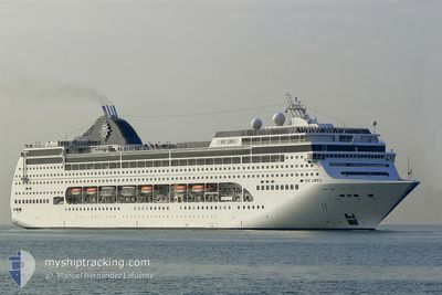
MSC LIRICA
Passengers Ship
Current Trip
| Time Travelled | 1 day |
|---|---|
| Remaining Time | 6 h, 26 mins |
| Distance Travelled | 666.78 nm |
| Remaining Distance | 110.47 nm |
| AVG Speed | 18.2 Knopen |
| MAX Speed | 19.3 Knopen |
| AVG Wind | 15.6 knots |
| MAX Wind | 30.8 knots |
| MIN Temp | 10.2°C / 50.36°F |
| MAX Temp | 19.6°C / 67.28°F |
| Diepgang | 6.8 M |
| Positie ontvangen | Nu |
Current Position
| Lengtegraad | 15.52679° |
|---|---|
| Breedtegraat | 42.72637° |
| Status | Under way using engine |
| Snelheid | 17.2 Knopen |
| Koers | 308.2° |
| Gebied | Adriatic Sea |
| Station | T-AIS |
| Positie ontvangen | Nu |
Info
Information
The current position of MSC LIRICA is in Adriatic Sea with coordinates 42.72637° / 15.52679° as reported on 2024-04-19 03:06 by AIS to our vessel tracker app. The vessel's current speed is 17.2 Knopen and is heading at the port of ANCONA. The estimated time of arrival as calculated by MyShipTracking vessel tracking app is 2024-04-19 09:33 LT
The vessel MSC LIRICA (IMO: 9246102, MMSI: 356042000) is a Passengers Ship that was built in 2003 ( 21 Jaar oud ). It's sailing under the flag of [PA] Panama.
In this page you can find informations about the vessels current position, last detected port calls, and current voyage information. If the vessels is not in coverage by AIS you will find the latest position.
The current position of MSC LIRICA is detected by our AIS receivers and we are not responsible for the reliability of the data. The last position was recorded while the vessel was in Coverage by the Ais receivers of our vessel tracking app.
The current draught of MSC LIRICA as reported by AIS is 6.8 meters
Weather
| Temperature | 10.2°C / 50.36°F |
|---|---|
| Wind Speed | 7 knots |
| Direction | 63° ENE |
| Pressure | 1011.5 hPa |
| Humidity | 75.7 % |
| Cloud Coverage | 100 % |
Featured Company
Last Port Calls
| Port | Arrival | Departure | Time In Port |
|---|---|---|---|
| 2024-04-17 04:05 | 2024-04-17 14:48 | 10 h | |
| 2024-04-16 05:05 | 2024-04-16 21:58 | 16 h | |
| 2024-04-14 11:16 | 2024-04-14 19:01 | 7 h | |
| 2024-04-13 04:00 | 2024-04-13 14:43 | 10 h | |
| 2024-04-12 10:05 | 2024-04-12 18:20 | 8 h | |
| 2024-04-10 04:13 | 2024-04-10 14:48 | 10 h | |
| 2024-04-09 04:58 | 2024-04-09 21:59 | 17 h | |
| 2024-04-07 11:26 | 2024-04-07 18:23 | 6 h | |
| 2024-04-06 04:05 | 2024-04-06 15:02 | 10 h | |
| 2024-04-05 10:19 | 2024-04-05 18:24 | 8 h |
Last Trips
| Origin | Departure | Destination | Arrival | Distance | |
|---|---|---|---|---|---|
| 2024-04-17 00:58 | 2024-04-17 07:05 | 82.70 nm | |||
| 2024-04-14 21:01 | 2024-04-16 08:05 | 599.83 nm | |||
| 2024-04-13 16:43 | 2024-04-14 13:16 | 361.51 nm | |||
| 2024-04-12 20:20 | 2024-04-13 06:00 | 149.70 nm | |||
| 2024-04-10 17:48 | 2024-04-12 12:05 | 780.49 nm | |||
| 2024-04-10 00:59 | 2024-04-10 07:13 | 82.13 nm | |||
| 2024-04-07 20:23 | 2024-04-09 07:58 | 604.15 nm | |||
| 2024-04-06 17:02 | 2024-04-07 13:26 | 360.80 nm | |||
| 2024-04-05 20:24 | 2024-04-06 06:05 | 148.47 nm | |||
| 2024-04-03 18:13 | 2024-04-05 12:19 | 781.52 nm |
Events
| Tijd | Evenement | Details | Positie / Bestemming | Info |
|---|---|---|---|---|
| 2024-04-19 00:10 | Wijzig zee gebeid | Croatian part of the Adriatic Sea Italian part of the Adriatic Sea |
42.17429 / 16.37429
Adriatic Sea
ITAOI
|
Snelheid: 17.3 kn Koers: 317.2° |
| 2024-04-18 22:30 | Binnenbereik |
41.82731 / 16.81655
Adriatic Sea
ITAOI
|
Snelheid: 17.3 kn Koers: 315.4° |
|
| 2024-04-18 17:11 | Buitenbereik |
40.66606 / 18.37062
Adriatic Sea
ITAOI
|
Snelheid: 18.6 kn Koers: 317.8° |
|
| 2024-04-18 14:47 | Wijzig zee gebeid | Italian part of the Adriatic Sea Greek part of the Ionian Sea |
40.02068 / 18.87109
Adriatic Sea
ITAOI
|
Snelheid: 19.1 kn Koers: 334.3° |
| 2024-04-18 13:43 | Status Changed | Under way using engine Default |
39.70317 / 19.05561
ITAOI
|
Snelheid: 19 kn Koers: 335° |
| 2024-04-18 13:43 | Binnenbereik |
39.70911 / 19.05214
Ionian Sea
ITAOI
|
Snelheid: 19.3 kn Koers: 335.5° |
|
| 2024-04-18 13:08 | Status Changed | Default Under way using engine |
39.53667 / 19.15333
ITAOI
|
Snelheid: 18.8 kn Koers: 335.4° |
| 2024-04-18 12:14 | Buitenbereik |
39.27431 / 19.30779
Ionian Sea
ITAOI
|
Snelheid: 18.8 kn Koers: 335.4° |
|
| 2024-04-18 12:07 | Binnenbereik |
39.24112 / 19.32744
Ionian Sea
ITAOI
|
Snelheid: 18.8 kn Koers: 335.4° |
|
| 2024-04-18 10:45 | Buitenbereik |
38.85323 / 19.55371
Ionian Sea
ITAOI
|
Snelheid: 18.8 kn Koers: 335.4° |