
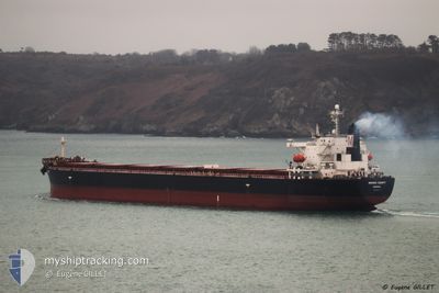
MINOAN DIGNITY
Not available
Current Trip
| Time Travelled | 12 days |
|---|---|
| Remaining Time | 7 days |
| Distance Travelled | 3602.45 nm |
| Remaining Distance | 2383.07 nm |
| AVG Speed | 12.3 Knopen |
| MAX Speed | 15.7 Knopen |
| AVG Wind | 7.1 knots |
| MAX Wind | 14.5 knots |
| MIN Temp | 24.4°C / 75.92°F |
| MAX Temp | 30.3°C / 86.54°F |
| Diepgang | 7 M |
| Positie ontvangen | 2 d geleden |
Current Position
| Lengtegraad | 76.75097° |
|---|---|
| Breedtegraat | 7.33611° |
| Status | Under way using engine |
| Snelheid | 12.2 Knopen |
| Koers | 294.3° |
| Gebied | Laccadive Sea |
| Station | T-AIS |
| Positie ontvangen | 2 d geleden |
Info
Information
The current position of MINOAN DIGNITY is in Laccadive Sea with coordinates 7.33611° / 76.75097° as reported on 2024-04-22 11:47 by AIS to our vessel tracker app. The vessel's current speed is 12.2 Knopen and is heading at the port of SUEZ CANAL. The estimated time of arrival as calculated by MyShipTracking vessel tracking app is 2024-05-03 01:02 LT
The vessel MINOAN DIGNITY (MMSI: 636016405) is a Not available It's sailing under the flag of [LR] Liberia.
In this page you can find informations about the vessels current position, last detected port calls, and current voyage information. If the vessels is not in coverage by AIS you will find the latest position.
The current position of MINOAN DIGNITY is detected by our AIS receivers and we are not responsible for the reliability of the data. The last position was recorded while the vessel was in Coverage by the Ais receivers of our vessel tracking app.
The current draught of MINOAN DIGNITY as reported by AIS is 7 meters
Weather
| Temperature | 29.4°C / 84.92°F |
|---|---|
| Wind Speed | 11 knots |
| Direction | 55° NE |
| Pressure | 1006.5 hPa |
| Humidity | 74.7 % |
| Cloud Coverage | 49 % |
Featured Company
Last Port Calls
| Port | Arrival | Departure | Time In Port |
|---|---|---|---|
| 2024-04-07 23:51 | 2024-04-12 23:32 | 4 d | |
| 2024-03-17 04:46 | 2024-03-17 13:24 | 8 h | |
| 2024-02-18 10:11 | 2024-02-25 23:03 | 7 d | |
| 2024-02-02 13:57 | 2024-02-04 07:16 | 1 d |
Most Visited Ports (Last year)
| Port | Arrivals | |
|---|---|---|
| 4 | ||
| 2 | ||
| 1 | ||
| 1 | ||
| 1 | ||
| 1 |
Last Trips
Events
| Tijd | Evenement | Details | Positie / Bestemming | Info |
|---|---|---|---|---|
| 2024-04-22 12:16 | Status Changed | Default Under way using engine |
7.37253 / 76.66092
SUEZ EGYPT
|
Snelheid: 12.2 kn Koers: 294.3° |
| 2024-04-22 11:47 | Buitenbereik |
7.33611 / 76.75097
Laccadive Sea
|
Snelheid: 12.2 kn Koers: 294.3° |
|
| 2024-04-22 10:34 | Status Changed | Under way using engine Default |
7.22660 / 76.98021
SUEZ EGYPT
|
Snelheid: 12.2 kn Koers: 294° |
| 2024-04-22 10:11 | Status Changed | Default Under way using engine |
7.19367 / 77.05254
SUEZ EGYPT
|
Snelheid: 12.4 kn Koers: 293.5° |
| 2024-04-22 10:03 | Status Changed | Under way using engine Default |
7.18274 / 77.07741
SUEZ EGYPT
|
Snelheid: 13.1 kn Koers: 294° |
| 2024-04-22 10:03 | Binnenbereik |
7.18274 / 77.07741
Laccadive Sea
|
Snelheid: 12.4 kn Koers: 293.5° |
|
| 2024-04-22 07:36 | Status Changed | Default Under way using engine |
6.97673 / 77.55836
SUEZ EGYPT
|
Snelheid: 12.1 kn Koers: 294.7° |
| 2024-04-22 07:34 | Buitenbereik |
6.97368 / 77.56501
Laccadive Sea
|
Snelheid: 12.1 kn Koers: 294.7° |
|
| 2024-04-22 07:13 | Gevonden in zee | Indian part of the Laccadive Sea |
6.94486 / 77.62788
Laccadive Sea
|
Snelheid: 12.1 kn Koers: 294.7° |
| 2024-04-22 07:12 | Status Changed | Under way using engine Default |
6.94324 / 77.63145
SUEZ EGYPT
|
Snelheid: 12.2 kn Koers: 294° |