
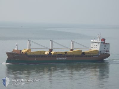
MINERVAGRACHT
General Cargo
Current Trip
| Time Travelled | 7 days |
|---|---|
| Remaining Time | --- |
| Distance Travelled | 2152.21 nm |
| Remaining Distance | --- |
| AVG Speed | 11.7 Knopen |
| MAX Speed | 14.6 Knopen |
| AVG Wind | 15 knots |
| MAX Wind | 27.7 knots |
| MIN Temp | 12.2°C / 53.96°F |
| MAX Temp | 18.2°C / 64.76°F |
| Diepgang | 6.3 M |
| Positie ontvangen | 2 d geleden |
Current Position
| Lengtegraad | 141.90101° |
|---|---|
| Breedtegraat | -39.29290° |
| Status | Under way using engine |
| Snelheid | 12 Knopen |
| Koers | 282° |
| Gebied | Great Australian Bight |
| Station | T-AIS |
| Positie ontvangen | 2 d geleden |
Info
Information
The current position of MINERVAGRACHT is in Great Australian Bight with coordinates -39.29290° / 141.90101° as reported on 2024-04-23 02:23 by AIS to our vessel tracker app. The vessel's current speed is 12 Knopen and is heading at the port of DAR ES SALAAM. The estimated time of arrival as calculated by MyShipTracking vessel tracking app is 2024-05-11 03:00 LT
The vessel MINERVAGRACHT (IMO: 9571521, MMSI: 246769000) is a General Cargo that was built in 2011 ( 13 Jaar oud ). It's sailing under the flag of [NL] Netherlands.
In this page you can find informations about the vessels current position, last detected port calls, and current voyage information. If the vessels is not in coverage by AIS you will find the latest position.
The current position of MINERVAGRACHT is detected by our AIS receivers and we are not responsible for the reliability of the data. The last position was recorded while the vessel was in Coverage by the Ais receivers of our vessel tracking app.
The current draught of MINERVAGRACHT as reported by AIS is 6.3 meters
Weather
| Temperature | 14.9°C / 58.82°F |
|---|---|
| Wind Speed | 11 knots |
| Direction | 171° S |
| Pressure | 1031.8 hPa |
| Humidity | 68.5 % |
| Cloud Coverage | 13 % |
Featured Company
Last Port Calls
| Port | Arrival | Departure | Time In Port |
|---|---|---|---|
| 2024-04-15 09:03 | 2024-04-17 22:13 | 2 d | |
| 2024-04-04 01:30 | 2024-04-07 23:10 | 3 d | |
| 2024-03-09 07:20 | 2024-03-10 09:34 | 1 d | |
| 2024-02-09 07:55 | 2024-02-10 12:30 | 1 d | |
| 2024-02-08 06:07 | 2024-02-08 14:10 | 8 h | |
| 2024-02-01 15:18 |
Most Visited Ports (Last year)
| Port | Arrivals | |
|---|---|---|
| 2 | ||
| 2 | ||
| 2 | ||
| 2 | ||
| 1 | ||
| 1 |
Last Trips
| Origin | Departure | Destination | Arrival | Distance | |
|---|---|---|---|---|---|
| 2024-04-08 09:10 | 2024-04-15 21:03 | 2021.25 nm | |||
| 2024-03-10 11:34 | 2024-04-04 11:30 | 6949.24 nm | |||
| 2024-02-10 13:30 | 2024-03-09 09:20 | 7067.69 nm | |||
| 2024-02-08 15:10 | 2024-02-09 08:55 | 215.64 nm | |||
| 2024-02-01 16:18 | 2024-02-08 07:07 | 1405.88 nm |
Events
| Tijd | Evenement | Details | Positie / Bestemming | Info |
|---|---|---|---|---|
| 2024-04-23 02:31 | Status Changed | Default Under way using engine |
-39.28737 / 141.86548
TZDAR
|
Snelheid: 12 kn Koers: 282° |
| 2024-04-23 02:23 | Buitenbereik |
-39.29290 / 141.90101
Great Australian Bight
TZDAR
|
Snelheid: 12 kn Koers: 282° |
|
| 2024-04-23 02:22 | Status Changed | Under way using engine Default |
-39.29362 / 141.90526
TZDAR
|
Snelheid: 12 kn Koers: 282° |
| 2024-04-23 02:19 | Binnenbereik |
-39.29290 / 141.90101
Great Australian Bight
TZDAR
|
Snelheid: 12 kn Koers: 282° |
|
| 2024-04-23 00:14 | Status Changed | Default Under way using engine |
-39.36860 / 142.45657
TZDAR
|
Snelheid: 12.6 kn Koers: 272.9° |
| 2024-04-23 00:10 | Buitenbereik |
-39.36935 / 142.47572
Great Australian Bight
TZDAR
|
Snelheid: 12.6 kn Koers: 272.9° |
|
| 2024-04-22 22:17 | Status Changed | Under way using engine Default |
-39.36867 / 142.99400
TZDAR
|
Snelheid: 12.9 kn Koers: 271° |
| 2024-04-22 22:15 | Status Changed | Default Under way using engine |
-39.36875 / 143.00160
TZDAR
|
Snelheid: 12.7 kn Koers: 270.9° |
| 2024-04-22 19:20 | Wijzig zee gebeid | Australian part of the Great Australian Bight Australian part of the Bass Strait |
-39.36330 / 143.80538
Great Australian Bight
TZDAR
|
Snelheid: 12.8 kn Koers: 269.1° |
| 2024-04-22 14:41 | Status Changed | Under way using engine Default |
-39.44622 / 145.18926
TZDAR
|
Snelheid: 14.2 kn Koers: 279° |