
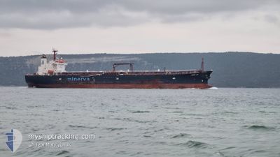
MINERVA JOY
Oil Products Tanker
Current Trip
ORDERS
| Time Travelled | 15 days |
|---|---|
| Remaining Time | --- |
| Distance Travelled | 429.69 nm |
| Remaining Distance | --- |
| AVG Speed | 5.4 Knopen |
| MAX Speed | 12.4 Knopen |
| AVG Wind | 8.4 knots |
| MAX Wind | 21.1 knots |
| MIN Temp | 11°C / 51.8°F |
| MAX Temp | 18.8°C / 65.84°F |
| Diepgang | 7.4 M |
| Positie ontvangen | 1 m geleden |
Current Position
| Lengtegraad | 28.47302° |
|---|---|
| Breedtegraat | 40.71766° |
| Status | Under way using engine |
| Snelheid | 0.7 Knopen |
| Koers | 122° |
| Gebied | Sea of Marmara |
| Station | T-AIS |
| Positie ontvangen | 1 m geleden |
Info
Information
The current position of MINERVA JOY is in Sea of Marmara with coordinates 40.71766° / 28.47302° as reported on 2024-04-19 19:10 by AIS to our vessel tracker app. The vessel's current speed is 0.7 Knopen
The vessel MINERVA JOY (IMO: 9363479, MMSI: 229446000) is a Oil Products Tanker that was built in 2008 ( 16 Jaar oud ). It's sailing under the flag of [MT] Malta.
In this page you can find informations about the vessels current position, last detected port calls, and current voyage information. If the vessels is not in coverage by AIS you will find the latest position.
The current position of MINERVA JOY is detected by our AIS receivers and we are not responsible for the reliability of the data. The last position was recorded while the vessel was in Coverage by the Ais receivers of our vessel tracking app.
The current draught of MINERVA JOY as reported by AIS is 7.4 meters
Weather
| Temperature | 12.8°C / 55.04°F |
|---|---|
| Wind Speed | 21 knots |
| Direction | 57° ENE |
| Pressure | 1009.4 hPa |
| Humidity | 84.7 % |
| Cloud Coverage | 80 % |
Featured Company
Most Visited Ports (Last year)
| Port | Arrivals | |
|---|---|---|
| 5 | ||
| 3 | ||
| 2 | ||
| 2 | ||
| 2 | ||
| 1 |
Events
| Tijd | Evenement | Details | Positie / Bestemming | Info |
|---|---|---|---|---|
| 2024-04-19 18:28 | Stop beweging | 16.68 nm, South West of AMBARLI |
40.72448 / 28.47886
ORDERS
|
Snelheid: 0.3 kn Koers: 126° |
| 2024-04-19 17:14 | Start beweging | 12.99 nm, South West of AMBARLI |
40.78181 / 28.51166
ORDERS
|
Snelheid: 3.1 kn Koers: 115° |
| 2024-04-19 00:54 | Stop beweging | 11.19 nm, South of YESILKOY |
40.77161 / 28.78376
ORDERS
|
Snelheid: 0.3 kn Koers: 8° |
| 2024-04-18 23:42 | Start beweging | 15.79 nm, South of YESILKOY |
40.69335 / 28.79123
ORDERS
|
Snelheid: 3.2 kn Koers: 50° |
| 2024-04-18 16:14 | Stop beweging | 9.32 nm, South of YESILKOY |
40.80798 / 28.89081
ORDERS
|
Snelheid: 0.3 kn Koers: 48° |
| 2024-04-18 14:27 | Start beweging | 11.81 nm, South of AMBARLI |
40.76749 / 28.73134
ORDERS
|
Snelheid: 4.6 kn Koers: 74° |
| 2024-04-18 13:55 | Stop beweging | 11.84 nm, South of AMBARLI |
40.76636 / 28.72687
ORDERS
|
Snelheid: 0.3 kn Koers: 344° |
| 2024-04-18 12:42 | Start beweging | 16.69 nm, South of AMBARLI |
40.68414 / 28.72536
ORDERS
|
Snelheid: 3.2 kn Koers: 13° |
| 2024-04-17 15:37 | Stop beweging | 14.06 nm, South of AMBARLI |
40.72598 / 28.69989
ORDERS
|
Snelheid: 0.3 kn Koers: 27° |
| 2024-04-16 20:32 | Start beweging | 14.36 nm, South West of AMBARLI |
40.76097 / 28.49845
ORDERS
|
Snelheid: 3.4 kn Koers: 167° |