
MILA
Cargo
Current Trip
ROERMOND
| Time Travelled | 4 days |
|---|---|
| Remaining Time | --- |
| Distance Travelled | 7.60 nm |
| Remaining Distance | --- |
| AVG Speed | 6.9 Knopen |
| MAX Speed | 7.8 Knopen |
| AVG Wind | 13.8 knots |
| MAX Wind | 19.8 knots |
| MIN Temp | 6.1°C / 42.98°F |
| MAX Temp | 11.6°C / 52.88°F |
| Diepgang | 3.2 M |
| Positie ontvangen | 11 h, 52 m geleden |
Current Position
| Lengtegraad | 6.00791° |
|---|---|
| Breedtegraat | 51.25411° |
| Status | Under way using engine |
| Snelheid | 7.8 Knopen |
| Koers | 158.3° |
| Gebied | North Sea |
| Station | T-AIS |
| Positie ontvangen | 11 h, 52 m geleden |
Info
Information
The current position of MILA is in North Sea with coordinates 51.25411° / 6.00791° as reported on 2024-04-19 11:30 by AIS to our vessel tracker app. The vessel's current speed is 7.8 Knopen
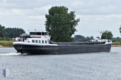
The vessel MILA (MMSI: 244660557) is a Cargo It's sailing under the flag of [NL] Netherlands.
In this page you can find informations about the vessels current position, last detected port calls, and current voyage information. If the vessels is not in coverage by AIS you will find the latest position.
The current position of MILA is detected by our AIS receivers and we are not responsible for the reliability of the data. The last position was recorded while the vessel was in Coverage by the Ais receivers of our vessel tracking app.
The current draught of MILA as reported by AIS is 3.2 meters
Weather
| Temperature | 10.1°C / 50.18°F |
|---|---|
| Wind Speed | 15 knots |
| Direction | 298° WNW |
| Pressure | 1007.5 hPa |
| Humidity | 83.5 % |
| Cloud Coverage | 100 % |
Featured Company
Last Port Calls
| Port | Arrival | Departure | Time In Port |
|---|---|---|---|
| 2024-04-15 04:55 | |||
| 2024-04-07 17:07 | |||
| 2024-04-03 12:17 | |||
| 2024-03-15 19:42 | 2024-03-16 09:20 | 13 h | |
| 2024-03-09 15:23 | 2024-03-09 16:55 | 1 h | |
| 2024-03-08 20:39 | 2024-03-09 09:36 | 12 h | |
| 2024-03-07 15:58 | 2024-03-08 07:16 | 15 h | |
| 2024-03-07 12:32 | 2024-03-07 12:45 | 12 m | |
| 2024-03-07 01:23 | 2024-03-07 08:49 | 7 h | |
| 2024-03-07 00:51 | 2024-03-07 01:10 | 18 m |
Last Trips
| Origin | Departure | Destination | Arrival | Distance | |
|---|---|---|---|---|---|
| 2024-03-09 17:55 | 2024-03-15 20:42 | 326.85 nm | |||
| 2024-03-09 10:36 | 2024-03-09 16:23 | 43.81 nm | |||
| 2024-03-08 08:16 | 2024-03-08 21:39 | 67.17 nm | |||
| 2024-03-07 13:45 | 2024-03-07 16:58 | 20.67 nm | |||
| 2024-03-07 09:49 | 2024-03-07 13:32 | 1.46 nm | |||
| 2024-03-07 02:10 | 2024-03-07 02:23 | 0.64 nm | |||
| 2024-03-06 11:50 | 2024-03-07 01:51 | 98.74 nm | |||
| 2024-03-06 11:18 | 2024-03-06 11:24 | 1.01 nm | |||
| 2024-03-06 10:39 | 2024-03-06 10:44 | 0.56 nm | |||
| 2024-03-05 14:37 | 2024-03-06 10:24 | 1.45 nm |
Events
| Tijd | Evenement | Details | Positie / Bestemming | Info |
|---|---|---|---|---|
| 2024-04-19 11:30 | Buitenbereik |
51.25411 / 6.00791
North Sea
|
Snelheid: 7.8 kn Koers: 158.3° |
|
| 2024-04-19 11:30 | Binnenbereik |
51.25411 / 6.00791
North Sea
|
Snelheid: 7.8 kn Koers: 158.3° |
|
| 2024-04-18 12:17 | Buitenbereik |
51.22114 / 5.97903
North Sea
|
Snelheid: 2.5 kn Koers: 198.3° |
|
| 2024-04-18 11:45 | Binnenbereik |
51.26626 / 6.02373
North Sea
|
Snelheid: 7.1 kn Koers: 253° |
|
| 2024-04-17 13:37 | Buitenbereik |
51.26611 / 6.01637
North Sea
|
Snelheid: 6.3 kn Koers: 105.5° |
|
| 2024-04-17 13:37 | Binnenbereik |
51.26611 / 6.01637
North Sea
|
Snelheid: 6.3 kn Koers: 105.5° |
|
| 2024-04-16 13:44 | Buitenbereik |
51.26599 / 6.01688
North Sea
|
Snelheid: 6 kn Koers: 103.6° |
|
| 2024-04-16 13:44 | Binnenbereik |
51.26599 / 6.01688
North Sea
|
Snelheid: 6 kn Koers: 103.6° |
|
| 2024-04-16 11:26 | Buitenbereik |
51.25628 / 6.00633
North Sea
|
Snelheid: 7.4 kn Koers: 159° |
|
| 2024-04-16 11:17 | Binnenbereik |
51.26607 / 6.02273
North Sea
|
Snelheid: 6.6 kn Koers: 255.9° |