
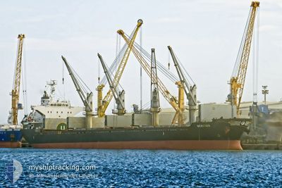
MERITIUS
Bulk Carrier
Current Trip
| Time Travelled | 7 days |
|---|---|
| Remaining Time | 3 days |
| Distance Travelled | 2314.39 nm |
| Remaining Distance | 1162.82 nm |
| AVG Speed | 13 Knopen |
| MAX Speed | 16.3 Knopen |
| AVG Wind | 11.4 knots |
| MAX Wind | 31.8 knots |
| MIN Temp | 6.5°C / 43.7°F |
| MAX Temp | 19.2°C / 66.56°F |
| Diepgang | 8.4 M |
| Positie ontvangen | 2 d geleden |
Current Position
| Lengtegraad | 0.31147° |
|---|---|
| Breedtegraat | 36.62215° |
| Status | Under way using engine |
| Snelheid | 12.5 Knopen |
| Koers | 79° |
| Gebied | Mediterranean Sea - Western Basin |
| Station | T-AIS |
| Positie ontvangen | 2 d geleden |
Info
Information
The current position of MERITIUS is in Mediterranean Sea - Western Basin with coordinates 36.62215° / 0.31147° as reported on 2024-04-23 14:46 by AIS to our vessel tracker app. The vessel's current speed is 12.5 Knopen and is heading at the port of DAMIETTA. The estimated time of arrival as calculated by MyShipTracking vessel tracking app is 2024-04-28 20:54 LT
The vessel MERITIUS (IMO: 9515632, MMSI: 538007384) is a Bulk Carrier that was built in 2009 ( 15 Jaar oud ). It's sailing under the flag of [MH] Marshall Is.
In this page you can find informations about the vessels current position, last detected port calls, and current voyage information. If the vessels is not in coverage by AIS you will find the latest position.
The current position of MERITIUS is detected by our AIS receivers and we are not responsible for the reliability of the data. The last position was recorded while the vessel was in Coverage by the Ais receivers of our vessel tracking app.
The current draught of MERITIUS as reported by AIS is 8.4 meters
Weather
| Temperature | 15.2°C / 59.36°F |
|---|---|
| Wind Speed | 17 knots |
| Direction | 282° WNW |
| Pressure | 1013.7 hPa |
| Humidity | 71.1 % |
| Cloud Coverage | 31 % |
Featured Company
Last Port Calls
| Port | Arrival | Departure | Time In Port |
|---|---|---|---|
| 2024-04-18 05:50 | 2024-04-18 06:58 | 1 h | |
| 2024-04-13 22:56 | 2024-04-18 04:00 | 4 d | |
| 2024-04-13 21:36 | 2024-04-13 21:50 | 13 m | |
| 2024-04-12 08:58 | 2024-04-13 02:12 | 17 h | |
| 2024-04-08 07:41 | 2024-04-11 16:03 | 3 d | |
| 2024-03-24 19:30 | 2024-03-26 08:10 | 1 d | |
| 2024-03-20 15:38 | 2024-03-23 21:14 | 3 d | |
| 2024-03-12 22:12 | 2024-03-15 09:43 | 2 d | |
| 2024-02-27 09:41 | 2024-02-29 15:57 | 2 d | |
| 2024-02-03 22:39 | 2024-02-06 02:46 | 2 d |
Last Trips
| Origin | Departure | Destination | Arrival | Distance | |
|---|---|---|---|---|---|
| 2024-04-18 06:00 | 2024-04-18 07:50 | 9.12 nm | |||
| 2024-04-13 23:50 | 2024-04-14 00:56 | 8.29 nm | |||
| 2024-04-13 04:12 | 2024-04-13 23:36 | 152.02 nm | |||
| 2024-04-11 18:03 | 2024-04-12 10:58 | 127.39 nm | |||
| 2024-03-26 10:10 | 2024-04-08 09:41 | 3410.42 nm | |||
| 2024-03-23 23:14 | 2024-03-24 21:30 | 74.88 nm | |||
| 2024-02-29 16:57 | 2024-03-20 17:38 | 2849.48 nm | |||
| 2024-02-29 16:57 | 2024-03-13 00:12 | 2638.44 nm | |||
| 2024-02-06 03:46 | 2024-02-27 10:41 | 1545.11 nm | |||
| 2024-01-04 10:45 | 2024-02-03 23:39 | 9140.28 nm |
Events
| Tijd | Evenement | Details | Positie / Bestemming | Info |
|---|---|---|---|---|
| 2024-04-23 15:33 | Status Changed | Default Under way using engine |
36.65263 / .56983
DAMIETTA
|
Snelheid: 12.5 kn Koers: 79° |
| 2024-04-23 14:46 | Buitenbereik |
36.62215 / .31147
Mediterranean Sea - Western Basin
DAMIETTA
|
Snelheid: 12.5 kn Koers: 79° |
|
| 2024-04-23 08:11 | Gevonden in zee | Algerian part of the Mediterranean Sea - Western Basin |
36.35948 / -1.40303
Mediterranean Sea - Western Basin
DAMIETTA
|
Snelheid: 13.6 kn Koers: 77° |
| 2024-04-23 06:51 | Gevonden in zee | Spanish part of the Mediterranean Sea - Western Basin |
36.30060 / -1.75553
Mediterranean Sea - Western Basin
DAMIETTA
|
Snelheid: 14.6 kn Koers: 79° |
| 2024-04-23 04:15 | Status Changed | Under way using engine Default |
36.21297 / -2.47970
DAMIETTA
|
Snelheid: 13 kn Koers: 84° |
| 2024-04-23 03:58 | Status Changed | Default Under way using engine |
36.21072 / -2.55702
DAMIETTA
|
Snelheid: 12.8 kn Koers: 84° |
| 2024-04-23 03:52 | Status Changed | Under way using engine Default |
36.21058 / -2.58362
DAMIETTA
|
Snelheid: 12.8 kn Koers: 85° |
| 2024-04-23 03:31 | Status Changed | Default Under way using engine |
36.20420 / -2.67507
DAMIETTA
|
Snelheid: 12.6 kn Koers: 84° |
| 2024-04-23 02:16 | Status Changed | Under way using engine Default |
36.18547 / -3.00173
DAMIETTA
|
Snelheid: 12.6 kn Koers: 85° |
| 2024-04-23 01:58 | Status Changed | Default Under way using engine |
36.18063 / -3.07603
DAMIETTA
|
Snelheid: 12.5 kn Koers: 85° |