
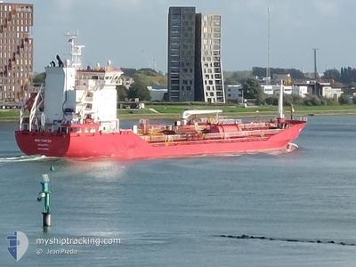
MED TUNCER
Tanker
Current Trip
| Time Travelled | 1 day |
|---|---|
| Remaining Time | 15 h, 2 mins |
| Distance Travelled | 218.75 nm |
| Remaining Distance | 220.70 nm |
| AVG Speed | 9.9 Knopen |
| MAX Speed | 15.4 Knopen |
| AVG Wind | 4.2 knots |
| MAX Wind | 12.2 knots |
| MIN Temp | 14.2°C / 57.56°F |
| MAX Temp | 21.6°C / 70.88°F |
| Diepgang | 5.2 M |
| Positie ontvangen | 10 m geleden |
Current Position
| Lengtegraad | 25.88196° |
|---|---|
| Breedtegraat | 39.91166° |
| Status | Under way using engine |
| Snelheid | 12.9 Knopen |
| Koers | 215° |
| Gebied | Aegean Sea |
| Station | T-AIS |
| Positie ontvangen | 10 m geleden |
Info
Information
The current position of MED TUNCER is in Aegean Sea with coordinates 39.91166° / 25.88196° as reported on 2024-04-18 08:40 by AIS to our vessel tracker app. The vessel's current speed is 12.9 Knopen and is heading at the port of AGIOI THEODORI. The estimated time of arrival as calculated by MyShipTracking vessel tracking app is 2024-04-18 23:53 LT
The vessel MED TUNCER (IMO: 9830599, MMSI: 215033000) is a Tanker It's sailing under the flag of [MT] Malta.
In this page you can find informations about the vessels current position, last detected port calls, and current voyage information. If the vessels is not in coverage by AIS you will find the latest position.
The current position of MED TUNCER is detected by our AIS receivers and we are not responsible for the reliability of the data. The last position was recorded while the vessel was in Coverage by the Ais receivers of our vessel tracking app.
The current draught of MED TUNCER as reported by AIS is 5.2 meters
Weather
| Temperature | 16.4°C / 61.52°F |
|---|---|
| Wind Speed | 8 knots |
| Direction | 264° W |
| Pressure | 1003.8 hPa |
| Humidity | 79.7 % |
| Cloud Coverage | 6 % |
Featured Company
Last Port Calls
| Port | Arrival | Departure | Time In Port |
|---|---|---|---|
| 2024-03-12 13:53 | 2024-04-16 12:33 | ||
| 2024-03-07 07:20 | 2024-03-08 15:48 | 1 d | |
| 2024-03-06 23:02 | 2024-03-07 07:14 | 8 h | |
| 2024-03-05 13:59 | 2024-03-06 06:53 | 16 h | |
| 2024-03-01 19:38 | 2024-03-02 08:30 | 12 h | |
| 2024-02-28 22:47 | 2024-02-29 21:43 | 22 h | |
| 2024-02-23 10:57 | 2024-02-24 08:25 | 21 h | |
| 2024-02-19 06:49 | 2024-02-20 10:16 | 1 d | |
| 2024-02-15 17:54 | 2024-02-15 23:45 | 5 h | |
| 2024-02-02 15:40 | 2024-02-07 11:34 | 4 d |
Most Visited Ports (Last year)
| Port | Arrivals | |
|---|---|---|
| 7 | ||
| 4 | ||
| 4 | ||
| 3 | ||
| 2 | ||
| 2 |
Last Trips
| Origin | Departure | Destination | Arrival | Distance | |
|---|---|---|---|---|---|
| 2024-03-08 16:48 | 2024-03-12 16:53 | 863.21 nm | |||
| 2024-03-07 08:14 | 2024-03-07 08:20 | 0.07 nm | |||
| 2024-03-06 07:53 | 2024-03-07 00:02 | 0.96 nm | |||
| 2024-03-02 09:30 | 2024-03-05 14:59 | 802.52 nm | |||
| 2024-02-29 22:43 | 2024-03-01 20:38 | 254.39 nm | |||
| 2024-02-24 09:25 | 2024-02-28 23:47 | 270.87 nm | |||
| 2024-02-20 11:16 | 2024-02-23 11:57 | 622.89 nm | |||
| 2024-02-16 00:45 | 2024-02-19 07:49 | 834.20 nm | |||
| 2024-02-07 12:34 | 2024-02-15 18:54 | 1494.14 nm | |||
| 2024-02-02 14:30 | 2024-02-02 16:40 | 21.02 nm |
Events
| Tijd | Evenement | Details | Positie / Bestemming | Info |
|---|---|---|---|---|
| 2024-04-18 08:26 | Status Changed | Under way using engine Default |
39.95333 / 25.92127
GRAGT
|
Snelheid: 12.6 kn Koers: 262° |
| 2024-04-18 08:00 | Status Changed | Default Under way using engine |
40.01468 / 26.01275
GRAGT
|
Snelheid: 12.5 kn Koers: 262.3° |
| 2024-04-18 07:44 | Gevonden in zee | Turkish part of the Aegean Sea |
40.02097 / 26.08202
Aegean Sea
GRAGT
|
Snelheid: 12.5 kn Koers: 264.5° |
| 2024-04-18 05:27 | Binnenbereik |
40.30004 / 26.57496
Sea of Marmara
GRAGT
|
Snelheid: 14.4 kn Koers: 230° |
|
| 2024-04-18 02:27 | Status Changed | Default Under way using engine |
40.54646 / 27.05804
GRAGT
|
Snelheid: 8.9 kn Koers: 242.2° |
| 2024-04-18 02:26 | Buitenbereik |
40.54707 / 27.05958
Sea of Marmara
GRAGT
|
Snelheid: 8.9 kn Koers: 242.2° |
|
| 2024-04-17 19:29 | Start beweging | 2.76 nm, East of AMBARLI |
40.96045 / 28.73515
GRAGT
|
Snelheid: 3.7 kn Koers: 213° |
| 2024-04-17 19:27 | ETA Changed | 2024/04/19 05:00 2024/04/18 09:00 |
40.96123 / 28.73480
GRAGT
|
Snelheid: 0.6 kn Koers: 111° |
| 2024-04-17 19:26 | Status Changed | Under way using engine At anchor |
40.96110 / 28.73493
GRAGT
|
Snelheid: 0.6 kn Koers: 99° |
| 2024-04-17 04:26 | Status Changed | At anchor Default |
40.96276 / 28.73814
GRAGT
|
Snelheid: 0.1 kn Koers: 185° |