
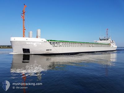
MARJATTA
General Cargo
Current Trip
| Time Travelled | 1 day |
|---|---|
| Remaining Time | 22 h, 3 mins |
| Distance Travelled | 328.79 nm |
| Remaining Distance | 243.90 nm |
| AVG Speed | 10.7 Knopen |
| MAX Speed | 11.2 Knopen |
| AVG Wind | 12.4 knots |
| MAX Wind | 16 knots |
| MIN Temp | 1.9°C / 35.42°F |
| MAX Temp | 3.9°C / 39.02°F |
| Diepgang | 5.5 M |
| Positie ontvangen | 1 m geleden |
Current Position
| Lengtegraad | 16.47096° |
|---|---|
| Breedtegraat | 56.05970° |
| Status | Under way using engine |
| Snelheid | 11 Knopen |
| Koers | 238.7° |
| Gebied | Baltic Sea |
| Station | T-AIS |
| Positie ontvangen | 1 m geleden |
Info
Information
The current position of MARJATTA is in Baltic Sea with coordinates 56.05970° / 16.47096° as reported on 2024-04-25 14:28 by AIS to our vessel tracker app. The vessel's current speed is 11 Knopen and is heading at the port of LUBECK. The estimated time of arrival as calculated by MyShipTracking vessel tracking app is 2024-04-26 12:32 LT
The vessel MARJATTA (IMO: 9345374, MMSI: 212198000) is a General Cargo that was built in 2006 ( 18 Jaar oud ). It's sailing under the flag of [CY] Cyprus.
In this page you can find informations about the vessels current position, last detected port calls, and current voyage information. If the vessels is not in coverage by AIS you will find the latest position.
The current position of MARJATTA is detected by our AIS receivers and we are not responsible for the reliability of the data. The last position was recorded while the vessel was in Coverage by the Ais receivers of our vessel tracking app.
The current draught of MARJATTA as reported by AIS is 5.5 meters
Weather
| Temperature | 3.9°C / 39.02°F |
|---|---|
| Wind Speed | 8 knots |
| Direction | 97° E |
| Pressure | 1006.3 hPa |
| Humidity | 82.5 % |
| Cloud Coverage | 8 % |
Featured Company
Last Port Calls
| Port | Arrival | Departure | Time In Port |
|---|---|---|---|
| 2024-04-22 08:07 | 2024-04-24 08:00 | 1 d | |
| 2024-04-20 11:01 | 2024-04-21 20:50 | 1 d | |
| 2024-04-16 01:40 | 2024-04-18 13:15 | 2 d | |
| 2024-04-07 21:33 | 2024-04-11 00:42 | 3 d | |
| 2024-04-01 19:13 | 2024-04-04 13:15 | 2 d | |
| 2024-03-24 22:06 | 2024-03-26 17:16 | 1 d | |
| 2024-03-17 18:38 | 2024-03-19 12:48 | 1 d | |
| 2024-03-14 10:48 | 2024-03-14 11:47 | 58 m | |
| 2024-03-09 12:19 | 2024-03-13 19:13 | 4 d | |
| 2024-03-04 20:01 | 2024-03-06 17:19 | 1 d |
Last Trips
| Origin | Departure | Destination | Arrival | Distance | |
|---|---|---|---|---|---|
| 2024-04-21 23:50 | 2024-04-22 11:07 | 126.02 nm | |||
| 2024-04-18 15:15 | 2024-04-20 14:01 | 392.14 nm | |||
| 2024-04-11 02:42 | 2024-04-16 03:40 | 564.72 nm | |||
| 2024-04-04 15:15 | 2024-04-07 23:33 | 541.11 nm | |||
| 2024-03-26 18:16 | 2024-04-01 21:13 | 649.12 nm | |||
| 2024-03-19 13:48 | 2024-03-24 23:06 | 645.43 nm | |||
| 2024-03-14 12:47 | 2024-03-17 19:38 | 414.14 nm | |||
| 2024-03-13 20:13 | 2024-03-14 11:48 | 126.04 nm | |||
| 2024-03-06 18:19 | 2024-03-09 13:19 | 550.50 nm | |||
| 2024-02-29 16:28 | 2024-03-04 21:01 | 382.79 nm |
Events
| Tijd | Evenement | Details | Positie / Bestemming | Info |
|---|---|---|---|---|
| 2024-04-25 14:01 | Status Changed | Under way using engine Default |
56.10262 / 16.59913
DELBE
|
Snelheid: 10.8 kn Koers: 238° |
| 2024-04-25 13:57 | Status Changed | Default Under way using engine |
56.10905 / 16.61742
DELBE
|
Snelheid: 10.8 kn Koers: 232.2° |
| 2024-04-25 13:50 | Wijzig zee gebeid | Swedish part of the Baltic Sea Finnish part of the Baltic Sea |
56.12013 / 16.64773
Baltic Sea
DELBE
|
Snelheid: 10.8 kn Koers: 232.2° |
| 2024-04-25 13:50 | Status Changed | Under way using engine Default |
56.12013 / 16.64773
DELBE
|
Snelheid: 10.9 kn Koers: 233° |
| 2024-04-25 13:48 | Binnenbereik |
56.12013 / 16.64773
Baltic Sea
DELBE
|
Snelheid: 10.8 kn Koers: 232.2° |
|
| 2024-04-24 14:56 | Status Changed | Default Under way using engine |
59.45504 / 21.07919
DELBE
|
Snelheid: 10.7 kn Koers: 207.8° |
| 2024-04-24 14:45 | Buitenbereik |
59.48439 / 21.10856
Baltic Sea
DELBE
|
Snelheid: 10.7 kn Koers: 207.8° |
|
| 2024-04-24 13:23 | Gevonden in zee | Finnish part of the Baltic Sea |
59.70100 / 21.32637
Baltic Sea
DELBE
|
Snelheid: 10.7 kn Koers: 190° |
| 2024-04-24 10:27 | Status Changed | Under way using engine Default |
60.13712 / 21.68254
DELBE
|
Snelheid: 10 kn Koers: 255° |
| 2024-04-24 09:44 | Status Changed | Default Under way using engine |
60.22666 / 21.79333
DELBE
|
Snelheid: 10.5 kn Koers: 237.7° |