
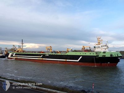
MARGIRIS
Trawler
Current Trip
PANAMA
| Time Travelled | 10 days |
|---|---|
| Remaining Time | --- |
| Distance Travelled | 1721.28 nm |
| Remaining Distance | --- |
| AVG Speed | 10 Knopen |
| MAX Speed | 15.3 Knopen |
| AVG Wind | 26.4 knots |
| MAX Wind | 37.9 knots |
| MIN Temp | 8°C / 46.4°F |
| MAX Temp | 17.1°C / 62.78°F |
| Diepgang | 5 M |
| Positie ontvangen | 4 d geleden |
Current Position
| Lengtegraad | -29.38186° |
|---|---|
| Breedtegraat | 37.27260° |
| Status | Under way using engine |
| Snelheid | 12.5 Knopen |
| Koers | 253° |
| Gebied | North Atlantic Ocean |
| Station | T-AIS |
| Positie ontvangen | 4 d geleden |
Info
Information
The current position of MARGIRIS is in North Atlantic Ocean with coordinates 37.27260° / -29.38186° as reported on 2024-04-15 01:31 by AIS to our vessel tracker app. The vessel's current speed is 12.5 Knopen
The vessel MARGIRIS (IMO: 8301187, MMSI: 277330000) is a Trawler that was built in 1985 ( 39 Jaar oud ). It's sailing under the flag of [LT] Lithuania.
In this page you can find informations about the vessels current position, last detected port calls, and current voyage information. If the vessels is not in coverage by AIS you will find the latest position.
The current position of MARGIRIS is detected by our AIS receivers and we are not responsible for the reliability of the data. The last position was recorded while the vessel was in Coverage by the Ais receivers of our vessel tracking app.
The current draught of MARGIRIS as reported by AIS is 5 meters
Weather
| Temperature | 16.9°C / 62.42°F |
|---|---|
| Wind Speed | 27 knots |
| Direction | 65° ENE |
| Pressure | 1016.3 hPa |
| Humidity | 88.3 % |
| Cloud Coverage | 51 % |
Featured Company
Last Port Calls
Most Visited Ports (Last year)
| Port | Arrivals | |
|---|---|---|
| 8 | ||
| 2 | ||
| 2 | ||
| 1 |
Last Trips
| Origin | Departure | Destination | Arrival | Distance | |
|---|---|---|---|---|---|
| 2024-04-03 14:23 | 2024-04-03 16:27 | 11.27 nm | |||
| 2024-03-28 05:04 | 2024-03-28 06:33 | 9.58 nm | |||
| 2024-02-27 03:55 | 2024-03-17 11:37 | 1821.34 nm | |||
| 2024-02-07 23:26 | 2024-02-23 23:32 | 1287.65 nm | |||
| 2024-01-12 20:19 | 2024-02-03 12:36 | 1670.14 nm |
Events
| Tijd | Evenement | Details | Positie / Bestemming | Info |
|---|---|---|---|---|
| 2024-04-15 01:31 | Buitenbereik |
37.27260 / -29.38186
North Atlantic Ocean
|
Snelheid: 12.5 kn Koers: 253° |
|
| 2024-04-14 16:11 | Binnenbereik |
37.85504 / -27.09416
North Atlantic Ocean
|
Snelheid: 12.6 kn Koers: 254.9° |
|
| 2024-04-14 12:46 | Buitenbereik |
38.07188 / -26.24048
North Atlantic Ocean
|
Snelheid: 12.8 kn Koers: 226.7° |
|
| 2024-04-14 10:34 | Wijzig zee gebeid | Portuguese (Azores) part of the North Atlantic Ocean High seas of the North Atlantic Ocean |
38.39484 / -25.80062
North Atlantic Ocean
|
Snelheid: 12.9 kn Koers: 227.6° |
| 2024-04-14 10:33 | Binnenbereik |
38.39484 / -25.80062
North Atlantic Ocean
|
Snelheid: 12.9 kn Koers: 227.6° |
|
| 2024-04-12 00:07 | Buitenbereik |
45.72827 / -13.27374
North Atlantic Ocean
|
Snelheid: 11.3 kn Koers: 233.3° |
|
| 2024-04-11 18:05 | Wijzig zee gebeid | High seas of the North Atlantic Ocean French part of the Celtic Sea |
46.35585 / -11.88352
North Atlantic Ocean
|
Snelheid: 10.9 kn Koers: 240.2° |
| 2024-04-11 18:05 | Binnenbereik |
46.35585 / -11.88352
North Atlantic Ocean
|
Snelheid: 10.9 kn Koers: 240.2° |
|
| 2024-04-10 19:28 | Buitenbereik |
48.51793 / -6.47350
Celtic Sea
|
Snelheid: 11.2 kn Koers: 241.7° |
|
| 2024-04-10 13:49 | Gevonden in zee | French part of the Celtic Sea |
49.04456 / -5.38398
Celtic Sea
|
Snelheid: 11.3 kn Koers: 241.4° |