
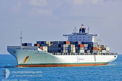
MAERSK NOKWANDA
Container Ship
Current Trip
| Time Travelled | 1 day |
|---|---|
| Remaining Time | --- |
| Distance Travelled | 389.68 nm |
| Remaining Distance | --- |
| AVG Speed | 12.7 Knopen |
| MAX Speed | 15.7 Knopen |
| AVG Wind | 14.7 knots |
| MAX Wind | 25 knots |
| MIN Temp | 4.4°C / 39.92°F |
| MAX Temp | 15.5°C / 59.9°F |
| Diepgang | 13.5 M |
| Positie ontvangen | 2 m geleden |
Current Position
| Lengtegraad | --- |
|---|---|
| Breedtegraat | --- |
| Status | Under way using engine |
| Snelheid | 13.9 Knopen |
| Koers | 199.8° |
| Gebied | Aegean Sea |
| Station | T-AIS |
| Positie ontvangen | 2 m geleden |
Info
Information
The current position of MAERSK NOKWANDA is in Aegean Sea with coordinates 37.07380° / 24.10513° as reported on 2025-12-09 22:14 by AIS to our vessel tracker app. The vessel's current speed is 13.9 Knopen and is heading at the port of TANGER MED. The estimated time of arrival as calculated by MyShipTracking vessel tracking app is 2025-12-14 11:00 LT
The vessel MAERSK NOKWANDA (IMO: 9294393, MMSI: 477552200) is a Container Ship that was built in 2005 ( 20 Jaar oud ). It's sailing under the flag of [HK] Hong Kong.
In this page you can find informations about the vessels current position, last detected port calls, and current voyage information. If the vessels is not in coverage by AIS you will find the latest position.
The current position of MAERSK NOKWANDA is detected by our AIS receivers and we are not responsible for the reliability of the data. The last position was recorded while the vessel was in Coverage by the Ais receivers of our vessel tracking app.
The current draught of MAERSK NOKWANDA as reported by AIS is 13.5 meters
Weather
| Temperature | 15.5°C / 59.9°F |
|---|---|
| Wind Speed | 22 knots |
| Direction | 359° N |
| Pressure | 1021.8 hPa |
| Humidity | 68.8 % |
| Cloud Coverage | 31 % |
Featured Company
Last Port Calls
| Port | Arrival | Departure | Time In Port |
|---|---|---|---|
| 2025-12-08 01:06 | 2025-12-08 18:33 | 17 h | |
| 2025-12-06 19:14 | 2025-12-07 19:34 | 1 d | |
| 2025-12-04 21:05 | 2025-12-05 15:02 | 17 h | |
| 2025-12-02 12:39 | 2025-12-03 07:56 | 19 h | |
| 2025-11-30 22:53 | 2025-12-01 13:15 | 14 h | |
| 2025-11-26 13:28 | 2025-11-27 01:34 | 12 h | |
| 2025-11-25 09:10 | 2025-11-26 05:40 | 20 h | |
| 2025-11-13 14:58 | 2025-11-14 18:18 | 1 d | |
| 2025-11-12 04:30 | 2025-11-13 04:10 | 23 h | |
| 2025-11-09 08:57 | 2025-11-10 08:04 | 23 h |
Most Visited Ports (Last year)
| Port | Arrivals | |
|---|---|---|
| 12 | ||
| 12 | ||
| 12 | ||
| 11 | ||
| 6 | ||
| 6 |
Last Trips
| Origin | Departure | Destination | Arrival | Distance | |
|---|---|---|---|---|---|
| 2025-12-07 19:34 | 2025-12-08 01:06 | 58.27 nm | |||
| 2025-12-05 15:02 | 2025-12-06 19:14 | 80.52 nm | |||
| 2025-12-03 07:56 | 2025-12-04 21:05 | 387.41 nm | |||
| 2025-12-01 13:15 | 2025-12-02 12:39 | 262.99 nm | |||
| 2025-11-27 01:34 | 2025-11-30 22:53 | 1516.96 nm | |||
| 2025-11-26 05:40 | 2025-11-26 13:28 | 51.70 nm | |||
| 2025-11-14 18:18 | 2025-11-25 09:10 | 4370.24 nm | |||
| 2025-11-13 04:10 | 2025-11-13 14:58 | 44.00 nm | |||
| 2025-11-10 08:04 | 2025-11-12 04:30 | 771.05 nm | |||
| 2025-11-08 15:25 | 2025-11-09 08:57 | 91.59 nm |
Events
| Tijd | Evenement | Details | Positie / Bestemming | Info |
|---|---|---|---|---|
| 2025-12-09 20:45 | Status Changed | Under way using engine Default |
37.40008 / 24.28213
MAPTM
|
Snelheid: 14.5 kn Koers: 200° |
| 2025-12-09 20:29 | Status Changed | Default Under way using engine |
37.45880 / 24.30910
MAPTM
|
Snelheid: 14.4 kn Koers: 214.7° |
| 2025-12-09 20:22 | Status Changed | Under way using engine Default |
37.48349 / 24.32772
MAPTM
|
Snelheid: 14.6 kn Koers: 222° |
| 2025-12-09 20:15 | Status Changed | Default Under way using engine |
37.50787 / 24.35478
MAPTM
|
Snelheid: 14.6 kn Koers: 222.3° |
| 2025-12-09 15:23 | Status Changed | Under way using engine Default |
38.58863 / 24.97856
MAPTM
|
Snelheid: 14.1 kn Koers: 204° |
| 2025-12-09 15:08 | Binnenbereik |
38.58863 / 24.97856
Aegean Sea
MAPTM
|
Snelheid: 14 kn Koers: 203.7° |
|
| 2025-12-09 11:37 | Status Changed | Default Under way using engine |
39.40187 / 25.43683
MAPTM
|
Snelheid: 14.1 kn Koers: 204.7° |
| 2025-12-09 11:35 | Status Changed | Under way using engine Default |
39.41262 / 25.44316
MAPTM
|
Snelheid: 14.2 kn Koers: 206° |
| 2025-12-09 11:35 | Buitenbereik |
39.41262 / 25.44316
Aegean Sea
MAPTM
|
Snelheid: 14.1 kn Koers: 204.7° |
|
| 2025-12-09 11:24 | Status Changed | Default Under way using engine |
39.44833 / 25.46500
MAPTM
|
Snelheid: 14.3 kn Koers: 205.6° |