
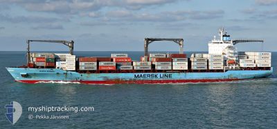
MAERSK NEWBURY
Container Ship
Current Trip
COT1U>COSMP
| Time Travelled | 9 days |
|---|---|
| Remaining Time | --- |
| Distance Travelled | 4014.83 nm |
| Remaining Distance | --- |
| AVG Speed | 18.5 Knopen |
| MAX Speed | 21 Knopen |
| AVG Wind | 11.1 knots |
| MAX Wind | 21.8 knots |
| MIN Temp | 10°C / 50°F |
| MAX Temp | 29.2°C / 84.56°F |
| Diepgang | 10 M |
| Positie ontvangen | 3 d geleden |
Current Position
| Lengtegraad | -39.73341° |
|---|---|
| Breedtegraat | 40.07643° |
| Status | Under way using engine |
| Snelheid | 19.2 Knopen |
| Koers | 57.2° |
| Gebied | North Atlantic Ocean |
| Station | T-AIS |
| Positie ontvangen | 3 d geleden |
Info
Information
The current position of MAERSK NEWBURY is in North Atlantic Ocean with coordinates 40.07643° / -39.73341° as reported on 2024-04-21 12:38 by AIS to our vessel tracker app. The vessel's current speed is 19.2 Knopen
The vessel MAERSK NEWBURY (IMO: 9231470, MMSI: 566278000) is a Container Ship that was built in 2001 ( 23 Jaar oud ). It's sailing under the flag of [SG] Singapore.
In this page you can find informations about the vessels current position, last detected port calls, and current voyage information. If the vessels is not in coverage by AIS you will find the latest position.
The current position of MAERSK NEWBURY is detected by our AIS receivers and we are not responsible for the reliability of the data. The last position was recorded while the vessel was in Coverage by the Ais receivers of our vessel tracking app.
The current draught of MAERSK NEWBURY as reported by AIS is 10 meters
Weather
| Temperature | 10°C / 50°F |
|---|---|
| Wind Speed | 12 knots |
| Direction | 339° NNW |
| Pressure | 1016.5 hPa |
| Humidity | 73.7 % |
| Cloud Coverage | 35 % |
Featured Company
Last Port Calls
| Port | Arrival | Departure | Time In Port |
|---|---|---|---|
| 2024-04-15 03:44 | 2024-04-15 19:55 | 16 h | |
| 2024-04-11 06:05 | 2024-04-14 10:38 | 3 d | |
| 2024-04-10 01:09 | 2024-04-10 16:39 | 15 h | |
| 2024-04-06 23:04 | 2024-04-07 17:26 | 18 h | |
| 2024-04-02 21:25 | 2024-04-03 12:49 | 15 h | |
| 2024-03-12 16:26 | 2024-03-18 06:49 | 5 d | |
| 2024-03-11 13:29 | 2024-03-12 06:06 | 16 h | |
| 2024-03-08 19:48 | 2024-03-10 10:44 | 1 d | |
| 2024-03-07 03:43 | 2024-03-08 00:41 | 20 h | |
| 2024-02-24 22:16 | 2024-02-25 13:01 | 14 h |
Most Visited Ports (Last year)
| Port | Arrivals | |
|---|---|---|
| 9 | ||
| 8 | ||
| 8 | ||
| 8 | ||
| 7 | ||
| 7 |
Last Trips
| Origin | Departure | Destination | Arrival | Distance | |
|---|---|---|---|---|---|
| 2024-04-14 05:38 | 2024-04-14 22:44 | 284.73 nm | |||
| 2024-04-10 11:39 | 2024-04-11 01:05 | 242.38 nm | |||
| 2024-04-07 12:26 | 2024-04-09 20:09 | 20.84 nm | |||
| 2024-04-03 06:49 | 2024-04-06 18:04 | 1262.23 nm | |||
| 2024-03-18 07:49 | 2024-04-02 15:25 | 5957.36 nm | |||
| 2024-03-12 07:06 | 2024-03-12 17:26 | 135.27 nm | |||
| 2024-03-10 11:44 | 2024-03-11 14:29 | 411.42 nm | |||
| 2024-03-08 00:41 | 2024-03-08 20:48 | 261.37 nm | |||
| 2024-02-25 08:01 | 2024-03-07 03:43 | 4368.86 nm | |||
| 2024-02-23 09:34 | 2024-02-24 17:16 | 292.21 nm |
Events
| Tijd | Evenement | Details | Positie / Bestemming | Info |
|---|---|---|---|---|
| 2024-04-21 12:49 | Status Changed | Default Under way using engine |
40.10862 / -39.67049
COT1U>COSMP
|
Snelheid: 19.2 kn Koers: 57.2° |
| 2024-04-21 12:38 | Buitenbereik |
40.07643 / -39.73341
North Atlantic Ocean
|
Snelheid: 19.2 kn Koers: 57.2° |
|
| 2024-04-21 12:25 | Wijzig zee gebeid | High seas of the North Atlantic Ocean Colombian part of the Caribbean Sea |
40.03690 / -39.81091
North Atlantic Ocean
|
Snelheid: 18.7 kn Koers: 59° |
| 2024-04-21 12:25 | Status Changed | Under way using engine Default |
40.03690 / -39.81091
COT1U>COSMP
|
Snelheid: 18.6 kn Koers: 58° |
| 2024-04-21 12:25 | Binnenbereik |
40.03690 / -39.81091
North Atlantic Ocean
|
Snelheid: 18.7 kn Koers: 59° |
|
| 2024-04-15 20:07 | Status Changed | Default Moored |
11.26833 / -74.24667
COT1U>COSMP
|
Snelheid: 13.2 kn Koers: 7.4° |
| 2024-04-15 20:04 | Buitenbereik |
11.25672 / -74.24837
Caribbean Sea
|
Snelheid: 13.2 kn Koers: 7.4° |
|
| 2024-04-15 20:01 | Status Changed | Moored Default |
11.24586 / -74.24511
COT1U>COSMP
|
Snelheid: 8 kn Koers: -1° |
| 2024-04-15 19:55 | Vertrekhaven |
|
11.24500 / -74.22667
COT1U>COSMP
|
Snelheid: 5 kn Koers: -1° |
| 2024-04-15 19:52 | Status Changed | Default Moored |
11.24667 / -74.22166
[CO] SANTA MARTA
|
Snelheid: 0.6 kn Koers: 204° |