
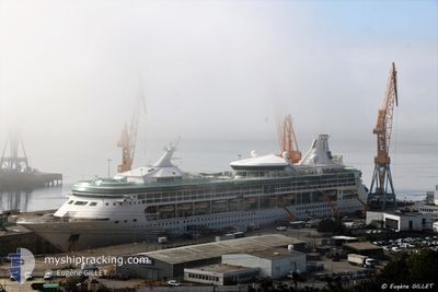
M/V RHAPSODY OTS
Passengers Ship
Current Trip
| Time Travelled | 12 h, 41 mins |
|---|---|
| Remaining Time | --- |
| Distance Travelled | 224.37 nm |
| Remaining Distance | --- |
| AVG Speed | 17.7 Knopen |
| MAX Speed | 19.3 Knopen |
| AVG Wind | 12.4 knots |
| MAX Wind | 18 knots |
| MIN Temp | 26.8°C / 80.24°F |
| MAX Temp | 27.5°C / 81.5°F |
| Diepgang | 7.7 M |
| Positie ontvangen | 1 m geleden |
Current Position
| Lengtegraad | -61.49098° |
|---|---|
| Breedtegraat | 14.70843° |
| Status | Under way using engine |
| Snelheid | 16.6 Knopen |
| Koers | 152.4° |
| Gebied | Caribbean Sea |
| Station | T-AIS |
| Positie ontvangen | 1 m geleden |
Info
Information
The current position of M/V RHAPSODY OTS is in Caribbean Sea with coordinates 14.70843° / -61.49098° as reported on 2024-04-25 09:48 by AIS to our vessel tracker app. The vessel's current speed is 16.6 Knopen
The vessel M/V RHAPSODY OTS (IMO: 9116864, MMSI: 311805000) is a Passengers Ship that was built in 1997 ( 27 Jaar oud ). It's sailing under the flag of [BS] Bahamas.
In this page you can find informations about the vessels current position, last detected port calls, and current voyage information. If the vessels is not in coverage by AIS you will find the latest position.
The current position of M/V RHAPSODY OTS is detected by our AIS receivers and we are not responsible for the reliability of the data. The last position was recorded while the vessel was in Coverage by the Ais receivers of our vessel tracking app.
The current draught of M/V RHAPSODY OTS as reported by AIS is 7.7 meters
Weather
| Temperature | 27.5°C / 81.5°F |
|---|---|
| Wind Speed | 12 knots |
| Direction | 75° ENE |
| Pressure | 1013.7 hPa |
| Humidity | 73.1 % |
| Cloud Coverage | 2 % |
Featured Company
Last Port Calls
| Port | Arrival | Departure | Time In Port |
|---|---|---|---|
| 2024-04-24 11:20 | 2024-04-24 21:08 | 9 h | |
| 2024-04-21 10:46 | 2024-04-21 19:22 | 8 h | |
| 2024-04-20 09:57 | 2024-04-20 21:42 | 11 h | |
| 2024-04-17 11:10 | 2024-04-17 21:55 | 10 h | |
| 2024-04-14 13:06 | 2024-04-14 23:06 | 9 h | |
| 2024-04-13 11:22 | 2024-04-13 21:14 | 9 h | |
| 2024-04-09 11:11 | 2024-04-09 22:09 | 10 h | |
| 2024-04-07 13:07 | 2024-04-07 23:20 | 10 h | |
| 2024-04-06 11:23 | 2024-04-06 20:52 | 9 h | |
| 2024-04-04 10:15 | 2024-04-04 20:03 | 9 h |
Last Trips
| Origin | Departure | Destination | Arrival | Distance | |
|---|---|---|---|---|---|
| 2024-04-21 15:22 | 2024-04-24 07:20 | 962.05 nm | |||
| 2024-04-20 17:42 | 2024-04-21 06:46 | 187.09 nm | |||
| 2024-04-17 17:55 | 2024-04-20 05:57 | 1161.99 nm | |||
| 2024-04-14 18:06 | 2024-04-17 07:10 | 478.26 nm | |||
| 2024-04-13 16:14 | 2024-04-14 08:06 | 279.76 nm | |||
| 2024-04-09 18:09 | 2024-04-13 06:22 | 848.54 nm | |||
| 2024-04-07 18:20 | 2024-04-09 07:11 | 465.30 nm | |||
| 2024-04-06 15:52 | 2024-04-07 08:07 | 279.48 nm | |||
| 2024-04-04 16:03 | 2024-04-06 06:23 | 695.97 nm | |||
| 2024-03-31 18:06 | 2024-04-04 06:15 | 612.80 nm |
Events
| Tijd | Evenement | Details | Positie / Bestemming | Info |
|---|---|---|---|---|
| 2024-04-25 09:34 | Destination Changed | CASTRIES, ST LUCIA PHILIPSBURG, ST MA |
14.76185 / -61.52474
CASTRIES, ST LUCIA
|
Snelheid: 16.4 kn Koers: 145.6° |
| 2024-04-25 09:34 | ETA Changed | 2024/04/25 13:00 2024/04/24 11:00 |
14.76185 / -61.52474
CASTRIES, ST LUCIA
|
Snelheid: 16.4 kn Koers: 145.6° |
| 2024-04-25 09:19 | Wijzig zee gebeid | Guadeloupe and Martinique part of the Caribbean Sea Sint-Eustasius part of the Caribbean Sea |
14.81607 / -61.56133
Caribbean Sea
|
Snelheid: 15.9 kn Koers: 147.8° |
| 2024-04-25 09:19 | Status Changed | Under way using engine Default |
14.81607 / -61.56133
PHILIPSBURG, ST MA
|
Snelheid: 16 kn Koers: 147° |
| 2024-04-25 09:00 | Binnenbereik |
14.81607 / -61.56133
Caribbean Sea
|
Snelheid: 15.9 kn Koers: 147.8° |
|
| 2024-04-24 22:39 | Status Changed | Default Under way using engine |
17.58667 / -63.07834
PHILIPSBURG, ST MA
|
Snelheid: 19 kn Koers: 183° |
| 2024-04-24 22:34 | Buitenbereik |
17.60929 / -63.07720
Caribbean Sea
|
Snelheid: 19 kn Koers: 183° |
|
| 2024-04-24 22:31 | Wijzig zee gebeid | Sint-Eustasius part of the Caribbean Sea Saba part of the Caribbean Sea |
17.62733 / -63.07612
Caribbean Sea
|
Snelheid: 19 kn Koers: 182.5° |
| 2024-04-24 22:31 | Status Changed | Under way using engine Default |
17.62733 / -63.07612
PHILIPSBURG, ST MA
|
Snelheid: 19 kn Koers: 179° |
| 2024-04-24 22:17 | Status Changed | Default Under way using engine |
17.70025 / -63.08062
PHILIPSBURG, ST MA
|
Snelheid: 18.8 kn Koers: 174° |