
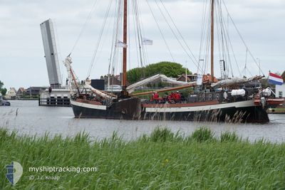
LUTGERDINA
Dredging or underwater ops
Current Trip
ROBINSON_CRUSOE
| Time Travelled | 18 h, 43 mins |
|---|---|
| Remaining Time | --- |
| Distance Travelled | 12.27 nm |
| Remaining Distance | --- |
| AVG Speed | 3.6 Knopen |
| MAX Speed | 5.1 Knopen |
| AVG Wind | 7 knots |
| MAX Wind | 11.9 knots |
| MIN Temp | 7°C / 44.6°F |
| MAX Temp | 11.2°C / 52.16°F |
| Diepgang | 0 M |
| Positie ontvangen | Nu |
Current Position
| Lengtegraad | 5.07662° |
|---|---|
| Breedtegraat | 52.19774° |
| Status | Under way using engine |
| Snelheid | |
| Koers | --- |
| Gebied | North Sea |
| Station | T-AIS |
| Positie ontvangen | Nu |
Info
Information
The current position of LUTGERDINA is in North Sea with coordinates 52.19774° / 5.07662° as reported on 2024-04-19 03:06 by AIS to our vessel tracker app. The vessel's current speed is 0 Knopen
The vessel LUTGERDINA (IMO: 8748763, MMSI: 246326000) is a Dredging or underwater ops It's sailing under the flag of [NL] Netherlands.
In this page you can find informations about the vessels current position, last detected port calls, and current voyage information. If the vessels is not in coverage by AIS you will find the latest position.
The current position of LUTGERDINA is detected by our AIS receivers and we are not responsible for the reliability of the data. The last position was recorded while the vessel was in Coverage by the Ais receivers of our vessel tracking app.
Weather
| Temperature | 8.3°C / 46.94°F |
|---|---|
| Wind Speed | 12 knots |
| Direction | 271° W |
| Pressure | 1008.9 hPa |
| Humidity | 96.1 % |
| Cloud Coverage | 100 % |
Featured Company
Last Port Calls
| Port | Arrival | Departure | Time In Port |
|---|---|---|---|
| 2024-04-17 13:43 | 2024-04-18 08:24 | 18 h | |
| 2024-04-17 12:52 | 2024-04-17 13:14 | 21 m | |
| 2024-04-16 14:01 | 2024-04-17 09:00 | 18 h | |
| 2024-04-14 18:24 | 2024-04-16 09:39 | 1 d | |
| 2024-04-12 13:31 | 2024-04-14 14:29 | 2 d | |
| 2024-04-11 15:55 | 2024-04-12 08:41 | 16 h | |
| 2024-04-11 11:14 | 2024-04-11 12:02 | 47 m | |
| 2024-04-10 16:00 | 2024-04-11 07:57 | 15 h | |
| 2024-04-10 12:30 | 2024-04-10 14:09 | 1 h | |
| 2024-04-09 12:01 | 2024-04-10 08:11 | 20 h |
Last Trips
| Origin | Departure | Destination | Arrival | Distance | |
|---|---|---|---|---|---|
| 2024-04-17 15:14 | 2024-04-17 15:43 | 1.47 nm | |||
| 2024-04-17 11:00 | 2024-04-17 14:52 | 13.76 nm | |||
| 2024-04-16 11:39 | 2024-04-16 16:01 | 18.29 nm | |||
| 2024-04-14 16:29 | 2024-04-14 20:24 | 15.98 nm | |||
| 2024-04-12 10:41 | 2024-04-12 15:31 | 29.30 nm | |||
| 2024-04-11 14:02 | 2024-04-11 17:55 | 14.48 nm | |||
| 2024-04-11 09:57 | 2024-04-11 13:14 | 7.76 nm | |||
| 2024-04-10 16:09 | 2024-04-10 18:00 | 5.34 nm | |||
| 2024-04-10 10:11 | 2024-04-10 14:30 | 17.57 nm | |||
| 2024-04-09 10:48 | 2024-04-09 14:01 | 16.48 nm |
Events
| Tijd | Evenement | Details | Positie / Bestemming | Info |
|---|---|---|---|---|
| 2024-04-18 13:04 | Stop beweging | 0.62 nm, South West of OUDLOOSDRECHT |
52.19768 / 5.07712
ROBINSON_CRUSOE
|
Snelheid: 0.3 kn Koers: 511° |
| 2024-04-18 12:39 | Start beweging | 1.31 nm, East of NIEUWERSLUIS |
52.19613 / 5.04190
ROBINSON_CRUSOE
|
Snelheid: 3.1 kn Koers: 98.5° |
| 2024-04-18 12:29 | Stop beweging | 1.15 nm, East of NIEUWERSLUIS |
52.19896 / 5.03728
ROBINSON_CRUSOE
|
Snelheid: 0.2 kn Koers: 511° |
| 2024-04-18 12:18 | Start beweging | 0.77 nm, North East of NIEUWERSLUIS |
52.20171 / 5.02532
ROBINSON_CRUSOE
|
Snelheid: 3.1 kn Koers: 96.5° |
| 2024-04-18 11:39 | Stop beweging | 0.94 nm, North East of NIEUWERSLUIS |
52.20835 / 5.02285
ROBINSON_CRUSOE
|
Snelheid: 0.3 kn Koers: 511° |
| 2024-04-18 11:11 | Start beweging | 1.92 nm, West of KORTENHOEF |
52.22743 / 5.03356
ROBINSON_CRUSOE
|
Snelheid: 3.2 kn Koers: 181.3° |
| 2024-04-18 10:51 | Stop beweging | 1.96 nm, West of KORTENHOEF |
52.23076 / 5.03291
ROBINSON_CRUSOE
|
Snelheid: 0.3 kn Koers: 511° |
| 2024-04-18 08:57 | Start beweging | 1.31 nm, South East of WEESP |
52.29068 / 5.07316
ROBINSON_CRUSOE
|
Snelheid: 4.4 kn Koers: 202.1° |
| 2024-04-18 08:49 | Stop beweging | 1.26 nm, South East of WEESP |
52.29250 / 5.07409
ROBINSON_CRUSOE
|
Snelheid: 0.2 kn Koers: 511° |
| 2024-04-18 08:24 | Vertrekhaven |
|
52.29885 / 5.05884
ROBINSON_CRUSOE
|
Snelheid: 3.9 kn Koers: 123.2° |