
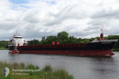
LONGVIKING
General Cargo
Current Trip
Current Position
| Lengtegraad | 10.87408° |
|---|---|
| Breedtegraat | 54.79648° |
| Status | Under way using engine |
| Snelheid | 10.8 Knopen |
| Koers | 357° |
| Gebied | Kattegat |
| Station | T-AIS |
| Positie ontvangen | Nu |
Info
Information
The current position of LONGVIKING is in Kattegat with coordinates 54.79648° / 10.87408° as reported on 2024-04-20 07:30 by AIS to our vessel tracker app. The vessel's current speed is 10.8 Knopen and is heading at the port of STIGSNAES. The estimated time of arrival as calculated by MyShipTracking vessel tracking app is 2024-04-20 11:28 LT
The vessel LONGVIKING (IMO: 9547324, MMSI: 245901000) is a General Cargo that was built in 2010 ( 14 Jaar oud ). It's sailing under the flag of [NL] Netherlands.
In this page you can find informations about the vessels current position, last detected port calls, and current voyage information. If the vessels is not in coverage by AIS you will find the latest position.
The current position of LONGVIKING is detected by our AIS receivers and we are not responsible for the reliability of the data. The last position was recorded while the vessel was in Coverage by the Ais receivers of our vessel tracking app.
The current draught of LONGVIKING as reported by AIS is 6 meters
Weather
| Temperature | 4.7°C / 40.46°F |
|---|---|
| Wind Speed | 10 knots |
| Direction | 38° NE |
| Pressure | 1015.6 hPa |
| Humidity | 65.5 % |
| Cloud Coverage | 96 % |
Featured Company
Last Port Calls
| Port | Arrival | Departure | Time In Port |
|---|---|---|---|
| 2024-04-17 13:04 | |||
| 2024-04-14 20:57 | 2024-04-15 15:03 | 18 h | |
| 2024-04-12 06:57 | 2024-04-12 20:02 | 13 h | |
| 2024-04-08 18:01 | 2024-04-10 10:12 | 1 d | |
| 2024-04-02 06:12 | 2024-04-02 18:38 | 12 h | |
| 2024-03-30 16:32 | 2024-03-31 06:08 | 13 h | |
| 2024-03-27 03:17 | 2024-03-27 17:44 | 14 h | |
| 2024-03-24 05:17 | 2024-03-24 21:25 | 16 h | |
| 2024-03-21 02:51 | 2024-03-21 17:30 | 14 h | |
| 2024-03-18 08:18 | 2024-03-19 03:43 | 19 h |
Most Visited Ports (Last year)
| Port | Arrivals | |
|---|---|---|
| 8 | ||
| 6 | ||
| 6 | ||
| 4 | ||
| 3 | ||
| 3 |
Last Trips
| Origin | Departure | Destination | Arrival | Distance | |
|---|---|---|---|---|---|
| 2024-04-15 17:03 | 2024-04-17 16:04 | 493.37 nm | |||
| 2024-04-12 23:02 | 2024-04-14 22:57 | 490.10 nm | |||
| 2024-04-10 12:12 | 2024-04-12 09:57 | 492.77 nm | |||
| 2024-04-02 20:38 | 2024-04-08 20:01 | 1205.44 nm | |||
| 2024-03-31 09:08 | 2024-04-02 08:12 | 572.72 nm | |||
| 2024-03-27 18:44 | 2024-03-30 18:32 | 548.78 nm | |||
| 2024-03-24 23:25 | 2024-03-27 04:17 | 577.07 nm | |||
| 2024-03-21 18:30 | 2024-03-24 07:17 | 576.33 nm | |||
| 2024-03-19 05:43 | 2024-03-21 03:51 | 429.79 nm | |||
| 2024-03-16 12:37 | 2024-03-18 10:18 | 453.20 nm |
Events
| Tijd | Evenement | Details | Positie / Bestemming | Info |
|---|---|---|---|---|
| 2024-04-20 07:14 | Wijzig zee gebeid | Danish part of the Kattegat Danish part of the Baltic Sea |
54.74940 / 10.87943
Kattegat
DKSTN
|
Snelheid: 10.4 kn Koers: 356° |
| 2024-04-20 06:02 | Wijzig zee gebeid | Danish part of the Baltic Sea German part of the Baltic Sea |
54.62752 / 11.13633
Baltic Sea
DKSTN
|
Snelheid: 10.5 kn Koers: 296° |
| 2024-04-20 05:41 | Wijzig zee gebeid | German part of the Baltic Sea Danish part of the Baltic Sea |
54.59843 / 11.23233
Baltic Sea
DKSTN
|
Snelheid: 11 kn Koers: 297° |
| 2024-04-20 00:50 | Gevonden in zee | Danish part of the Baltic Sea |
54.67757 / 12.42502
Baltic Sea
DKSTN
|
Snelheid: 10.4 kn Koers: 236° |
| 2024-04-20 00:41 | Gevonden in zee | German part of the Baltic Sea |
54.69202 / 12.46297
Baltic Sea
DKSTN
|
Snelheid: 10.4 kn Koers: 236° |
| 2024-04-19 22:56 | Wijzig zee gebeid | Danish part of the Baltic Sea German part of the Baltic Sea |
54.83188 / 12.92435
Baltic Sea
DKSTN
|
Snelheid: 10.3 kn Koers: 247° |
| 2024-04-19 21:25 | Status Changed | Under way using engine Default |
54.92120 / 13.33417
DKSTN
|
Snelheid: 9.8 kn Koers: 251° |
| 2024-04-19 21:20 | Status Changed | Default Under way using engine |
54.92565 / 13.35678
DKSTN
|
Snelheid: 9.9 kn Koers: 252° |
| 2024-04-19 21:15 | Status Changed | Under way using engine Default |
54.93015 / 13.38088
DKSTN
|
Snelheid: 9.9 kn Koers: 251° |
| 2024-04-19 21:12 | Binnenbereik |
54.93015 / 13.38088
Baltic Sea
DKSTN
|
Snelheid: 9.9 kn Koers: 252° |