
LONGVIEW LOGGER
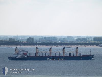
Bulk Carrier
Current Trip
| Time Travelled | 48 days |
|---|---|
| Remaining Time | 2 days |
| Distance Travelled | 13143.08 nm |
| Remaining Distance | 575.78 nm |
| AVG Speed | 11.5 Knopen |
| MAX Speed | 14.8 Knopen |
| AVG Wind | 13.8 knots |
| MAX Wind | 28.7 knots |
| MIN Temp | 8.2°C / 46.76°F |
| MAX Temp | 31°C / 87.8°F |
| Diepgang | 7.4 M |
| Positie ontvangen | 4 h, 5 m geleden |
Current Position
| Lengtegraad | -12.91828° |
|---|---|
| Breedtegraat | 28.62412° |
| Status | Under way using engine |
| Snelheid | 10.3 Knopen |
| Koers | 32.8° |
| Gebied | North Atlantic Ocean |
| Station | T-AIS |
| Positie ontvangen | 4 h, 5 m geleden |
Info
Information
The current position of LONGVIEW LOGGER is in North Atlantic Ocean with coordinates 28.62412° / -12.91828° as reported on 2024-04-24 15:33 by AIS to our vessel tracker app. The vessel's current speed is 10.3 Knopen and is heading at the port of GIBRALTAR. The estimated time of arrival as calculated by MyShipTracking vessel tracking app is 2024-04-27 01:28 LT
The vessel LONGVIEW LOGGER (IMO: 9338541, MMSI: 477969800) is a Bulk Carrier that was built in 2007 ( 17 Jaar oud ). It's sailing under the flag of [HK] Hong Kong.
In this page you can find informations about the vessels current position, last detected port calls, and current voyage information. If the vessels is not in coverage by AIS you will find the latest position.
The current position of LONGVIEW LOGGER is detected by our AIS receivers and we are not responsible for the reliability of the data. The last position was recorded while the vessel was in Coverage by the Ais receivers of our vessel tracking app.
The current draught of LONGVIEW LOGGER as reported by AIS is 7.4 meters
Weather
| Temperature | 19.5°C / 67.1°F |
|---|---|
| Wind Speed | 16 knots |
| Direction | 7° N |
| Pressure | 1014.2 hPa |
| Humidity | 79.5 % |
| Cloud Coverage | --- |
Featured Company
Last Trips
| Origin | Departure | Destination | Arrival | Distance | |
|---|---|---|---|---|---|
| 2024-03-01 16:19 | 2024-03-04 06:47 | 565.01 nm | |||
| 2024-02-28 15:16 | 2024-02-29 06:43 | 42.51 nm | |||
| 2024-02-14 05:14 | 2024-02-25 10:00 | 572.40 nm | |||
| 2024-02-08 17:39 | 2024-02-12 16:29 | 495.55 nm | |||
| 2024-01-25 12:28 | 2024-02-07 16:10 | 3342.93 nm |
Events
| Tijd | Evenement | Details | Positie / Bestemming | Info |
|---|---|---|---|---|
| 2024-04-24 15:38 | Status Changed | Default Under way using engine |
28.63624 / -12.90950
GI GIB
|
Snelheid: 10.3 kn Koers: 32.8° |
| 2024-04-24 15:33 | Wijzig zee gebeid | Spanish (Canary Islands) part of the North Atlantic Ocean Moroccan part of the North Atlantic Ocean |
28.62412 / -12.91828
North Atlantic Ocean
GI GIB
|
Snelheid: 10.3 kn Koers: 32.8° |
| 2024-04-24 15:33 | Status Changed | Under way using engine Default |
28.62412 / -12.91828
GI GIB
|
Snelheid: 10.4 kn Koers: 32° |
| 2024-04-24 15:33 | Buitenbereik |
28.62412 / -12.91828
North Atlantic Ocean
GI GIB
|
Snelheid: 10.3 kn Koers: 32.8° |
|
| 2024-04-24 15:22 | Binnenbereik |
28.62412 / -12.91828
North Atlantic Ocean
GI GIB
|
Snelheid: 10.3 kn Koers: 32.8° |
|
| 2024-04-24 14:14 | Status Changed | Default Under way using engine |
28.43269 / -13.06715
GI GIB
|
Snelheid: 10.8 kn Koers: 38.9° |
| 2024-04-24 14:10 | Buitenbereik |
28.42206 / -13.07681
North Atlantic Ocean
GI GIB
|
Snelheid: 10.8 kn Koers: 38.9° |
|
| 2024-04-24 13:43 | Status Changed | Under way using engine Default |
28.35866 / -13.13341
GI GIB
|
Snelheid: 10.9 kn Koers: 34° |
| 2024-04-24 13:38 | Status Changed | Default Under way using engine |
28.34776 / -13.14163
GI GIB
|
Snelheid: 10.8 kn Koers: 33.7° |
| 2024-04-24 13:33 | Status Changed | Under way using engine Default |
28.33521 / -13.15112
GI GIB
|
Snelheid: 10.9 kn Koers: 33° |