
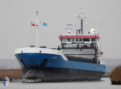
LEONIE
General Cargo
Current Trip
| Time Travelled | 7 days |
|---|---|
| Remaining Time | 5 days |
| Distance Travelled | 1152.42 nm |
| Remaining Distance | 1172.30 nm |
| AVG Speed | 8.5 Knopen |
| MAX Speed | 12 Knopen |
| AVG Wind | 14.9 knots |
| MAX Wind | 32 knots |
| MIN Temp | -0.3°C / 31.46°F |
| MAX Temp | 9.9°C / 49.82°F |
| Diepgang | 5.4 M |
| Positie ontvangen | 38 m geleden |
Current Position
| Lengtegraad | 24.23839° |
|---|---|
| Breedtegraat | 59.75809° |
| Status | Under way using engine |
| Snelheid | 9.8 Knopen |
| Koers | 256.1° |
| Gebied | Gulf of Finland |
| Station | T-AIS |
| Positie ontvangen | 38 m geleden |
Info
Information
The current position of LEONIE is in Gulf of Finland with coordinates 59.75809° / 24.23839° as reported on 2024-04-25 19:43 by AIS to our vessel tracker app. The vessel's current speed is 9.8 Knopen and is heading at the port of ZEEBRUGGE. The estimated time of arrival as calculated by MyShipTracking vessel tracking app is 2024-04-30 20:27 LT
The vessel LEONIE (IMO: 9331361, MMSI: 244772000) is a General Cargo that was built in 2007 ( 17 Jaar oud ). It's sailing under the flag of [NL] Netherlands.
In this page you can find informations about the vessels current position, last detected port calls, and current voyage information. If the vessels is not in coverage by AIS you will find the latest position.
The current position of LEONIE is detected by our AIS receivers and we are not responsible for the reliability of the data. The last position was recorded while the vessel was in Coverage by the Ais receivers of our vessel tracking app.
The current draught of LEONIE as reported by AIS is 5.4 meters
Weather
| Temperature | 2.5°C / 36.5°F |
|---|---|
| Wind Speed | 5 knots |
| Direction | 357° N |
| Pressure | 1005.1 hPa |
| Humidity | 98.3 % |
| Cloud Coverage | 100 % |
Featured Company
Last Port Calls
| Port | Arrival | Departure | Time In Port |
|---|---|---|---|
| 2024-04-18 02:12 | 2024-04-18 15:22 | 13 h | |
| 2024-04-14 01:19 | 2024-04-18 01:32 | 4 d | |
| 2024-03-26 05:41 | 2024-04-08 19:13 | 13 d | |
| 2024-03-19 23:29 | 2024-03-20 15:27 | 15 h | |
| 2024-03-18 09:25 | 2024-03-19 10:50 | 1 d | |
| 2024-03-15 11:02 | 2024-03-16 11:15 | 1 d | |
| 2024-03-13 13:29 | 2024-03-14 18:16 | 1 d | |
| 2024-03-08 14:11 | 2024-03-11 13:25 | 2 d | |
| 2024-03-04 16:58 | 2024-03-07 13:31 | 2 d | |
| 2024-03-02 21:16 |
Last Trips
| Origin | Departure | Destination | Arrival | Distance | |
|---|---|---|---|---|---|
| 2024-04-18 03:32 | 2024-04-18 04:12 | 8.89 nm | |||
| 2024-04-08 22:13 | 2024-04-14 03:19 | 1079.43 nm | |||
| 2024-03-20 16:27 | 2024-03-26 07:41 | 888.50 nm | |||
| 2024-03-19 11:50 | 2024-03-20 00:29 | 139.04 nm | |||
| 2024-03-16 12:15 | 2024-03-18 10:25 | 363.09 nm | |||
| 2024-03-14 19:16 | 2024-03-15 12:02 | 172.79 nm | |||
| 2024-03-11 14:25 | 2024-03-13 14:29 | 421.90 nm | |||
| 2024-03-07 14:31 | 2024-03-08 15:11 | 176.06 nm | |||
| 2024-03-01 16:33 | 2024-03-02 22:16 | 110.10 nm | |||
| 2024-02-21 20:15 | 2024-02-28 17:29 | 1414.75 nm |
Events
| Tijd | Evenement | Details | Positie / Bestemming | Info |
|---|---|---|---|---|
| 2024-04-25 19:46 | Status Changed | Default Under way using engine |
59.75650 / 24.22513
BEZEE
|
Snelheid: 9.8 kn Koers: 256.1° |
| 2024-04-25 19:43 | Status Changed | Under way using engine Default |
59.75809 / 24.23839
BEZEE
|
Snelheid: 9.7 kn Koers: 257° |
| 2024-04-25 19:40 | Status Changed | Default Under way using engine |
59.76035 / 24.25678
BEZEE
|
Snelheid: 9.6 kn Koers: 255.7° |
| 2024-04-25 19:21 | Status Changed | Under way using engine Default |
59.77247 / 24.35312
BEZEE
|
Snelheid: 9.6 kn Koers: 256° |
| 2024-04-25 19:19 | Status Changed | Default Under way using engine |
59.77396 / 24.36503
BEZEE
|
Snelheid: 10 kn Koers: 257° |
| 2024-04-25 18:10 | Gevonden in zee | Finnish part of the Gulf of Finland |
59.81969 / 24.72800
Gulf of Finland
BEZEE
|
Snelheid: 9.7 kn Koers: 257.5° |
| 2024-04-25 16:34 | ETA Changed | 2024/04/30 07:00 2024/04/30 18:00 |
59.87369 / 25.24064
BEZEE
|
Snelheid: 9.7 kn Koers: 258.9° |
| 2024-04-25 16:21 | ETA Changed | 2024/04/30 18:00 2024/04/29 18:00 |
59.87926 / 25.30421
BEZEE
|
Snelheid: 9.7 kn Koers: 260.6° |
| 2024-04-25 16:20 | Gevonden in zee | Estonian part of the Gulf of Finland |
59.87975 / 25.31030
Gulf of Finland
BEZEE
|
Snelheid: 9.7 kn Koers: 261.3° |
| 2024-04-25 15:03 | Status Changed | Under way using engine Default |
59.91807 / 25.71326
BEZEE
|
Snelheid: 9.6 kn Koers: 259° |