
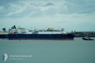
LENA RIVER
Tanker D
Current Trip
FOR ORDER
| Time Travelled | 21 days |
|---|---|
| Remaining Time | --- |
| Distance Travelled | 9638.21 nm |
| Remaining Distance | --- |
| AVG Speed | 17.9 Knopen |
| MAX Speed | 20.7 Knopen |
| AVG Wind | 13.5 knots |
| MAX Wind | 39 knots |
| MIN Temp | 10.2°C / 50.36°F |
| MAX Temp | 28.9°C / 84.02°F |
| Diepgang | 11.7 M |
| Positie ontvangen | 7 d geleden |
Current Position
| Lengtegraad | 18.10713° |
|---|---|
| Breedtegraat | -34.84040° |
| Status | Under way using engine |
| Snelheid | 19.1 Knopen |
| Koers | 141.6° |
| Gebied | South Atlantic Ocean |
| Station | T-AIS |
| Positie ontvangen | 7 d geleden |
Info
Information
The current position of LENA RIVER is in South Atlantic Ocean with coordinates -34.84040° / 18.10713° as reported on 2024-04-17 16:01 by AIS to our vessel tracker app. The vessel's current speed is 19.1 Knopen
The vessel LENA RIVER (IMO: 9629598, MMSI: 538005073) is a Tanker D It's sailing under the flag of [MH] Marshall Is.
In this page you can find informations about the vessels current position, last detected port calls, and current voyage information. If the vessels is not in coverage by AIS you will find the latest position.
The current position of LENA RIVER is detected by our AIS receivers and we are not responsible for the reliability of the data. The last position was recorded while the vessel was in Coverage by the Ais receivers of our vessel tracking app.
The current draught of LENA RIVER as reported by AIS is 11.7 meters
Weather
| Temperature | 27.7°C / 81.86°F |
|---|---|
| Wind Speed | 16 knots |
| Direction | 98° E |
| Pressure | 1010.9 hPa |
| Humidity | 76.2 % |
| Cloud Coverage | 100 % |
Featured Company
Most Visited Ports (Last year)
| Port | Arrivals | |
|---|---|---|
| 5 | ||
| 3 | ||
| 2 | ||
| 2 |
Events
| Tijd | Evenement | Details | Positie / Bestemming | Info |
|---|---|---|---|---|
| 2024-04-17 16:07 | Status Changed | Default Under way using engine |
-34.86504 / 18.13101
FOR ORDER
|
Snelheid: 19.1 kn Koers: 141.6° |
| 2024-04-17 16:01 | Status Changed | Under way using engine Default |
-34.84040 / 18.10713
FOR ORDER
|
Snelheid: 19.1 kn Koers: 141° |
| 2024-04-17 16:01 | Buitenbereik |
-34.84040 / 18.10713
South Atlantic Ocean
FOR ORDER
|
Snelheid: 19.1 kn Koers: 141.6° |
|
| 2024-04-17 15:53 | Binnenbereik |
-34.84040 / 18.10713
South Atlantic Ocean
FOR ORDER
|
Snelheid: 19.1 kn Koers: 141.6° |
|
| 2024-04-17 13:02 | Status Changed | Default Under way using engine |
-34.07249 / 17.47244
FOR ORDER
|
Snelheid: 19.7 kn Koers: 146.7° |
| 2024-04-17 12:59 | Wijzig zee gebeid | South African part of the South Atlantic Ocean Spanish (Canary Islands) part of the North Atlantic Ocean |
-34.05445 / 17.45846
South Atlantic Ocean
FOR ORDER
|
Snelheid: 19.7 kn Koers: 146.7° |
| 2024-04-17 12:59 | Buitenbereik |
-34.05445 / 17.45846
South Atlantic Ocean
FOR ORDER
|
Snelheid: 19.7 kn Koers: 146.7° |
|
| 2024-04-17 12:56 | Status Changed | Under way using engine Default |
-34.04251 / 17.44904
FOR ORDER
|
Snelheid: 19.2 kn Koers: 147° |
| 2024-04-17 12:43 | Binnenbereik |
-34.05445 / 17.45846
South Atlantic Ocean
FOR ORDER
|
Snelheid: 19.7 kn Koers: 146.7° |