
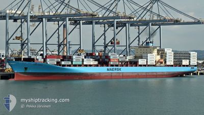
LARS MAERSK
Container Ship
Current Trip
| Time Travelled | 21 h, 12 mins |
|---|---|
| Remaining Time | 1 day |
| Distance Travelled | 271.17 nm |
| Remaining Distance | 461.63 nm |
| AVG Speed | 13.5 Knopen |
| MAX Speed | 15 Knopen |
| AVG Wind | 13.6 knots |
| MAX Wind | 18.2 knots |
| MIN Temp | 27°C / 80.6°F |
| MAX Temp | 32.2°C / 89.96°F |
| Diepgang | 10.1 M |
| Positie ontvangen | 20 h, 23 m geleden |
Current Position
| Lengtegraad | -79.50480° |
|---|---|
| Breedtegraat | 8.86711° |
| Status | Under way using engine |
| Snelheid | 14.1 Knopen |
| Koers | 141.8° |
| Gebied | North Pacific Ocean |
| Station | T-AIS |
| Positie ontvangen | 20 h, 23 m geleden |
Info
Information
The current position of LARS MAERSK is in North Pacific Ocean with coordinates 8.86711° / -79.50480° as reported on 2024-04-24 17:24 by AIS to our vessel tracker app. The vessel's current speed is 14.1 Knopen and is heading at the port of PUERTO BOLIVAR. The estimated time of arrival as calculated by MyShipTracking vessel tracking app is 2024-04-26 21:59 LT
The vessel LARS MAERSK (IMO: 9294379, MMSI: 220291000) is a Container Ship that was built in 2004 ( 20 Jaar oud ). It's sailing under the flag of [DK] Denmark.
In this page you can find informations about the vessels current position, last detected port calls, and current voyage information. If the vessels is not in coverage by AIS you will find the latest position.
The current position of LARS MAERSK is detected by our AIS receivers and we are not responsible for the reliability of the data. The last position was recorded while the vessel was in Coverage by the Ais receivers of our vessel tracking app.
The current draught of LARS MAERSK as reported by AIS is 10.1 meters
Weather
| Temperature | 27.4°C / 81.32°F |
|---|---|
| Wind Speed | 8 knots |
| Direction | 340° NNW |
| Pressure | 1011.3 hPa |
| Humidity | 80.5 % |
| Cloud Coverage | 100 % |
Featured Company
Last Port Calls
| Port | Arrival | Departure | Time In Port |
|---|---|---|---|
| 2024-04-23 16:27 | 2024-04-24 16:35 | 1 d | |
| 2024-04-21 18:55 | 2024-04-22 13:07 | 18 h | |
| 2024-04-18 20:52 | 2024-04-20 10:50 | 1 d | |
| 2024-04-03 17:21 | 2024-04-04 07:52 | 14 h | |
| 2024-03-25 21:50 | 2024-03-27 10:30 | 1 d | |
| 2024-03-23 22:17 | 2024-03-24 17:34 | 19 h | |
| 2024-03-08 12:37 |
Most Visited Ports (Last year)
| Port | Arrivals | |
|---|---|---|
| 10 | ||
| 10 | ||
| 8 | ||
| 8 | ||
| 5 | ||
| 5 |
Last Trips
| Origin | Departure | Destination | Arrival | Distance | |
|---|---|---|---|---|---|
| 2024-04-22 08:07 | 2024-04-23 11:27 | 362.79 nm | |||
| 2024-04-20 05:50 | 2024-04-21 13:55 | 413.33 nm | |||
| 2024-04-04 09:52 | 2024-04-18 15:52 | 4706.93 nm | |||
| 2024-03-27 13:30 | 2024-04-03 19:21 | 1966.59 nm | |||
| 2024-03-24 20:34 | 2024-03-26 00:50 | 110.88 nm | |||
| 2024-03-08 15:37 | 2024-03-24 01:17 | 414.47 nm |
Events
| Tijd | Evenement | Details | Positie / Bestemming | Info |
|---|---|---|---|---|
| 2024-04-24 17:30 | Status Changed | Default Under way using engine |
8.84674 / -79.48830
PABLB > ECPBO
|
Snelheid: 14.1 kn Koers: 141.8° |
| 2024-04-24 17:24 | Buitenbereik |
8.86711 / -79.50480
North Pacific Ocean
PABLB > ECPBO
|
Snelheid: 14.1 kn Koers: 141.8° |
|
| 2024-04-24 17:11 | Status Changed | Under way using engine Default |
8.89766 / -79.52872
PABLB > ECPBO
|
Snelheid: 8.3 kn Koers: 140° |
| 2024-04-24 17:10 | Status Changed | Default Under way using engine |
8.89886 / -79.52973
PABLB > ECPBO
|
Snelheid: 8.1 kn Koers: 141.6° |
| 2024-04-24 16:59 | Status Changed | Under way using engine Default |
8.91935 / -79.54632
PABLB > ECPBO
|
Snelheid: 9.5 kn Koers: 141° |
| 2024-04-24 16:50 | Status Changed | Default Under way using engine |
8.93774 / -79.56104
PABLB > ECPBO
|
Snelheid: 5.5 kn Koers: 154.9° |
| 2024-04-24 16:41 | Start beweging | 0.38 nm, South of BALBOA |
8.95001 / -79.56969
PABLB > ECPBO
|
Snelheid: 5.3 kn Koers: 164.1° |
| 2024-04-24 16:35 | Vertrekhaven |
|
8.95617 / -79.57075
PABLB > ECPBO
|
Snelheid: 0.9 kn Koers: 134° |
| 2024-04-24 16:20 | Status Changed | Under way using engine Moored |
8.95526 / -79.56576
[PA] BALBOA
|
Snelheid: Koers: 41° |
| 2024-04-24 16:17 | Status Changed | Moored Default |
8.95526 / -79.56578
[PA] BALBOA
|
Snelheid: Koers: 41° |