
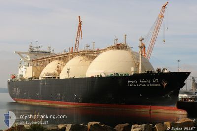
LALLA FATMA N'SOUMER
Lng Tanker
Current Trip
| Time Travelled | 3 days |
|---|---|
| Remaining Time | --- |
| Distance Travelled | 985.80 nm |
| Remaining Distance | --- |
| AVG Speed | 11.7 Knopen |
| MAX Speed | 13.7 Knopen |
| AVG Wind | 13.8 knots |
| MAX Wind | 30.8 knots |
| MIN Temp | 12.4°C / 54.32°F |
| MAX Temp | 18.5°C / 65.3°F |
| Diepgang | 11 M |
| Positie ontvangen | 18 h, 49 m geleden |
Current Position
| Lengtegraad | 14.95741° |
|---|---|
| Breedtegraat | 36.05092° |
| Status | Under way using engine |
| Snelheid | 11.5 Knopen |
| Koers | 101.5° |
| Gebied | Mediterranean Sea - Eastern Basin |
| Station | T-AIS |
| Positie ontvangen | 18 h, 49 m geleden |
Info
Information
The current position of LALLA FATMA N'SOUMER is in Mediterranean Sea - Eastern Basin with coordinates 36.05092° / 14.95741° as reported on 2024-04-24 07:03 by AIS to our vessel tracker app. The vessel's current speed is 11.5 Knopen and is heading at the port of DORTYOL. The estimated time of arrival as calculated by MyShipTracking vessel tracking app is 2024-04-28 04:00 LT
The vessel LALLA FATMA N'SOUMER (IMO: 9275347, MMSI: 311775000) is a Lng Tanker that was built in 2004 ( 20 Jaar oud ). It's sailing under the flag of [BS] Bahamas.
In this page you can find informations about the vessels current position, last detected port calls, and current voyage information. If the vessels is not in coverage by AIS you will find the latest position.
The current position of LALLA FATMA N'SOUMER is detected by our AIS receivers and we are not responsible for the reliability of the data. The last position was recorded while the vessel was in Coverage by the Ais receivers of our vessel tracking app.
The current draught of LALLA FATMA N'SOUMER as reported by AIS is 11 meters
Weather
| Temperature | 15.3°C / 59.54°F |
|---|---|
| Wind Speed | 24 knots |
| Direction | 297° WNW |
| Pressure | 1009.7 hPa |
| Humidity | 72.3 % |
| Cloud Coverage | 100 % |
Featured Company
Last Port Calls
| Port | Arrival | Departure | Time In Port |
|---|---|---|---|
| 2024-04-20 10:49 | 2024-04-21 14:25 | 1 d | |
| 2024-04-13 13:19 | 2024-04-14 20:34 | 1 d | |
| 2024-04-04 14:19 | 2024-04-05 16:38 | 1 d | |
| 2024-03-21 10:40 | 2024-03-22 15:22 | 1 d | |
| 2024-03-12 22:24 | 2024-03-12 22:51 | 27 m | |
| 2024-02-17 11:37 | 2024-02-18 15:22 | 1 d | |
| 2024-02-03 11:51 | 2024-02-04 16:48 | 1 d |
Last Trips
| Origin | Departure | Destination | Arrival | Distance | |
|---|---|---|---|---|---|
| 2024-04-14 23:34 | 2024-04-20 11:49 | 1875.13 nm | |||
| 2024-04-05 17:38 | 2024-04-13 16:19 | 2468.14 nm | |||
| 2024-03-22 16:22 | 2024-04-04 15:19 | 3702.97 nm | |||
| 2024-03-12 23:51 | 2024-03-21 11:40 | 1753.28 nm | |||
| 2024-02-18 16:22 | 2024-03-12 23:24 | 5277.47 nm | |||
| 2024-02-04 17:48 | 2024-02-17 12:37 | 3730.50 nm | |||
| 2024-01-19 15:01 | 2024-02-03 12:51 | 4258.80 nm |
Events
| Tijd | Evenement | Details | Positie / Bestemming | Info |
|---|---|---|---|---|
| 2024-04-24 07:05 | Status Changed | Default Under way using engine |
36.04933 / 14.96638
TR DYL
|
Snelheid: 11.5 kn Koers: 101.5° |
| 2024-04-24 07:03 | Buitenbereik |
36.05092 / 14.95741
Mediterranean Sea - Eastern Basin
TR DYL
|
Snelheid: 11.5 kn Koers: 101.5° |
|
| 2024-04-24 02:12 | Draught Changed | 11 10 |
36.33169 / 13.94501
TR DYL
|
Snelheid: 10.5 kn Koers: 112.3° |
| 2024-04-24 02:12 | Destination Changed | TR DYL DZ ARZ |
36.33169 / 13.94501
TR DYL
|
Snelheid: 10.5 kn Koers: 112.3° |
| 2024-04-24 02:12 | ETA Changed | 2024/04/28 04:00 2024/04/19 09:00 |
36.33169 / 13.94501
TR DYL
|
Snelheid: 10.5 kn Koers: 112.3° |
| 2024-04-24 01:49 | Status Changed | Under way using engine Default |
36.35727 / 13.86961
DZ ARZ
|
Snelheid: 10.8 kn Koers: 114° |
| 2024-04-24 01:46 | Status Changed | Default Under way using engine |
36.36052 / 13.86062
DZ ARZ
|
Snelheid: 10.7 kn Koers: 114° |
| 2024-04-24 01:35 | Gevonden in zee | Maltese part of the Mediterranean Sea - Eastern Basin |
36.37407 / 13.82227
Mediterranean Sea - Eastern Basin
|
Snelheid: 10.7 kn Koers: 113.5° |
| 2024-04-24 01:35 | Status Changed | Under way using engine Default |
36.37407 / 13.82227
DZ ARZ
|
Snelheid: 10.9 kn Koers: 111° |
| 2024-04-24 01:35 | Binnenbereik |
36.37407 / 13.82227
Mediterranean Sea - Eastern Basin
|
Snelheid: 10.7 kn Koers: 113.5° |