
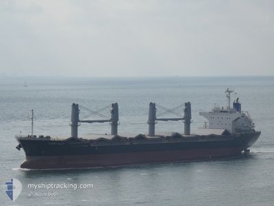
LADY LILLY
Bulk Carrier
Current Trip
FR MRS
| Time Travelled | 6 days |
|---|---|
| Remaining Time | --- |
| Distance Travelled | 206.13 nm |
| Remaining Distance | --- |
| AVG Speed | 5.9 Knopen |
| MAX Speed | 11.8 Knopen |
| AVG Wind | 30.8 knots |
| MAX Wind | 39.9 knots |
| MIN Temp | 8.1°C / 46.58°F |
| MAX Temp | 16°C / 60.8°F |
| Diepgang | 6.8 M |
| Positie ontvangen | 1 d geleden |
Current Position
| Lengtegraad | 5.17417° |
|---|---|
| Breedtegraat | 42.82866° |
| Status | Under way using engine |
| Snelheid | 7.5 Knopen |
| Koers | 332.7° |
| Gebied | Mediterranean Sea - Western Basin |
| Station | T-AIS |
| Positie ontvangen | 1 d geleden |
Info
Information
The current position of LADY LILLY is in Mediterranean Sea - Western Basin with coordinates 42.82866° / 5.17417° as reported on 2024-04-24 19:26 by AIS to our vessel tracker app. The vessel's current speed is 7.5 Knopen
The vessel LADY LILLY (IMO: 9642021, MMSI: 636018886) is a Bulk Carrier that was built in 2013 ( 11 Jaar oud ). It's sailing under the flag of [LR] Liberia.
In this page you can find informations about the vessels current position, last detected port calls, and current voyage information. If the vessels is not in coverage by AIS you will find the latest position.
The current position of LADY LILLY is detected by our AIS receivers and we are not responsible for the reliability of the data. The last position was recorded while the vessel was in Coverage by the Ais receivers of our vessel tracking app.
The current draught of LADY LILLY as reported by AIS is 6.8 meters
Weather
| Temperature | 13.4°C / 56.12°F |
|---|---|
| Wind Speed | 14 knots |
| Direction | 243° WSW |
| Pressure | 1008.9 hPa |
| Humidity | 71 % |
| Cloud Coverage | 100 % |
Featured Company
Last Port Calls
| Port | Arrival | Departure | Time In Port |
|---|---|---|---|
| 2024-04-10 20:18 | 2024-04-19 13:02 | 8 d | |
| 2024-04-03 01:22 | 2024-04-04 14:19 | 1 d | |
| 2024-03-29 13:12 | 2024-03-29 21:32 | 8 h | |
| 2024-03-13 01:32 | 2024-03-18 05:39 | 5 d | |
| 2024-02-16 23:14 | |||
| 2024-02-03 02:04 |
Last Trips
| Origin | Departure | Destination | Arrival | Distance | |
|---|---|---|---|---|---|
| 2024-04-04 16:19 | 2024-04-10 22:18 | 253.03 nm | |||
| 2024-03-29 21:32 | 2024-04-03 03:22 | 1200.88 nm | |||
| 2024-03-18 02:39 | 2024-03-29 13:12 | 2686.90 nm | |||
| 2024-02-02 23:04 | 2024-02-17 00:14 | 3355.63 nm |
Events
| Tijd | Evenement | Details | Positie / Bestemming | Info |
|---|---|---|---|---|
| 2024-04-24 19:30 | Status Changed | Default Under way using engine |
42.83577 / 5.16929
FR MRS
|
Snelheid: 7.5 kn Koers: 332.7° |
| 2024-04-24 19:26 | Buitenbereik |
42.82866 / 5.17417
Mediterranean Sea - Western Basin
|
Snelheid: 7.5 kn Koers: 332.7° |
|
| 2024-04-24 19:26 | Status Changed | Under way using engine Default |
42.82836 / 5.17438
FR MRS
|
Snelheid: 5.5 kn Koers: 354° |
| 2024-04-24 19:26 | Binnenbereik |
42.82866 / 5.17417
Mediterranean Sea - Western Basin
|
Snelheid: 7.5 kn Koers: 332.7° |
|
| 2024-04-24 19:05 | Start beweging |
42.79244 / 5.19813
FR MRS
|
Snelheid: 5.5 kn Koers: 354° |
|
| 2024-04-24 05:38 | Stop beweging |
42.79330 / 5.15554
FR MRS
|
Snelheid: 0.2 kn Koers: 314° |
|
| 2024-04-23 17:04 | Start beweging |
42.68333 / 5.06817
FR MRS
|
Snelheid: 4.1 kn Koers: 351° |
|
| 2024-04-23 05:23 | Stop beweging |
42.72111 / 5.11046
FR MRS
|
Snelheid: 0.3 kn Koers: 321° |
|
| 2024-04-23 04:19 | Start beweging |
42.72726 / 5.11027
FR MRS
|
Snelheid: 3.7 kn Koers: 318° |
|
| 2024-04-22 06:41 | Stop beweging |
42.84828 / 5.08272
FR MRS
|
Snelheid: 0.2 kn Koers: 344° |