
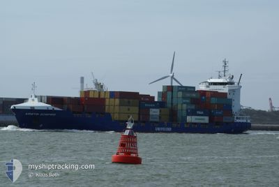
KRISTIN SCHEPERS
Container Ship
Current Trip
| Time Travelled | 3 days |
|---|---|
| Remaining Time | -5 mins |
| Distance Travelled | 915.51 nm |
| Remaining Distance | 44.74 nm |
| AVG Speed | 10.4 Knopen |
| MAX Speed | 17.3 Knopen |
| AVG Wind | 21.5 knots |
| MAX Wind | 32.1 knots |
| MIN Temp | 7.1°C / 44.78°F |
| MAX Temp | 16.1°C / 60.98°F |
| Diepgang | 7.6 M |
| Positie ontvangen | 1 m geleden |
Current Position
| Lengtegraad | 1.42319° |
|---|---|
| Breedtegraat | 51.41421° |
| Status | At anchor |
| Snelheid | 0.2 Knopen |
| Koers | 348° |
| Gebied | North Sea |
| Station | T-AIS |
| Positie ontvangen | 1 m geleden |
Info
Information
The current position of KRISTIN SCHEPERS is in North Sea with coordinates 51.41421° / 1.42319° as reported on 2024-04-19 22:38 by AIS to our vessel tracker app. The vessel's current speed is 0.2 Knopen and is heading at the port of TILBURY. The estimated time of arrival as calculated by MyShipTracking vessel tracking app is 2024-04-19 22:34 LT
The vessel KRISTIN SCHEPERS (IMO: 9404089, MMSI: 255806436) is a Container Ship that was built in 2007 ( 17 Jaar oud ). It's sailing under the flag of [PT] Portugal.
In this page you can find informations about the vessels current position, last detected port calls, and current voyage information. If the vessels is not in coverage by AIS you will find the latest position.
The current position of KRISTIN SCHEPERS is detected by our AIS receivers and we are not responsible for the reliability of the data. The last position was recorded while the vessel was in Coverage by the Ais receivers of our vessel tracking app.
The current draught of KRISTIN SCHEPERS as reported by AIS is 7.6 meters
Weather
| Temperature | 7.2°C / 44.96°F |
|---|---|
| Wind Speed | 23 knots |
| Direction | 346° NNW |
| Pressure | 1022.4 hPa |
| Humidity | 62.8 % |
| Cloud Coverage | 10 % |
Featured Company
Last Port Calls
| Port | Arrival | Departure | Time In Port |
|---|---|---|---|
| 2024-04-16 09:26 | 2024-04-16 20:00 | 10 h | |
| 2024-04-14 09:01 | 2024-04-15 17:51 | 1 d | |
| 2024-04-13 04:38 | 2024-04-13 13:25 | 8 h | |
| 2024-04-06 19:43 | 2024-04-07 07:27 | 11 h | |
| 2024-04-04 09:19 | 2024-04-04 19:56 | 10 h | |
| 2024-04-02 19:50 | 2024-04-03 14:43 | 18 h | |
| 2024-03-30 19:09 | 2024-03-31 01:35 | 6 h | |
| 2024-03-25 09:47 | 2024-03-29 10:48 | 4 d | |
| 2024-03-25 08:25 | 2024-03-25 09:33 | 1 h | |
| 2024-03-24 08:18 | 2024-03-24 18:03 | 9 h |
Last Trips
| Origin | Departure | Destination | Arrival | Distance | |
|---|---|---|---|---|---|
| 2024-04-15 18:51 | 2024-04-16 10:26 | 199.02 nm | |||
| 2024-04-13 15:25 | 2024-04-14 10:01 | 261.32 nm | |||
| 2024-04-07 09:27 | 2024-04-13 06:38 | 1460.38 nm | |||
| 2024-04-04 20:56 | 2024-04-06 21:43 | 280.70 nm | |||
| 2024-04-03 15:43 | 2024-04-04 10:19 | 299.18 nm | |||
| 2024-03-31 03:35 | 2024-04-02 20:50 | 764.88 nm | |||
| 2024-03-29 10:48 | 2024-03-30 20:09 | 474.65 nm | |||
| 2024-03-25 09:33 | 2024-03-25 09:47 | 1.96 nm | |||
| 2024-03-24 18:03 | 2024-03-25 08:25 | 183.76 nm | |||
| 2024-03-23 15:23 | 2024-03-24 08:18 | 254.13 nm |
Events
| Tijd | Evenement | Details | Positie / Bestemming | Info |
|---|---|---|---|---|
| 2024-04-19 19:04 | Stop beweging | 5.34 nm, North of RAMSGATE |
51.41454 / 1.42144
GBTIL
|
Snelheid: 0.3 kn Koers: 24° |
| 2024-04-19 19:03 | Status Changed | At anchor Under way using engine |
51.41458 / 1.42181
GBTIL
|
Snelheid: 0.6 kn Koers: 8° |
| 2024-04-19 11:55 | Gevonden in zee | United Kingdom part of the North Sea |
51.05986 / 1.60455
North Sea
GBTIL
|
Snelheid: 7.9 kn Koers: 41.1° |
| 2024-04-19 11:40 | Wijzig zee gebeid | French part of the North Sea French part of the English Channel |
51.03467 / 1.56790
North Sea
GBTIL
|
Snelheid: 8.3 kn Koers: 41.4° |
| 2024-04-19 07:26 | Wijzig zee gebeid | French part of the English Channel United Kingdom part of the English Channel |
50.53988 / .99997
English Channel
GBTIL
|
Snelheid: 10.7 kn Koers: 55.1° |
| 2024-04-19 03:22 | Status Changed | Under way using engine Default |
50.20551 / -.68748
GBTIL
|
Snelheid: 16.9 kn Koers: 72° |
| 2024-04-19 03:20 | Status Changed | Default Under way using engine |
50.20222 / -.70358
GBTIL
|
Snelheid: 16.7 kn Koers: 75.5° |
| 2024-04-19 02:40 | Gevonden in zee | United Kingdom part of the English Channel |
50.15455 / -.98631
English Channel
GBTIL
|
Snelheid: 16.4 kn Koers: 75.7° |
| 2024-04-19 02:40 | Status Changed | Under way using engine Default |
50.15455 / -.98631
GBTIL
|
Snelheid: 15.8 kn Koers: 77° |
| 2024-04-19 02:40 | Binnenbereik |
50.15455 / -.98631
English Channel
GBTIL
|
Snelheid: 16.4 kn Koers: 75.7° |