
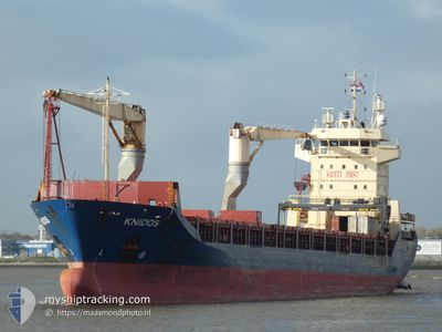
KNIDOS
General Cargo
Current Trip
| Time Travelled | 8 days |
|---|---|
| Remaining Time | 10 h, 53 mins |
| Distance Travelled | 2242.38 nm |
| Remaining Distance | 136.78 nm |
| AVG Speed | 11.7 Knopen |
| MAX Speed | 13.9 Knopen |
| AVG Wind | 9.7 knots |
| MAX Wind | 22 knots |
| MIN Temp | 26.6°C / 79.88°F |
| MAX Temp | 29.7°C / 85.46°F |
| Diepgang | 5.5 M |
| Positie ontvangen | 4 h, 25 m geleden |
Current Position
| Lengtegraad | 56.82520° |
|---|---|
| Breedtegraat | 25.89993° |
| Status | Under way using engine |
| Snelheid | 12 Knopen |
| Koers | 346.5° |
| Gebied | Gulf of Oman |
| Station | T-AIS |
| Positie ontvangen | 4 h, 25 m geleden |
Info
Information
The current position of KNIDOS is in Gulf of Oman with coordinates 25.89993° / 56.82520° as reported on 2024-04-25 14:59 by AIS to our vessel tracker app. The vessel's current speed is 12 Knopen and is heading at the port of JEBEL ALI. The estimated time of arrival as calculated by MyShipTracking vessel tracking app is 2024-04-26 06:17 LT
The vessel KNIDOS (IMO: 9214173, MMSI: 372193000) is a General Cargo that was built in 2000 ( 24 Jaar oud ). It's sailing under the flag of [PA] Panama.
In this page you can find informations about the vessels current position, last detected port calls, and current voyage information. If the vessels is not in coverage by AIS you will find the latest position.
The current position of KNIDOS is detected by our AIS receivers and we are not responsible for the reliability of the data. The last position was recorded while the vessel was in Coverage by the Ais receivers of our vessel tracking app.
The current draught of KNIDOS as reported by AIS is 5.5 meters
Weather
| Temperature | 27.2°C / 80.96°F |
|---|---|
| Wind Speed | 6 knots |
| Direction | 150° SSE |
| Pressure | 1006.9 hPa |
| Humidity | 55 % |
| Cloud Coverage | --- |
Featured Company
Last Port Calls
| Port | Arrival | Departure | Time In Port |
|---|---|---|---|
| 2024-04-16 15:38 | 2024-04-17 15:59 | 1 d | |
| 2024-04-14 01:58 | 2024-04-14 10:45 | 8 h | |
| 2024-04-07 07:14 | 2024-04-08 20:17 | 1 d | |
| 2024-03-26 18:30 | 2024-03-29 03:17 | 2 d | |
| 2024-03-15 11:53 | 2024-03-17 09:17 | 1 d | |
| 2024-02-28 12:40 | 2024-03-09 01:09 | 9 d | |
| 2024-02-17 08:55 | 2024-02-20 04:35 | 2 d | |
| 2024-02-12 09:38 | 2024-02-15 05:47 | 2 d | |
| 2024-02-08 02:30 | 2024-02-10 14:46 | 2 d | |
| 2024-02-05 01:02 | 2024-02-05 08:26 | 7 h |
Last Trips
| Origin | Departure | Destination | Arrival | Distance | |
|---|---|---|---|---|---|
| 2024-04-08 22:17 | 2024-04-16 18:38 | 2146.33 nm | |||
| 2024-04-08 22:17 | 2024-04-14 03:58 | 1430.64 nm | |||
| 2024-03-29 06:17 | 2024-04-07 09:14 | 1318.93 nm | |||
| 2024-03-17 11:17 | 2024-03-26 21:30 | 1863.94 nm | |||
| 2024-03-09 02:09 | 2024-03-15 13:53 | 1777.79 nm | |||
| 2024-02-20 07:35 | 2024-02-28 13:40 | 1781.01 nm | |||
| 2024-02-15 07:47 | 2024-02-17 11:55 | 442.47 nm | |||
| 2024-02-10 17:46 | 2024-02-12 11:38 | 486.86 nm | |||
| 2024-02-05 11:26 | 2024-02-08 05:30 | 218.35 nm | |||
| 2024-01-22 08:26 | 2024-02-05 04:02 | 3487.35 nm |
Events
| Tijd | Evenement | Details | Positie / Bestemming | Info |
|---|---|---|---|---|
| 2024-04-25 15:04 | Status Changed | Default Under way using engine |
25.91835 / 56.82035
AEJEA
|
Snelheid: 12 kn Koers: 346.5° |
| 2024-04-25 14:59 | Buitenbereik |
25.89993 / 56.82520
Gulf of Oman
AEJEA
|
Snelheid: 12 kn Koers: 346.5° |
|
| 2024-04-25 14:26 | Gevonden in zee | Omani part of the Gulf of Oman |
25.79410 / 56.85283
Gulf of Oman
AEJEA
|
Snelheid: 11.9 kn Koers: 346.6° |
| 2024-04-25 12:10 | Wijzig zee gebeid | Iranian part of the Gulf of Oman United Arab Emirates part of the Gulf of Oman |
25.35859 / 56.96329
Gulf of Oman
AEJEA
|
Snelheid: 12.2 kn Koers: 344.4° |
| 2024-04-25 10:50 | Wijzig zee gebeid | United Arab Emirates part of the Gulf of Oman Omani part of the Gulf of Oman |
25.09964 / 57.01962
Gulf of Oman
AEJEA
|
Snelheid: 11.4 kn Koers: 351.1° |
| 2024-04-25 10:06 | ETA Changed | 2024/04/26 08:00 2024/04/26 02:00 |
24.95996 / 57.04980
AEJEA
|
Snelheid: 7.6 kn Koers: 345.6° |
| 2024-04-25 09:13 | Status Changed | Under way using engine Default |
24.86496 / 57.14903
AEJEA
|
Snelheid: 11.5 kn Koers: 298° |
| 2024-04-25 09:08 | Status Changed | Default Under way using engine |
24.85717 / 57.16458
AEJEA
|
Snelheid: 11.5 kn Koers: 297.7° |
| 2024-04-25 09:03 | Status Changed | Under way using engine Default |
24.84892 / 57.18135
AEJEA
|
Snelheid: 11.5 kn Koers: 298° |
| 2024-04-25 08:52 | Status Changed | Default Under way using engine |
24.83281 / 57.21475
AEJEA
|
Snelheid: 11.5 kn Koers: 298.7° |