
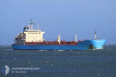
KIRSTEN MAERSK
Oil/Chemical Tanker
Current Trip
| Time Travelled | 6 days |
|---|---|
| Remaining Time | --- |
| Distance Travelled | 1326.50 nm |
| Remaining Distance | --- |
| AVG Speed | 12.8 Knopen |
| MAX Speed | 14.7 Knopen |
| AVG Wind | 11.1 knots |
| MAX Wind | 26.8 knots |
| MIN Temp | 13.3°C / 55.94°F |
| MAX Temp | 30.8°C / 87.44°F |
| Diepgang | 10.5 M |
| Positie ontvangen | 3 d geleden |
Current Position
| Lengtegraad | 32.54984° |
|---|---|
| Breedtegraat | 29.87394° |
| Status | Under way using engine |
| Snelheid | 12.1 Knopen |
| Koers | 173° |
| Gebied | Gulf of Suez |
| Station | T-AIS |
| Positie ontvangen | 3 d geleden |
Info
Information
The current position of KIRSTEN MAERSK is in Gulf of Suez with coordinates 29.87394° / 32.54984° as reported on 2024-04-21 13:06 by AIS to our vessel tracker app. The vessel's current speed is 12.1 Knopen
The vessel KIRSTEN MAERSK (IMO: 9431264, MMSI: 220530000) is a Oil/Chemical Tanker that was built in 2010 ( 14 Jaar oud ). It's sailing under the flag of [DK] Denmark.
In this page you can find informations about the vessels current position, last detected port calls, and current voyage information. If the vessels is not in coverage by AIS you will find the latest position.
The current position of KIRSTEN MAERSK is detected by our AIS receivers and we are not responsible for the reliability of the data. The last position was recorded while the vessel was in Coverage by the Ais receivers of our vessel tracking app.
The current draught of KIRSTEN MAERSK as reported by AIS is 10.5 meters
Weather
| Temperature | 31.4°C / 88.52°F |
|---|---|
| Wind Speed | 12 knots |
| Direction | 261° W |
| Pressure | 1004.2 hPa |
| Humidity | 49.4 % |
| Cloud Coverage | 2 % |
Featured Company
Last Port Calls
| Port | Arrival | Departure | Time In Port |
|---|---|---|---|
| 2024-04-21 03:40 | 2024-04-21 12:28 | 8 h | |
| 2024-04-16 19:20 | 2024-04-18 22:48 | 2 d | |
| 2024-04-02 04:36 | 2024-04-04 08:43 | 2 d | |
| 2024-03-25 03:37 | 2024-03-26 14:00 | 1 d | |
| 2024-03-18 15:27 | 2024-03-21 08:11 | 2 d | |
| 2024-03-12 12:41 | 2024-03-13 21:13 | 1 d | |
| 2024-02-08 22:04 | 2024-02-16 05:50 | 7 d | |
| 2024-02-01 15:24 | 2024-02-03 09:33 | 1 d |
Most Visited Ports (Last year)
| Port | Arrivals | |
|---|---|---|
| 4 | ||
| 4 | ||
| 4 | ||
| 3 | ||
| 3 | ||
| 3 |
Last Trips
| Origin | Departure | Destination | Arrival | Distance | |
|---|---|---|---|---|---|
| 2024-04-19 01:48 | 2024-04-21 05:40 | 633.40 nm | |||
| 2024-04-04 10:43 | 2024-04-16 22:20 | 811.15 nm | |||
| 2024-03-26 16:00 | 2024-04-02 06:36 | 733.55 nm | |||
| 2024-03-21 09:11 | 2024-03-25 05:37 | 874.77 nm | |||
| 2024-03-13 22:13 | 2024-03-18 16:27 | 1002.59 nm | |||
| 2024-02-03 10:33 | 2024-02-08 23:04 | 135.57 nm | |||
| 2024-01-21 06:54 | 2024-02-01 16:24 | 3507.06 nm |
Events
| Tijd | Evenement | Details | Positie / Bestemming | Info |
|---|---|---|---|---|
| 2024-04-24 17:24 | Stop beweging | 2.72 nm, West of RABIGH |
22.73043 / 38.94667
SA RAB
|
Snelheid: 0.3 kn Koers: 347° |
| 2024-04-24 15:22 | Start beweging | 15.53 nm, West of RABIGH |
22.70682 / 38.71715
SA RAB
|
Snelheid: 5.4 kn Koers: 104° |
| 2024-04-24 02:24 | Stop beweging | 18.44 nm, South West of RABIGH |
22.60863 / 38.69397
SA RAB
|
Snelheid: 0.3 kn Koers: 12° |
| 2024-04-24 00:46 | Start beweging | 20.72 nm, South West of RABIGH |
22.56189 / 38.67433
SA RAB
|
Snelheid: 6.9 kn Koers: 38° |
| 2024-04-23 20:41 | Stop beweging | 21.2 nm, South West of RABIGH |
22.57636 / 38.65561
SA RAB
|
Snelheid: 0.1 kn Koers: 339° |
| 2024-04-23 19:05 | Start beweging | 18.22 nm, West of RABIGH |
22.67388 / 38.67417
SA RAB
|
Snelheid: 4.1 kn Koers: 198° |
| 2024-04-23 11:48 | Stop beweging | 21.56 nm, West of RABIGH |
22.64863 / 38.61874
SA RAB
|
Snelheid: 0.3 kn Koers: 356° |
| 2024-04-21 13:12 | Status Changed | Default Under way using engine |
29.85352 / 32.55302
SA RAB
|
Snelheid: 12.1 kn Koers: 173° |
| 2024-04-21 13:06 | Buitenbereik |
29.87394 / 32.54984
Gulf of Suez
SA RAB
|
Snelheid: 12.1 kn Koers: 173° |
|
| 2024-04-21 13:00 | ETA Changed | 2024/04/23 13:00 2024/04/22 15:00 |
29.89341 / 32.54717
SA RAB
|
Snelheid: 9.8 kn Koers: 174° |