
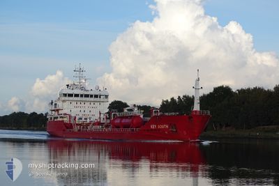
KEY SOUTH
Oil/Chemical Tanker
Current Trip
| Time Travelled | 4 days |
|---|---|
| Remaining Time | 5 h, 40 mins |
| Distance Travelled | 946.38 nm |
| Remaining Distance | 49.95 nm |
| AVG Speed | 8.8 Knopen |
| MAX Speed | 13.9 Knopen |
| AVG Wind | 16.9 knots |
| MAX Wind | 28 knots |
| MIN Temp | -4.1°C / 24.62°F |
| MAX Temp | 6.7°C / 44.06°F |
| Diepgang | 5.2 M |
| Positie ontvangen | Nu |
Current Position
| Lengtegraad | 11.06565° |
|---|---|
| Breedtegraat | 55.28399° |
| Status | Under way using engine |
| Snelheid | 9.3 Knopen |
| Koers | 339° |
| Gebied | Kattegat |
| Station | T-AIS |
| Positie ontvangen | Nu |
Info
Information
The current position of KEY SOUTH is in Kattegat with coordinates 55.28399° / 11.06565° as reported on 2024-04-25 08:21 by AIS to our vessel tracker app. The vessel's current speed is 9.3 Knopen and is heading at the port of ODENSE. The estimated time of arrival as calculated by MyShipTracking vessel tracking app is 2024-04-25 14:02 LT
The vessel KEY SOUTH (IMO: 9479802, MMSI: 248221000) is a Oil/Chemical Tanker that was built in 2010 ( 14 Jaar oud ). It's sailing under the flag of [MT] Malta.
In this page you can find informations about the vessels current position, last detected port calls, and current voyage information. If the vessels is not in coverage by AIS you will find the latest position.
The current position of KEY SOUTH is detected by our AIS receivers and we are not responsible for the reliability of the data. The last position was recorded while the vessel was in Coverage by the Ais receivers of our vessel tracking app.
The current draught of KEY SOUTH as reported by AIS is 5.2 meters
Weather
| Temperature | 6.4°C / 43.52°F |
|---|---|
| Wind Speed | 13 knots |
| Direction | 124° SE |
| Pressure | 1003.6 hPa |
| Humidity | 76.2 % |
| Cloud Coverage | 100 % |
Featured Company
Last Port Calls
| Port | Arrival | Departure | Time In Port |
|---|---|---|---|
| 2024-04-20 12:08 | 2024-04-20 20:52 | 8 h | |
| 2024-04-14 13:50 | 2024-04-16 07:49 | 1 d | |
| 2024-04-13 17:20 | 2024-04-14 09:37 | 16 h | |
| 2024-04-11 01:05 | 2024-04-11 11:35 | 10 h | |
| 2024-04-09 14:56 | 2024-04-11 00:25 | 1 d | |
| 2024-04-05 20:13 | 2024-04-06 18:04 | 21 h | |
| 2024-04-04 09:57 | 2024-04-04 18:12 | 8 h | |
| 2024-03-31 10:11 | 2024-04-03 04:33 | 2 d | |
| 2024-03-27 18:01 | 2024-03-28 23:01 | 1 d | |
| 2024-03-26 21:30 | 2024-03-26 22:41 | 1 h |
Most Visited Ports (Last year)
| Port | Arrivals | |
|---|---|---|
| 9 | ||
| 8 | ||
| 8 | ||
| 6 | ||
| 5 | ||
| 4 |
Last Trips
| Origin | Departure | Destination | Arrival | Distance | |
|---|---|---|---|---|---|
| 2024-04-16 09:49 | 2024-04-20 14:08 | 991.98 nm | |||
| 2024-04-14 11:37 | 2024-04-14 15:50 | 48.80 nm | |||
| 2024-04-11 13:35 | 2024-04-13 19:20 | 530.46 nm | |||
| 2024-04-11 02:25 | 2024-04-11 03:05 | 2.89 nm | |||
| 2024-04-06 20:04 | 2024-04-09 16:56 | 541.91 nm | |||
| 2024-04-04 20:12 | 2024-04-05 22:13 | 200.30 nm | |||
| 2024-04-03 06:33 | 2024-04-04 11:57 | 123.11 nm | |||
| 2024-03-29 01:01 | 2024-03-31 12:11 | 467.02 nm | |||
| 2024-03-26 23:41 | 2024-03-27 20:01 | 239.51 nm | |||
| 2024-03-26 17:22 | 2024-03-26 22:30 | 48.54 nm |
Events
| Tijd | Evenement | Details | Positie / Bestemming | Info |
|---|---|---|---|---|
| 2024-04-25 04:29 | Wijzig zee gebeid | Danish part of the Kattegat Danish part of the Baltic Sea |
54.74803 / 10.88029
Kattegat
DKODE
|
Snelheid: 8.7 kn Koers: 355.9° |
| 2024-04-25 03:02 | Wijzig zee gebeid | Danish part of the Baltic Sea German part of the Baltic Sea |
54.62634 / 11.13913
Baltic Sea
DKODE
|
Snelheid: 8.8 kn Koers: 294.1° |
| 2024-04-25 02:44 | Wijzig zee gebeid | German part of the Baltic Sea Danish part of the Baltic Sea |
54.60840 / 11.20946
Baltic Sea
DKODE
|
Snelheid: 9.1 kn Koers: 293.8° |
| 2024-04-24 18:20 | Gevonden in zee | Danish part of the Baltic Sea |
54.83894 / 12.93294
Baltic Sea
DKODE
|
Snelheid: 8.4 kn Koers: 250.3° |
| 2024-04-24 14:35 | Gevonden in zee | German part of the Baltic Sea |
55.01431 / 13.79923
Baltic Sea
DKODE
|
Snelheid: 8.6 kn Koers: 249.7° |
| 2024-04-24 10:10 | ETA Changed | 2024/04/25 12:30 2024/04/25 12:00 |
55.43902 / 14.58068
DKODE
|
Snelheid: 8.4 kn Koers: 217.6° |
| 2024-04-24 09:32 | Gevonden in zee | Swedish part of the Baltic Sea |
55.48575 / 14.72385
Baltic Sea
DKODE
|
Snelheid: 8.9 kn Koers: 242.6° |
| 2024-04-24 07:20 | Wijzig zee gebeid | Danish part of the Kattegat Swedish part of the Baltic Sea |
55.64830 / 15.22830
Kattegat
DKODE
|
Snelheid: 9.2 kn Koers: 245.2° |
| 2024-04-24 00:42 | Status Changed | Under way using engine Default |
56.15337 / 16.75069
DKODE
|
Snelheid: 8.8 kn Koers: 233° |
| 2024-04-24 00:40 | Status Changed | Default Under way using engine |
56.15608 / 16.75728
DKODE
|
Snelheid: 8.8 kn Koers: 232.2° |