
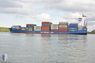
JSP MISTRAL
Container Ship
Current Trip
| Time Travelled | 5 h, 16 mins |
|---|---|
| Remaining Time | 17 h, 58 mins |
| Distance Travelled | 82.17 nm |
| Remaining Distance | 306.95 nm |
| AVG Speed | 15.7 Knopen |
| MAX Speed | 17.5 Knopen |
| AVG Wind | 14.4 knots |
| MAX Wind | 20 knots |
| MIN Temp | 3.9°C / 39.02°F |
| MAX Temp | 6°C / 42.8°F |
| Diepgang | 6 M |
| Positie ontvangen | 1 m geleden |
Current Position
| Lengtegraad | -1.52271° |
|---|---|
| Breedtegraat | 55.65948° |
| Status | Under way using engine |
| Snelheid | 16.7 Knopen |
| Koers | 146° |
| Gebied | North Sea |
| Station | T-AIS |
| Positie ontvangen | 1 m geleden |
Info
Information
The current position of JSP MISTRAL is in North Sea with coordinates 55.65948° / -1.52271° as reported on 2024-04-25 06:59 by AIS to our vessel tracker app. The vessel's current speed is 16.7 Knopen and is heading at the port of ROTTERDAM. The estimated time of arrival as calculated by MyShipTracking vessel tracking app is 2024-04-26 00:59 LT
The vessel JSP MISTRAL (IMO: 9368041, MMSI: 305643000) is a Container Ship that was built in 2009 ( 15 Jaar oud ). It's sailing under the flag of [AG] Antigua Barbuda.
In this page you can find informations about the vessels current position, last detected port calls, and current voyage information. If the vessels is not in coverage by AIS you will find the latest position.
The current position of JSP MISTRAL is detected by our AIS receivers and we are not responsible for the reliability of the data. The last position was recorded while the vessel was in Coverage by the Ais receivers of our vessel tracking app.
The current draught of JSP MISTRAL as reported by AIS is 6 meters
Weather
| Temperature | 5.5°C / 41.9°F |
|---|---|
| Wind Speed | 20 knots |
| Direction | 343° NNW |
| Pressure | 1003.7 hPa |
| Humidity | 71 % |
| Cloud Coverage | 89 % |
Featured Company
Last Port Calls
| Port | Arrival | Departure | Time In Port |
|---|---|---|---|
| 2024-04-24 02:58 | 2024-04-25 01:45 | 22 h | |
| 2024-04-22 21:06 | 2024-04-23 05:39 | 8 h | |
| 2024-04-20 20:32 | 2024-04-22 03:33 | 1 d | |
| 2024-04-20 08:30 | 2024-04-20 19:15 | 10 h | |
| 2024-04-19 13:43 | 2024-04-20 06:43 | 16 h | |
| 2024-04-16 18:09 | 2024-04-18 11:02 | 1 d | |
| 2024-04-15 15:13 | 2024-04-16 02:04 | 10 h | |
| 2024-04-13 11:54 | 2024-04-14 21:59 | 1 d | |
| 2024-04-13 04:53 | 2024-04-13 11:51 | 6 h | |
| 2024-04-12 16:11 | 2024-04-13 03:22 | 11 h |
Most Visited Ports (Last year)
| Port | Arrivals | |
|---|---|---|
| 86 | ||
| 28 | ||
| 27 | ||
| 25 | ||
| 22 | ||
| 16 |
Last Trips
| Origin | Departure | Destination | Arrival | Distance | |
|---|---|---|---|---|---|
| 2024-04-23 06:39 | 2024-04-24 03:58 | 146.21 nm | |||
| 2024-04-22 05:33 | 2024-04-22 22:06 | 257.14 nm | |||
| 2024-04-20 21:15 | 2024-04-20 22:32 | 15.35 nm | |||
| 2024-04-20 08:43 | 2024-04-20 10:30 | 16.13 nm | |||
| 2024-04-18 12:02 | 2024-04-19 15:43 | 388.29 nm | |||
| 2024-04-16 03:04 | 2024-04-16 19:09 | 144.51 nm | |||
| 2024-04-14 23:59 | 2024-04-15 16:13 | 256.70 nm | |||
| 2024-04-13 13:51 | 2024-04-13 13:54 | 0.73 nm | |||
| 2024-04-13 05:22 | 2024-04-13 06:53 | 15.94 nm | |||
| 2024-04-11 14:35 | 2024-04-12 18:11 | 402.06 nm |
Events
| Tijd | Evenement | Details | Positie / Bestemming | Info |
|---|---|---|---|---|
| 2024-04-25 03:14 | ETA Changed | 2024/04/26 02:30 2024/04/26 03:00 |
56.04525 / -3.12100
NLRTM
|
Snelheid: 13.2 kn Koers: 94.1° |
| 2024-04-25 03:01 | Draught Changed | 6 6.3 |
56.04228 / -3.18762
NLRTM
|
Snelheid: 15.6 kn Koers: 74.4° |
| 2024-04-25 03:01 | Destination Changed | NLRTM GBGRG |
56.04228 / -3.18762
NLRTM
|
Snelheid: 15.6 kn Koers: 74.4° |
| 2024-04-25 03:01 | ETA Changed | 2024/04/26 03:00 2024/04/24 01:45 |
56.04228 / -3.18762
NLRTM
|
Snelheid: 15.6 kn Koers: 74.4° |
| 2024-04-25 02:12 | Status Changed | Under way using engine Default |
56.02313 / -3.49617
GBGRG
|
Snelheid: 12.4 kn Koers: 109° |
| 2024-04-25 02:10 | Status Changed | Default Under way using engine |
56.02457 / -3.50397
GBGRG
|
Snelheid: 12.2 kn Koers: 108.9° |
| 2024-04-25 01:45 | Status Changed | Under way using engine Default |
56.03841 / -3.66855
GBGRG
|
Snelheid: 3.4 kn Koers: 65° |
| 2024-04-25 01:45 | Vertrekhaven |
|
56.03841 / -3.66855
GBGRG
|
Snelheid: 3.4 kn Koers: 65° |
| 2024-04-25 01:41 | Start beweging |
56.03617 / -3.68174
[GB] GRANGEMOUTH
|
Snelheid: 3.4 kn Koers: 65° |
|
| 2024-04-25 01:26 | Stop beweging |
56.03502 / -3.68574
[GB] GRANGEMOUTH
|
Snelheid: Koers: 61° |