
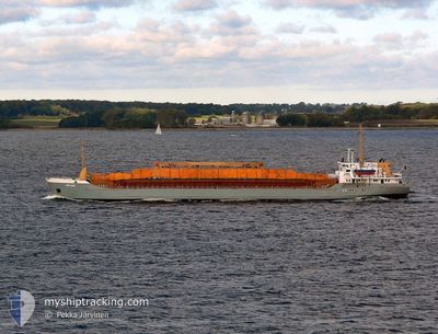
JAOHAR H
General Cargo
Current Trip
| Time Travelled | 6 days |
|---|---|
| Remaining Time | 1 h, 0 mins |
| Distance Travelled | 959.76 nm |
| Remaining Distance | 57.35 nm |
| AVG Speed | 7.1 Knopen |
| MAX Speed | 9.4 Knopen |
| AVG Wind | 6.6 knots |
| MAX Wind | 21 knots |
| MIN Temp | 13.9°C / 57.02°F |
| MAX Temp | 25.5°C / 77.9°F |
| Diepgang | 5.2 M |
| Positie ontvangen | 18 h, 5 m geleden |
Current Position
| Lengtegraad | 29.19239° |
|---|---|
| Breedtegraat | 41.42878° |
| Status | Under way using engine |
| Snelheid | 8 Knopen |
| Koers | 356.2° |
| Gebied | Black Sea |
| Station | T-AIS |
| Positie ontvangen | 18 h, 5 m geleden |
Info
Information
The current position of JAOHAR H is in Black Sea with coordinates 41.42878° / 29.19239° as reported on 2024-04-24 19:58 by AIS to our vessel tracker app. The vessel's current speed is 8 Knopen and is heading at the port of MANGALIA. The estimated time of arrival as calculated by MyShipTracking vessel tracking app is 2024-04-25 15:03 LT
The vessel JAOHAR H (IMO: 8401511, MMSI: 667001285) is a General Cargo that was built in 1984 ( 40 Jaar oud ). It's sailing under the flag of [SL] Sierra Leone.
In this page you can find informations about the vessels current position, last detected port calls, and current voyage information. If the vessels is not in coverage by AIS you will find the latest position.
The current position of JAOHAR H is detected by our AIS receivers and we are not responsible for the reliability of the data. The last position was recorded while the vessel was in Coverage by the Ais receivers of our vessel tracking app.
The current draught of JAOHAR H as reported by AIS is 5.2 meters
Weather
| Temperature | 14.6°C / 58.28°F |
|---|---|
| Wind Speed | 4 knots |
| Direction | 134° SE |
| Pressure | 1004.4 hPa |
| Humidity | 83.3 % |
| Cloud Coverage | 100 % |
Featured Company
Events
| Tijd | Evenement | Details | Positie / Bestemming | Info |
|---|---|---|---|---|
| 2024-04-24 19:58 | Status Changed | Default Under way using engine |
41.42920 / 29.19232
RO MAG
|
Snelheid: 8 kn Koers: 356.2° |
| 2024-04-24 19:58 | Buitenbereik |
41.42878 / 29.19239
Black Sea
RO MAG
|
Snelheid: 8 kn Koers: 356.2° |
|
| 2024-04-24 18:26 | Wijzig zee gebeid | Turkish part of the Black Sea Turkish part of the Sea of Marmara |
41.23589 / 29.14178
Black Sea
RO MAG
|
Snelheid: 7.8 kn Koers: 30.7° |
| 2024-04-24 17:25 | ETA Changed | 2024/04/25 17:00 2024/04/25 05:00 |
41.13528 / 29.07278
RO MAG
|
Snelheid: 8 kn Koers: 315.9° |
| 2024-04-24 15:09 | ETA Changed | 2024/04/25 05:00 2024/04/25 02:00 |
40.93413 / 28.97434
RO MAG
|
Snelheid: 5.5 kn Koers: 20.8° |
| 2024-04-24 15:04 | Status Changed | Under way using engine At anchor |
40.92664 / 28.96890
RO MAG
|
Snelheid: 5.9 kn Koers: 33° |
| 2024-04-24 12:33 | Start beweging | 1.78 nm, East of ZEYTINBURNU |
40.97661 / 28.93188
RO MAG
|
Snelheid: 3.2 kn Koers: 152° |
| 2024-04-24 10:22 | Status Changed | At anchor Under way using engine |
40.98044 / 28.93057
RO MAG
|
Snelheid: 0.1 kn Koers: 171° |
| 2024-04-24 08:15 | Stop beweging | 1.8 nm, East of ZEYTINBURNU |
40.98147 / 28.93230
RO MAG
|
Snelheid: 0.3 kn Koers: 23° |
| 2024-04-24 05:15 | Status Changed | Under way using engine Default |
40.82713 / 28.57073
RO MAG
|
Snelheid: 8.3 kn Koers: 83° |