
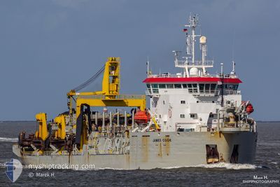
JAMES COOK
Trailing Suction Hopper Dredger
Current Trip
GALANG
| Time Travelled | 1 day |
|---|---|
| Remaining Time | --- |
| Distance Travelled | 95.60 nm |
| Remaining Distance | --- |
| AVG Speed | 11.7 Knopen |
| MAX Speed | 14.5 Knopen |
| AVG Wind | 6.6 knots |
| MAX Wind | 9 knots |
| MIN Temp | 27.5°C / 81.5°F |
| MAX Temp | 30.1°C / 86.18°F |
| Diepgang | 7 M |
| Positie ontvangen | 1 d geleden |
Current Position
| Lengtegraad | 103.64347° |
|---|---|
| Breedtegraat | 1.17525° |
| Status | Under way using engine |
| Snelheid | 14.4 Knopen |
| Koers | 268.8° |
| Gebied | Singapore Strait |
| Station | T-AIS |
| Positie ontvangen | 1 d geleden |
Info
Information
The current position of JAMES COOK is in Singapore Strait with coordinates 1.17525° / 103.64347° as reported on 2024-04-23 23:40 by AIS to our vessel tracker app. The vessel's current speed is 14.4 Knopen
The vessel JAMES COOK (IMO: 9020261, MMSI: 253254000) is a Trailing Suction Hopper Dredger that was built in 1992 ( 32 Jaar oud ). It's sailing under the flag of [LU] Luxembourg.
In this page you can find informations about the vessels current position, last detected port calls, and current voyage information. If the vessels is not in coverage by AIS you will find the latest position.
The current position of JAMES COOK is detected by our AIS receivers and we are not responsible for the reliability of the data. The last position was recorded while the vessel was in Coverage by the Ais receivers of our vessel tracking app.
The current draught of JAMES COOK as reported by AIS is 7 meters
Weather
| Temperature | 29.5°C / 85.1°F |
|---|---|
| Wind Speed | 3 knots |
| Direction | 61° ENE |
| Pressure | 1005.9 hPa |
| Humidity | 68.8 % |
| Cloud Coverage | 100 % |
Featured Company
Most Visited Ports (Last year)
| Port | Arrivals | |
|---|---|---|
| 3 |
Events
| Tijd | Evenement | Details | Positie / Bestemming | Info |
|---|---|---|---|---|
| 2024-04-24 07:05 | Stop beweging | 20.19 nm, South West of TANJUNG PINANG |
.72667 / 104.17167
GALANG
|
Snelheid: Koers: -1° |
| 2024-04-23 23:48 | Status Changed | Default Under way using engine |
1.17592 / 103.61147
GALANG
|
Snelheid: 14.4 kn Koers: 268.8° |
| 2024-04-23 23:40 | Status Changed | Under way using engine Default |
1.17525 / 103.64347
GALANG
|
Snelheid: 14.5 kn Koers: 282° |
| 2024-04-23 23:40 | Buitenbereik |
1.17525 / 103.64347
Singapore Strait
GALANG
|
Snelheid: 14.4 kn Koers: 268.8° |
|
| 2024-04-23 23:32 | Status Changed | Default Under way using engine |
1.16976 / 103.67447
GALANG
|
Snelheid: 13.9 kn Koers: 298° |
| 2024-04-23 23:22 | Wijzig zee gebeid | Indonesian part of the Singapore Strait Singaporean part of the Singapore Strait |
1.15169 / 103.70854
Singapore Strait
GALANG
|
Snelheid: 13.8 kn Koers: 298.9° |
| 2024-04-23 23:22 | Status Changed | Under way using engine Default |
1.15044 / 103.71079
GALANG
|
Snelheid: 13.6 kn Koers: 294° |
| 2024-04-23 23:08 | Status Changed | Default Under way using engine |
1.15180 / 103.76018
GALANG
|
Snelheid: 13 kn Koers: 238.8° |
| 2024-04-23 23:02 | Status Changed | Under way using engine Default |
1.16294 / 103.77835
GALANG
|
Snelheid: 13.1 kn Koers: 240° |
| 2024-04-23 23:00 | Status Changed | Default Under way using engine |
1.16578 / 103.78299
GALANG
|
Snelheid: 13.1 kn Koers: 244.4° |