
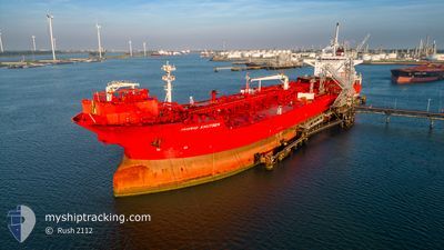
INGRID KNUTSEN
Shuttle Tanker
Current Trip
SKAGEN
| Time Travelled | 16 days |
|---|---|
| Remaining Time | --- |
| Distance Travelled | 529.44 nm |
| Remaining Distance | --- |
| AVG Speed | 6.7 Knopen |
| MAX Speed | 12.1 Knopen |
| AVG Wind | 19 knots |
| MAX Wind | 36.9 knots |
| MIN Temp | 3.7°C / 38.66°F |
| MAX Temp | 12.7°C / 54.86°F |
| Diepgang | 9 M |
| Positie ontvangen | 2 m geleden |
Current Position
| Lengtegraad | 10.61885° |
|---|---|
| Breedtegraat | 57.68903° |
| Status | At anchor |
| Snelheid | |
| Koers | 219° |
| Gebied | Kattegat |
| Station | T-AIS |
| Positie ontvangen | 2 m geleden |
Info
Information
The current position of INGRID KNUTSEN is in Kattegat with coordinates 57.68903° / 10.61885° as reported on 2024-04-20 05:57 by AIS to our vessel tracker app. The vessel's current speed is 0 Knopen
The vessel INGRID KNUTSEN (IMO: 9649225, MMSI: 235103057) is a Shuttle Tanker that was built in 2013 ( 11 Jaar oud ). It's sailing under the flag of [GB] United Kingdom.
In this page you can find informations about the vessels current position, last detected port calls, and current voyage information. If the vessels is not in coverage by AIS you will find the latest position.
The current position of INGRID KNUTSEN is detected by our AIS receivers and we are not responsible for the reliability of the data. The last position was recorded while the vessel was in Coverage by the Ais receivers of our vessel tracking app.
The current draught of INGRID KNUTSEN as reported by AIS is 9 meters
Weather
| Temperature | 5.2°C / 41.36°F |
|---|---|
| Wind Speed | 9 knots |
| Direction | 316° NW |
| Pressure | 1014.1 hPa |
| Humidity | 60.3 % |
| Cloud Coverage | 37 % |
Featured Company
Last Port Calls
| Port | Arrival | Departure | Time In Port |
|---|---|---|---|
| 2024-04-02 17:52 | 2024-04-03 13:37 | 19 h | |
| 2024-03-27 00:48 | 2024-03-28 04:49 | 1 d | |
| 2024-03-21 13:47 | 2024-03-22 15:07 | 1 d | |
| 2024-03-16 21:08 | 2024-03-17 19:06 | 21 h | |
| 2024-02-28 22:41 | 2024-03-02 17:59 | 2 d | |
| 2024-02-01 14:34 |
Last Trips
| Origin | Departure | Destination | Arrival | Distance | |
|---|---|---|---|---|---|
| 2024-03-28 05:49 | 2024-04-02 19:52 | 720.57 nm | |||
| 2024-03-22 16:07 | 2024-03-27 01:48 | 492.05 nm | |||
| 2024-03-17 20:06 | 2024-03-21 14:47 | 176.53 nm | |||
| 2024-03-02 18:59 | 2024-03-16 22:08 | 2056.12 nm | |||
| 2024-02-01 15:34 | 2024-02-28 23:41 | 3791.73 nm |
Events
| Tijd | Evenement | Details | Positie / Bestemming | Info |
|---|---|---|---|---|
| 2024-04-19 23:39 | Stop beweging | 1.58 nm, South East of SKAGEN |
57.68922 / 10.61571
SKAGEN
|
Snelheid: 0.2 kn Koers: 171° |
| 2024-04-19 23:39 | Start beweging | 1.58 nm, South East of SKAGEN |
57.68922 / 10.61568
SKAGEN
|
Snelheid: 3.6 kn Koers: 171° |
| 2024-04-19 20:13 | Status Changed | At anchor Default |
57.68722 / 10.61161
SKAGEN
|
Snelheid: Koers: 86° |
| 2024-04-19 20:10 | Status Changed | Default At anchor |
57.68719 / 10.61162
SKAGEN
|
Snelheid: Koers: 83° |
| 2024-04-18 07:30 | Stop beweging | 1.78 nm, South of SKAGEN |
57.68590 / 10.61668
SKAGEN
|
Snelheid: 0.3 kn Koers: 326° |
| 2024-04-18 07:27 | Start beweging | 1.77 nm, South East of SKAGEN |
57.68633 / 10.61784
SKAGEN
|
Snelheid: 3.9 kn Koers: 320° |
| 2024-04-17 22:44 | Status Changed | At anchor Default |
57.68594 / 10.61292
SKAGEN
|
Snelheid: 0.1 kn Koers: 54° |
| 2024-04-17 22:41 | Status Changed | Default At anchor |
57.68618 / 10.61256
SKAGEN
|
Snelheid: Koers: 58° |
| 2024-04-17 11:11 | Status Changed | At anchor Default |
57.68959 / 10.61910
SKAGEN
|
Snelheid: Koers: 210° |
| 2024-04-17 11:08 | Status Changed | Default At anchor |
57.68958 / 10.61912
SKAGEN
|
Snelheid: Koers: 209° |