
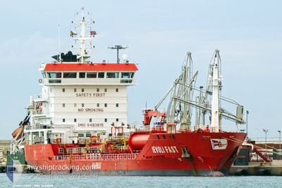
IEVOLI FAST
Oil/Chemical Tanker
Current Trip
| Time Travelled | 10 days |
|---|---|
| Remaining Time | 5 h, 17 mins |
| Distance Travelled | 2393.75 nm |
| Remaining Distance | 41.27 nm |
| AVG Speed | 9.7 Knopen |
| MAX Speed | 14.6 Knopen |
| AVG Wind | 15.3 knots |
| MAX Wind | 38 knots |
| MIN Temp | 6°C / 42.8°F |
| MAX Temp | 20.6°C / 69.08°F |
| Diepgang | 7.4 M |
| Positie ontvangen | 4 m geleden |
Current Position
| Lengtegraad | 3.66353° |
|---|---|
| Breedtegraat | 52.50442° |
| Status | Under way using engine |
| Snelheid | 8.4 Knopen |
| Koers | 220.5° |
| Gebied | North Sea |
| Station | T-AIS |
| Positie ontvangen | 4 m geleden |
Info
Information
The current position of IEVOLI FAST is in North Sea with coordinates 52.50442° / 3.66353° as reported on 2024-04-25 20:44 by AIS to our vessel tracker app. The vessel's current speed is 8.4 Knopen and is heading at the port of AMSTERDAM. The estimated time of arrival as calculated by MyShipTracking vessel tracking app is 2024-04-26 02:05 LT
The vessel IEVOLI FAST (IMO: 9403815, MMSI: 247243700) is a Oil/Chemical Tanker that was built in 2007 ( 17 Jaar oud ). It's sailing under the flag of [IT] Italy.
In this page you can find informations about the vessels current position, last detected port calls, and current voyage information. If the vessels is not in coverage by AIS you will find the latest position.
The current position of IEVOLI FAST is detected by our AIS receivers and we are not responsible for the reliability of the data. The last position was recorded while the vessel was in Coverage by the Ais receivers of our vessel tracking app.
The current draught of IEVOLI FAST as reported by AIS is 7.4 meters
Weather
| Temperature | 7.6°C / 45.68°F |
|---|---|
| Wind Speed | 10 knots |
| Direction | 290° WNW |
| Pressure | 1001.1 hPa |
| Humidity | 66.4 % |
| Cloud Coverage | 100 % |
Featured Company
Last Port Calls
| Port | Arrival | Departure | Time In Port |
|---|---|---|---|
| 2024-04-14 06:43 | 2024-04-15 09:50 | 1 d | |
| 2024-04-11 05:47 | 2024-04-12 06:44 | 1 d | |
| 2024-04-07 08:45 | 2024-04-08 17:01 | 1 d | |
| 2024-04-05 15:13 | 2024-04-06 19:04 | 1 d | |
| 2024-04-02 07:06 | 2024-04-04 06:29 | 1 d | |
| 2024-03-27 15:39 | 2024-03-27 21:13 | 5 h | |
| 2024-03-26 15:57 | 2024-03-27 14:18 | 22 h | |
| 2024-03-24 08:28 | 2024-03-25 08:40 | 1 d | |
| 2024-03-20 20:00 | 2024-03-21 21:55 | 1 d | |
| 2024-03-18 04:42 | 2024-03-18 13:29 | 8 h |
Most Visited Ports (Last year)
| Port | Arrivals | |
|---|---|---|
| 24 | ||
| 7 | ||
| 7 | ||
| 5 | ||
| 4 | ||
| 4 |
Last Trips
| Origin | Departure | Destination | Arrival | Distance | |
|---|---|---|---|---|---|
| 2024-04-12 08:44 | 2024-04-14 08:43 | 152.06 nm | |||
| 2024-04-08 19:01 | 2024-04-11 07:47 | 652.80 nm | |||
| 2024-04-06 21:04 | 2024-04-07 10:45 | 121.34 nm | |||
| 2024-04-04 08:29 | 2024-04-05 17:13 | 379.74 nm | |||
| 2024-03-27 22:13 | 2024-04-02 09:06 | 519.62 nm | |||
| 2024-03-27 15:18 | 2024-03-27 16:39 | 8.29 nm | |||
| 2024-03-25 09:40 | 2024-03-26 16:57 | 254.77 nm | |||
| 2024-03-21 22:55 | 2024-03-24 09:28 | 645.26 nm | |||
| 2024-03-18 14:29 | 2024-03-20 21:00 | 710.83 nm | |||
| 2024-03-17 06:48 | 2024-03-18 05:42 | 219.70 nm |
Events
| Tijd | Evenement | Details | Positie / Bestemming | Info |
|---|---|---|---|---|
| 2024-04-25 20:43 | Status Changed | Under way using engine Default |
52.50615 / 3.66606
NL AMS
|
Snelheid: 8 kn Koers: 225° |
| 2024-04-25 20:33 | Status Changed | Default Under way using engine |
52.52228 / 3.68850
NL AMS
|
Snelheid: 8.4 kn Koers: 174.9° |
| 2024-04-25 20:17 | Status Changed | Under way using engine Default |
52.55410 / 3.68020
NL AMS
|
Snelheid: 7.2 kn Koers: 83° |
| 2024-04-25 20:17 | Binnenbereik |
52.55410 / 3.68020
North Sea
|
Snelheid: 7.6 kn Koers: 145.3° |
|
| 2024-04-25 17:47 | Status Changed | Default Under way using engine |
52.65166 / 3.55767
NL AMS
|
Snelheid: 6.2 kn Koers: 216.3° |
| 2024-04-25 17:41 | Status Changed | Under way using engine Default |
52.66044 / 3.56925
NL AMS
|
Snelheid: 6.2 kn Koers: 215° |
| 2024-04-25 17:41 | Buitenbereik |
52.66044 / 3.56925
North Sea
|
Snelheid: 6.2 kn Koers: 216.3° |
|
| 2024-04-25 17:24 | Binnenbereik |
52.66044 / 3.56925
North Sea
|
Snelheid: 6.2 kn Koers: 216.3° |
|
| 2024-04-25 16:39 | Status Changed | Default Under way using engine |
52.73866 / 3.68265
NL AMS
|
Snelheid: 6.1 kn Koers: 222.6° |
| 2024-04-25 16:37 | Buitenbereik |
52.74121 / 3.68626
North Sea
|
Snelheid: 6.1 kn Koers: 222.6° |