
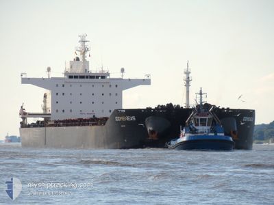
IDOMENEAS
Bulk Carrier
Current Trip
| Time Travelled | 5 days |
|---|---|
| Remaining Time | --- |
| Distance Travelled | 1278.97 nm |
| Remaining Distance | --- |
| AVG Speed | 10.4 Knopen |
| MAX Speed | 10.4 Knopen |
| AVG Wind | 8.5 knots |
| MAX Wind | 17 knots |
| MIN Temp | 25.5°C / 77.9°F |
| MAX Temp | 28.8°C / 83.84°F |
| Diepgang | 8.2 M |
| Positie ontvangen | 1 d geleden |
Current Position
| Lengtegraad | 57.27464° |
|---|---|
| Breedtegraat | 24.81700° |
| Status | Under way using engine |
| Snelheid | 12.3 Knopen |
| Koers | 127.1° |
| Gebied | Gulf of Oman |
| Station | T-AIS |
| Positie ontvangen | 1 d geleden |
Info
Information
The current position of IDOMENEAS is in Gulf of Oman with coordinates 24.81700° / 57.27464° as reported on 2024-04-24 03:28 by AIS to our vessel tracker app. The vessel's current speed is 12.3 Knopen and is heading at the port of MAPUTO. The estimated time of arrival as calculated by MyShipTracking vessel tracking app is 2024-05-07 02:00 LT
The vessel IDOMENEAS (IMO: 9448035, MMSI: 636017713) is a Bulk Carrier that was built in 2010 ( 14 Jaar oud ). It's sailing under the flag of [LR] Liberia.
In this page you can find informations about the vessels current position, last detected port calls, and current voyage information. If the vessels is not in coverage by AIS you will find the latest position.
The current position of IDOMENEAS is detected by our AIS receivers and we are not responsible for the reliability of the data. The last position was recorded while the vessel was in Coverage by the Ais receivers of our vessel tracking app.
The current draught of IDOMENEAS as reported by AIS is 8.2 meters
Weather
| Temperature | 27.8°C / 82.04°F |
|---|---|
| Wind Speed | 6 knots |
| Direction | 194° SSW |
| Pressure | 1009.2 hPa |
| Humidity | 74.4 % |
| Cloud Coverage | 1 % |
Featured Company
Last Port Calls
| Port | Arrival | Departure | Time In Port |
|---|---|---|---|
| 2024-04-17 16:44 | 2024-04-20 02:55 | 2 d | |
| 2024-02-21 08:01 | 2024-02-25 03:39 | 3 d | |
| 2024-02-13 05:10 | 2024-02-14 10:45 | 1 d |
Last Trips
| Origin | Departure | Destination | Arrival | Distance | |
|---|---|---|---|---|---|
| 2024-02-24 21:39 | 2024-04-17 22:14 | 11242.60 nm | |||
| 2024-02-14 04:45 | 2024-02-21 02:01 | 40.98 nm | |||
| 2023-12-27 15:31 | 2024-02-12 23:10 | 11766.39 nm |
Events
| Tijd | Evenement | Details | Positie / Bestemming | Info |
|---|---|---|---|---|
| 2024-04-24 03:35 | Status Changed | Default Under way using engine |
24.80167 / 57.29333
MAPUTO
|
Snelheid: 12.3 kn Koers: 127.1° |
| 2024-04-24 03:28 | Buitenbereik |
24.81700 / 57.27464
Gulf of Oman
MAPUTO
|
Snelheid: 12.3 kn Koers: 127.1° |
|
| 2024-04-24 03:26 | Status Changed | Under way using engine Default |
24.82143 / 57.26821
MAPUTO
|
Snelheid: 12.4 kn Koers: 127° |
| 2024-04-24 03:17 | Binnenbereik |
24.81700 / 57.27464
Gulf of Oman
MAPUTO
|
Snelheid: 12.3 kn Koers: 127.1° |
|
| 2024-04-24 02:03 | Status Changed | Default Under way using engine |
24.98715 / 57.01480
MAPUTO
|
Snelheid: 12.3 kn Koers: 127.6° |
| 2024-04-24 01:56 | Buitenbereik |
25.00206 / 56.99377
Gulf of Oman
MAPUTO
|
Snelheid: 12.3 kn Koers: 127.6° |
|
| 2024-04-24 01:55 | Status Changed | Under way using engine Default |
25.00417 / 56.99079
MAPUTO
|
Snelheid: 12.3 kn Koers: 129° |
| 2024-04-24 01:48 | Status Changed | Default Under way using engine |
25.01928 / 56.97009
MAPUTO
|
Snelheid: 12.3 kn Koers: 128.7° |
| 2024-04-24 01:28 | Wijzig zee gebeid | Omani part of the Gulf of Oman United Arab Emirates part of the Gulf of Oman |
25.06320 / 56.90881
Gulf of Oman
MAPUTO
|
Snelheid: 12.6 kn Koers: 127.7° |
| 2024-04-23 23:33 | ETA Changed | 2024/05/07 02:00 2024/05/07 12:00 |
25.18435 / 56.55029
MAPUTO
|
Snelheid: 5.6 kn Koers: 119.3° |