
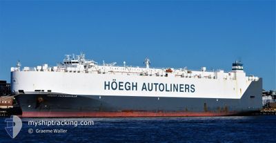
HOEGH JACKSONVILLE
Vehicles Carrier
Current Trip
| Time Travelled | 20 days |
|---|---|
| Remaining Time | 8 days |
| Distance Travelled | 6686.10 nm |
| Remaining Distance | 3354.62 nm |
| AVG Speed | 13.9 Knopen |
| MAX Speed | 17.6 Knopen |
| AVG Wind | 15.8 knots |
| MAX Wind | 37.8 knots |
| MIN Temp | 12.8°C / 55.04°F |
| MAX Temp | 29.4°C / 84.92°F |
| Diepgang | 9.6 M |
| Positie ontvangen | 1 d geleden |
Current Position
| Lengtegraad | 31.38927° |
|---|---|
| Breedtegraat | -29.77250° |
| Status | Under way using engine |
| Snelheid | 15.8 Knopen |
| Koers | 49.4° |
| Gebied | Indian Ocean |
| Station | T-AIS |
| Positie ontvangen | 1 d geleden |
Info
Information
The current position of HOEGH JACKSONVILLE is in Indian Ocean with coordinates -29.77250° / 31.38927° as reported on 2024-04-17 04:14 by AIS to our vessel tracker app. The vessel's current speed is 15.8 Knopen and is heading at the port of SOHAR. The estimated time of arrival as calculated by MyShipTracking vessel tracking app is 2024-04-27 09:42 LT
The vessel HOEGH JACKSONVILLE (IMO: 9673379, MMSI: 258977000) is a Vehicles Carrier that was built in 2014 ( 10 Jaar oud ). It's sailing under the flag of [NO] Norway.
In this page you can find informations about the vessels current position, last detected port calls, and current voyage information. If the vessels is not in coverage by AIS you will find the latest position.
The current position of HOEGH JACKSONVILLE is detected by our AIS receivers and we are not responsible for the reliability of the data. The last position was recorded while the vessel was in Coverage by the Ais receivers of our vessel tracking app.
The current draught of HOEGH JACKSONVILLE as reported by AIS is 9.6 meters
Weather
| Temperature | 26.5°C / 79.7°F |
|---|---|
| Wind Speed | 9 knots |
| Direction | 173° S |
| Pressure | 1015.7 hPa |
| Humidity | 79.4 % |
| Cloud Coverage | 100 % |
Featured Company
Last Port Calls
| Port | Arrival | Departure | Time In Port |
|---|---|---|---|
| 2024-03-28 18:33 | 2024-03-29 16:53 | 22 h | |
| 2024-03-22 17:58 | 2024-03-23 17:31 | 23 h | |
| 2024-03-20 11:10 | 2024-03-20 22:52 | 11 h | |
| 2024-03-17 19:28 | 2024-03-20 01:42 | 2 d | |
| 2024-03-15 15:58 | 2024-03-16 21:45 | 1 d | |
| 2024-03-13 16:32 | 2024-03-14 16:53 | 1 d | |
| 2024-03-12 00:21 | 2024-03-12 14:30 | 14 h | |
| 2024-03-09 03:45 | 2024-03-10 20:17 | 1 d | |
| 2024-03-02 03:55 | 2024-03-02 12:00 | 8 h |
Most Visited Ports (Last year)
| Port | Arrivals | |
|---|---|---|
| 3 | ||
| 3 | ||
| 3 | ||
| 3 | ||
| 3 | ||
| 3 |
Last Trips
| Origin | Departure | Destination | Arrival | Distance | |
|---|---|---|---|---|---|
| 2024-03-23 17:31 | 2024-03-28 18:33 | 1424.48 nm | |||
| 2024-03-20 23:52 | 2024-03-22 17:58 | 519.75 nm | |||
| 2024-03-20 02:42 | 2024-03-20 12:10 | 124.05 nm | |||
| 2024-03-16 22:45 | 2024-03-17 20:28 | 339.50 nm | |||
| 2024-03-14 17:53 | 2024-03-15 16:58 | 168.24 nm | |||
| 2024-03-12 14:30 | 2024-03-13 17:32 | 285.06 nm | |||
| 2024-03-10 21:17 | 2024-03-12 00:21 | 327.07 nm | |||
| 2024-03-02 13:00 | 2024-03-09 04:45 | 1424.46 nm | |||
| 2024-01-19 16:49 | 2024-03-02 04:55 | 10443.54 nm |
Events
| Tijd | Evenement | Details | Positie / Bestemming | Info |
|---|---|---|---|---|
| 2024-04-17 04:15 | Status Changed | Default Under way using engine |
-29.76833 / 31.39333
OM SOH
|
Snelheid: 15.8 kn Koers: 49.4° |
| 2024-04-17 04:14 | Buitenbereik |
-29.77250 / 31.38927
Indian Ocean
OM SOH
|
Snelheid: 15.8 kn Koers: 49.4° |
|
| 2024-04-17 03:48 | Status Changed | Under way using engine Default |
-29.84622 / 31.29037
OM SOH
|
Snelheid: 15.5 kn Koers: 48° |
| 2024-04-17 03:34 | Status Changed | Default Under way using engine |
-29.88820 / 31.23885
OM SOH
|
Snelheid: 15.4 kn Koers: 45.4° |
| 2024-04-17 03:28 | Status Changed | Under way using engine Default |
-29.90410 / 31.22098
OM SOH
|
Snelheid: 15.4 kn Koers: 45° |
| 2024-04-17 03:27 | Status Changed | Default Under way using engine |
-29.90927 / 31.21512
OM SOH
|
Snelheid: 15.3 kn Koers: 44.9° |
| 2024-04-17 03:16 | Status Changed | Under way using engine Default |
-29.94093 / 31.17843
OM SOH
|
Snelheid: 15.2 kn Koers: 45° |
| 2024-04-17 03:07 | Status Changed | Default Under way using engine |
-29.96896 / 31.14586
OM SOH
|
Snelheid: 15.2 kn Koers: 48.1° |
| 2024-04-17 03:01 | Wijzig zee gebeid | South African part of the Indian Ocean South African part of the South Atlantic Ocean |
-29.98667 / 31.12450
Indian Ocean
OM SOH
|
Snelheid: 15.2 kn Koers: 48.1° |
| 2024-04-17 03:01 | Status Changed | Under way using engine Default |
-29.98667 / 31.12450
OM SOH
|
Snelheid: 15.1 kn Koers: 47° |