
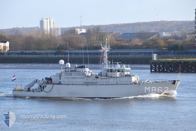
NATO WARSHIP M862
Military ops
Current Trip
Unknown
| Time Travelled | 2 days |
|---|---|
| Remaining Time | --- |
| Distance Travelled | 67.13 nm |
| Remaining Distance | --- |
| AVG Speed | 6.8 Knopen |
| MAX Speed | 11.6 Knopen |
| AVG Wind | 14.1 knots |
| MAX Wind | 19 knots |
| MIN Temp | 1.5°C / 34.7°F |
| MAX Temp | 4.6°C / 40.28°F |
| Diepgang | 0 M |
| Positie ontvangen | 10 h, 48 m geleden |
Current Position
| Lengtegraad | 27.88540° |
|---|---|
| Breedtegraat | 59.42354° |
| Status | Restricted manoeuverability |
| Snelheid | 3.8 Knopen |
| Koers | 114° |
| Gebied | Gulf of Finland |
| Station | T-AIS |
| Positie ontvangen | 10 h, 48 m geleden |
Info
Information
The current position of NATO WARSHIP M862 is in Gulf of Finland with coordinates 59.42354° / 27.88540° as reported on 2024-04-23 16:57 by AIS to our vessel tracker app. The vessel's current speed is 3.8 Knopen
The vessel NATO WARSHIP M862 (MMSI: 244591000) is a Military ops It's sailing under the flag of [NL] Netherlands.
In this page you can find informations about the vessels current position, last detected port calls, and current voyage information. If the vessels is not in coverage by AIS you will find the latest position.
The current position of NATO WARSHIP M862 is detected by our AIS receivers and we are not responsible for the reliability of the data. The last position was recorded while the vessel was in Coverage by the Ais receivers of our vessel tracking app.
Weather
| Temperature | 1.3°C / 34.34°F |
|---|---|
| Wind Speed | 12 knots |
| Direction | 219° SW |
| Pressure | 1013.7 hPa |
| Humidity | 94.8 % |
| Cloud Coverage | 100 % |
Featured Company
Last Port Calls
| Port | Arrival | Departure | Time In Port |
|---|---|---|---|
| 2024-04-21 05:40 | 2024-04-21 10:06 | 4 h | |
| 2024-04-12 07:02 | 2024-04-15 05:31 | 2 d | |
| 2024-04-05 09:02 | 2024-04-08 11:07 | 3 d | |
| 2024-03-29 08:55 | |||
| 2024-03-22 08:50 | 2024-03-25 09:37 | 3 d | |
| 2024-03-15 08:32 | |||
| 2024-02-23 06:47 | 2024-02-27 09:21 | 4 d | |
| 2024-02-19 21:37 | 2024-02-19 21:56 | 18 m | |
| 2024-02-16 11:04 | 2024-02-18 13:13 | 2 d | |
| 2024-02-02 08:23 | 2024-02-03 08:39 | 1 d |
Most Visited Ports (Last year)
| Port | Arrivals | |
|---|---|---|
| 22 | ||
| 5 | ||
| 3 | ||
| 2 | ||
| 2 | ||
| 1 |
Last Trips
| Origin | Departure | Destination | Arrival | Distance | |
|---|---|---|---|---|---|
| 2024-04-15 08:31 | 2024-04-21 08:40 | 246.61 nm | |||
| 2024-04-08 13:07 | 2024-04-12 10:02 | 244.09 nm | |||
| 2024-03-25 10:37 | 2024-03-29 09:55 | 558.67 nm | |||
| 2024-02-27 10:21 | 2024-03-15 09:32 | 946.55 nm | |||
| 2024-02-19 22:56 | 2024-02-23 07:47 | 833.71 nm | |||
| 2024-02-18 14:13 | 2024-02-19 22:37 | 340.65 nm | |||
| 2024-02-03 09:39 | 2024-02-16 12:04 | 298.53 nm | |||
| 2024-02-01 19:21 | 2024-02-02 09:23 | 20.12 nm |
Events
| Tijd | Evenement | Details | Positie / Bestemming | Info |
|---|---|---|---|---|
| 2024-04-23 16:57 | Buitenbereik |
59.42354 / 27.88540
Gulf of Finland
|
Snelheid: 3.8 kn Koers: 110.5° |
|
| 2024-04-23 14:09 | Binnenbereik |
59.43624 / 27.82916
Gulf of Finland
|
Snelheid: 3.6 kn Koers: 114.6° |
|
| 2024-04-23 12:58 | Buitenbereik |
59.42233 / 27.91657
Gulf of Finland
|
Snelheid: 1.9 kn Koers: 152.6° |
|
| 2024-04-23 10:25 | Binnenbereik |
59.43945 / 27.85535
Gulf of Finland
|
Snelheid: 1.5 kn Koers: 339.3° |
|
| 2024-04-23 08:21 | Buitenbereik |
59.43782 / 27.85229
Gulf of Finland
|
Snelheid: 2.4 kn Koers: 98.6° |
|
| 2024-04-23 08:15 | Start beweging | 3.5 nm, East of SILLAMAE |
59.43861 / 27.84478
|
Snelheid: 3.2 kn Koers: 110° |
| 2024-04-23 07:28 | Stop beweging | 4.18 nm, East of SILLAMAE |
59.43680 / 27.86809
|
Snelheid: 0.3 kn Koers: 188° |
| 2024-04-23 07:26 | Binnenbereik |
59.43711 / 27.86813
Gulf of Finland
|
Snelheid: 1 kn Koers: 189.1° |
|
| 2024-04-22 16:50 | Buitenbereik |
59.44154 / 27.85113
Gulf of Finland
|
Snelheid: 0.3 kn Koers: 249.7° |
|
| 2024-04-22 16:35 | Stop beweging | 3.73 nm, East of SILLAMAE |
59.44149 / 27.85102
|
Snelheid: 0.2 kn Koers: 40° |