
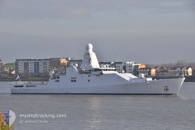
HNLMS GRONINGEN
Military ops
Current Trip
LAST UPDATE TIME
| Time Travelled | 2 days |
|---|---|
| Remaining Time | --- |
| Distance Travelled | 530.70 nm |
| Remaining Distance | --- |
| AVG Speed | 18.9 Knopen |
| MAX Speed | 20.8 Knopen |
| AVG Wind | 11.2 knots |
| MAX Wind | 17.2 knots |
| MIN Temp | 25.3°C / 77.54°F |
| MAX Temp | 27°C / 80.6°F |
| Diepgang | 5.4 M |
| Positie ontvangen | 1 d geleden |
Current Position
| Lengtegraad | -74.09219° |
|---|---|
| Breedtegraat | 19.92697° |
| Status | Under way using engine |
| Snelheid | 19.5 Knopen |
| Koers | 202.3° |
| Gebied | Caribbean Sea |
| Station | T-AIS |
| Positie ontvangen | 1 d geleden |
Info
Information
The current position of HNLMS GRONINGEN is in Caribbean Sea with coordinates 19.92697° / -74.09219° as reported on 2024-04-24 01:43 by AIS to our vessel tracker app. The vessel's current speed is 19.5 Knopen
The vessel HNLMS GRONINGEN (IMO: 4601084, MMSI: 245846000) is a Military ops It's sailing under the flag of [NL] Netherlands.
In this page you can find informations about the vessels current position, last detected port calls, and current voyage information. If the vessels is not in coverage by AIS you will find the latest position.
The current position of HNLMS GRONINGEN is detected by our AIS receivers and we are not responsible for the reliability of the data. The last position was recorded while the vessel was in Coverage by the Ais receivers of our vessel tracking app.
The current draught of HNLMS GRONINGEN as reported by AIS is 5.4 meters
Weather
| Temperature | 27°C / 80.6°F |
|---|---|
| Wind Speed | 16 knots |
| Direction | 38° NE |
| Pressure | 1016.4 hPa |
| Humidity | 74.1 % |
| Cloud Coverage | 66 % |
Featured Company
Last Port Calls
| Port | Arrival | Departure | Time In Port |
|---|---|---|---|
| 2024-04-17 16:57 | 2024-04-22 20:50 | 5 d | |
| 2024-04-07 14:07 | 2024-04-09 14:50 | 2 d | |
| 2024-03-13 15:36 | 2024-03-24 14:12 | 10 d | |
| 2024-02-08 15:01 | 2024-03-12 14:03 | ||
| 2024-02-07 16:13 | 2024-02-07 17:15 | 1 h | |
| 2024-02-07 06:38 | 2024-02-07 07:36 | 57 m | |
| 2024-02-02 09:10 | 2024-02-05 10:20 | 3 d |
Most Visited Ports (Last year)
| Port | Arrivals | |
|---|---|---|
| 6 | ||
| 2 | ||
| 1 | ||
| 1 | ||
| 1 |
Last Trips
| Origin | Departure | Destination | Arrival | Distance | |
|---|---|---|---|---|---|
| 2024-04-09 10:50 | 2024-04-17 12:57 | 566.38 nm | |||
| 2024-03-24 15:12 | 2024-04-07 10:07 | 4910.66 nm | |||
| 2024-03-12 15:03 | 2024-03-13 16:36 | 72.14 nm | |||
| 2024-02-07 18:15 | 2024-02-08 16:01 | 185.61 nm | |||
| 2024-02-07 08:36 | 2024-02-07 17:13 | 58.24 nm | |||
| 2024-02-05 11:20 | 2024-02-07 07:38 | 167.99 nm | |||
| 2024-01-29 15:25 | 2024-02-02 10:10 | 816.73 nm |
Events
| Tijd | Evenement | Details | Positie / Bestemming | Info |
|---|---|---|---|---|
| 2024-04-24 01:43 | Buitenbereik |
19.92697 / -74.09219
Caribbean Sea
|
Snelheid: 19.5 kn Koers: 202.3° |
|
| 2024-04-24 01:36 | Wijzig zee gebeid | Cuban part of the Caribbean Sea Cuban part of the North Atlantic Ocean |
19.95877 / -74.07800
Caribbean Sea
|
Snelheid: 19.7 kn Koers: 202.6° |
| 2024-04-24 00:21 | Status Changed | Under way using engine Default |
20.36951 / -74.02653
LAST UPDATE TIME
|
Snelheid: 18.8 kn Koers: 119° |
| 2024-04-24 00:21 | Binnenbereik |
20.36951 / -74.02653
North Atlantic Ocean
LAST UPDATE TIME
|
Snelheid: 19.5 kn Koers: 168.2° |
|
| 2024-04-23 23:05 | Status Changed | Default Under way using engine |
20.56441 / -74.38972
LAST UPDATE TIME
|
Snelheid: 19 kn Koers: 116.1° |
| 2024-04-23 22:53 | Status Changed | Under way using engine Default |
20.59248 / -74.45039
LAST UPDATE TIME
|
Snelheid: 18.8 kn Koers: 116° |
| 2024-04-23 22:53 | Buitenbereik |
20.59248 / -74.45039
North Atlantic Ocean
LAST UPDATE TIME
|
Snelheid: 19 kn Koers: 116.1° |
|
| 2024-04-23 22:32 | Status Changed | Default Under way using engine |
20.64014 / -74.55266
LAST UPDATE TIME
|
Snelheid: 18.8 kn Koers: 116.3° |
| 2024-04-23 22:26 | Status Changed | Under way using engine Default |
20.65571 / -74.58611
LAST UPDATE TIME
|
Snelheid: 18.8 kn Koers: 116° |
| 2024-04-23 22:20 | Status Changed | Default Under way using engine |
20.66806 / -74.61302
LAST UPDATE TIME
|
Snelheid: 18.5 kn Koers: 122.3° |