
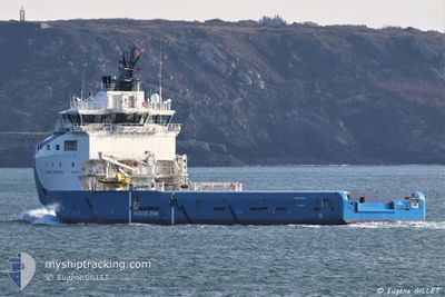
AURORA HORIZON
Cargo
Current Trip
SCARABEO 9
| Time Travelled | 2 days |
|---|---|
| Remaining Time | --- |
| Distance Travelled | 60.57 nm |
| Remaining Distance | --- |
| AVG Speed | 7 Knopen |
| MAX Speed | 8 Knopen |
| AVG Wind | 10.9 knots |
| MAX Wind | 14 knots |
| MIN Temp | 19.3°C / 66.74°F |
| MAX Temp | 21.4°C / 70.52°F |
| Diepgang | 5.9 M |
| Positie ontvangen | 1 d geleden |
Current Position
| Lengtegraad | 30.77002° |
|---|---|
| Breedtegraat | 32.14115° |
| Status | Under way using engine |
| Snelheid | 0.1 Knopen |
| Koers | 231° |
| Gebied | Mediterranean Sea - Eastern Basin |
| Station | T-AIS |
| Positie ontvangen | 1 d geleden |
Info
Information
The current position of AURORA HORIZON is in Mediterranean Sea - Eastern Basin with coordinates 32.14115° / 30.77002° as reported on 2024-04-17 17:41 by AIS to our vessel tracker app. The vessel's current speed is 0.1 Knopen
The vessel AURORA HORIZON (IMO: 9747493, MMSI: 258039000) is a Cargo It's sailing under the flag of [NO] Norway.
In this page you can find informations about the vessels current position, last detected port calls, and current voyage information. If the vessels is not in coverage by AIS you will find the latest position.
The current position of AURORA HORIZON is detected by our AIS receivers and we are not responsible for the reliability of the data. The last position was recorded while the vessel was in Coverage by the Ais receivers of our vessel tracking app.
The current draught of AURORA HORIZON as reported by AIS is 5.9 meters
Weather
| Temperature | 21.5°C / 70.7°F |
|---|---|
| Wind Speed | 13 knots |
| Direction | 113° ESE |
| Pressure | 1004.5 hPa |
| Humidity | 77.2 % |
| Cloud Coverage | 35 % |
Featured Company
Most Visited Ports (Last year)
| Port | Arrivals | |
|---|---|---|
| 31 | ||
| 15 | ||
| 10 | ||
| 4 | ||
| 2 | ||
| 2 |
Events
| Tijd | Evenement | Details | Positie / Bestemming | Info |
|---|---|---|---|---|
| 2024-04-17 17:41 | Buitenbereik |
32.14115 / 30.77002
Mediterranean Sea - Eastern Basin
|
Snelheid: 0.1 kn Koers: 156.3° |
|
| 2024-04-17 17:01 | Binnenbereik |
32.14129 / 30.76994
Mediterranean Sea - Eastern Basin
|
Snelheid: Koers: 358.4° |
|
| 2024-04-17 14:02 | Buitenbereik |
32.14571 / 30.76368
Mediterranean Sea - Eastern Basin
|
Snelheid: 0.1 kn Koers: 295.4° |
|
| 2024-04-17 12:46 | Binnenbereik |
32.14662 / 30.76302
Mediterranean Sea - Eastern Basin
|
Snelheid: Koers: 218.9° |
|
| 2024-04-17 05:22 | Buitenbereik |
32.13746 / 30.76028
Mediterranean Sea - Eastern Basin
SCARABEO 9
|
Snelheid: 3.1 kn Koers: 80.3° |
|
| 2024-04-16 21:36 | ETA Changed | 2024/04/17 07:30 2024/04/17 07:00 |
31.34021 / 30.09161
SCARABEO 9
|
Snelheid: 7 kn Koers: 18.8° |
| 2024-04-16 21:32 | Vertrekhaven |
|
31.33299 / 30.08845
SCARABEO 9
|
Snelheid: 6.8 kn Koers: 27° |
| 2024-04-16 21:25 | Start beweging |
31.32329 / 30.07960
[EG] ABU QIR
|
Snelheid: 5.7 kn Koers: 46° |
|
| 2024-04-16 20:56 | Draught Changed | 5.9 5 |
31.32042 / 30.07289
[EG] ABU QIR
|
Snelheid: Koers: 179° |
| 2024-04-16 20:56 | Destination Changed | SCARABEO 9 ABU QIR |
31.32042 / 30.07289
[EG] ABU QIR
|
Snelheid: Koers: 179° |