
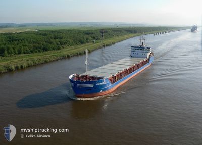
HAV STREYM
General Cargo
Current Trip
VIEROW VIA NOK
| Time Travelled | 1 day |
|---|---|
| Remaining Time | --- |
| Distance Travelled | 155.72 nm |
| Remaining Distance | --- |
| AVG Speed | 10.1 Knopen |
| MAX Speed | 11.2 Knopen |
| AVG Wind | 16.3 knots |
| MAX Wind | 23 knots |
| MIN Temp | 4.5°C / 40.1°F |
| MAX Temp | 8.9°C / 48.02°F |
| Diepgang | 4 M |
| Positie ontvangen | 16 h, 3 m geleden |
Current Position
| Lengtegraad | 13.55237° |
|---|---|
| Breedtegraat | 54.74648° |
| Status | Under way using engine |
| Snelheid | 10.3 Knopen |
| Koers | 92.9° |
| Gebied | Baltic Sea |
| Station | T-AIS |
| Positie ontvangen | 16 h, 3 m geleden |
Info
Information
The current position of HAV STREYM is in Baltic Sea with coordinates 54.74648° / 13.55237° as reported on 2024-04-19 04:55 by AIS to our vessel tracker app. The vessel's current speed is 10.3 Knopen
The vessel HAV STREYM (IMO: 9126625, MMSI: 231251000) is a General Cargo that was built in 1996 ( 28 Jaar oud ). It's sailing under the flag of [FO] Faroe Is.
In this page you can find informations about the vessels current position, last detected port calls, and current voyage information. If the vessels is not in coverage by AIS you will find the latest position.
The current position of HAV STREYM is detected by our AIS receivers and we are not responsible for the reliability of the data. The last position was recorded while the vessel was in Coverage by the Ais receivers of our vessel tracking app.
The current draught of HAV STREYM as reported by AIS is 4 meters
Weather
| Temperature | 4.4°C / 39.92°F |
|---|---|
| Wind Speed | 23 knots |
| Direction | 60° ENE |
| Pressure | 1003.1 hPa |
| Humidity | 96.6 % |
| Cloud Coverage | 100 % |
Featured Company
Last Port Calls
| Port | Arrival | Departure | Time In Port |
|---|---|---|---|
| 2024-04-18 15:33 | 2024-04-18 15:36 | 2 m | |
| 2024-04-17 15:16 | 2024-04-17 20:45 | 5 h | |
| 2024-04-16 22:15 | 2024-04-17 14:30 | 16 h | |
| 2024-04-09 01:46 | 2024-04-11 16:48 | 2 d | |
| 2024-04-04 03:18 | 2024-04-05 14:57 | 1 d | |
| 2024-04-02 16:10 | 2024-04-03 16:55 | 1 d | |
| 2024-03-28 01:02 | 2024-03-29 20:10 | 1 d | |
| 2024-03-27 01:58 | 2024-03-27 19:19 | 17 h | |
| 2024-03-20 14:54 | 2024-03-23 09:34 | 2 d | |
| 2024-03-14 17:29 | 2024-03-17 02:23 | 2 d |
Last Trips
| Origin | Departure | Destination | Arrival | Distance | |
|---|---|---|---|---|---|
| 2024-04-17 22:45 | 2024-04-18 17:33 | 143.23 nm | |||
| 2024-04-17 16:30 | 2024-04-17 17:16 | 8.42 nm | |||
| 2024-04-11 17:48 | 2024-04-17 00:15 | 775.12 nm | |||
| 2024-04-05 16:57 | 2024-04-09 02:46 | 799.61 nm | |||
| 2024-04-03 18:55 | 2024-04-04 05:18 | 95.25 nm | |||
| 2024-03-29 20:10 | 2024-04-02 18:10 | 783.60 nm | |||
| 2024-03-27 19:19 | 2024-03-28 01:02 | 10.68 nm | |||
| 2024-03-23 10:34 | 2024-03-27 01:58 | 822.65 nm | |||
| 2024-03-17 03:23 | 2024-03-20 15:54 | 745.42 nm | |||
| 2024-03-03 02:44 | 2024-03-14 18:29 | 1418.48 nm |
Events
| Tijd | Evenement | Details | Positie / Bestemming | Info |
|---|---|---|---|---|
| 2024-04-19 04:55 | Buitenbereik |
54.74648 / 13.55237
Baltic Sea
VIEROW VIA NOK
|
Snelheid: 10.3 kn Koers: 92.9° |
|
| 2024-04-19 00:23 | Wijzig zee gebeid | German part of the Baltic Sea Danish part of the Baltic Sea |
54.58881 / 12.32920
Baltic Sea
VIEROW VIA NOK
|
Snelheid: 10 kn Koers: 57.9° |
| 2024-04-19 00:20 | Wijzig zee gebeid | Danish part of the Baltic Sea German part of the Baltic Sea |
54.58384 / 12.31764
Baltic Sea
VIEROW VIA NOK
|
Snelheid: 10 kn Koers: 40.3° |
| 2024-04-18 22:44 | Wijzig zee gebeid | German part of the Baltic Sea Danish part of the Baltic Sea |
54.39768 / 12.06995
Baltic Sea
VIEROW VIA NOK
|
Snelheid: 9.7 kn Koers: 87.5° |
| 2024-04-18 20:29 | Gevonden in zee | Danish part of the Baltic Sea |
54.48926 / 11.46679
Baltic Sea
VIEROW VIA NOK
|
Snelheid: 10.2 kn Koers: 114.2° |
| 2024-04-18 18:05 | Gevonden in zee | German part of the Baltic Sea |
54.56793 / 10.78402
Baltic Sea
VIEROW VIA NOK
|
Snelheid: 11.2 kn Koers: 84.7° |
| 2024-04-18 17:32 | Gevonden in zee | Danish part of the Baltic Sea |
54.55677 / 10.61391
Baltic Sea
VIEROW VIA NOK
|
Snelheid: 10.5 kn Koers: 71.3° |
| 2024-04-18 16:14 | Wijzig zee gebeid | German part of the Baltic Sea German part of the North Sea |
54.45961 / 10.26577
Baltic Sea
VIEROW VIA NOK
|
Snelheid: 10.4 kn Koers: 39° |
| 2024-04-18 15:36 | Vertrekhaven |
|
54.36411 / 10.17141
VIEROW VIA NOK
|
Snelheid: 10 kn Koers: 52° |
| 2024-04-18 15:33 | Aankomsthaven |
|
54.36329 / 10.16109
[DE] KIEL
|
Snelheid: 10.1 kn Koers: 106.3° |