
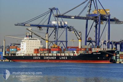
HAPPY BEE
Container Ship
Current Trip
| Time Travelled | 8 days |
|---|---|
| Remaining Time | --- |
| Distance Travelled | 2166.80 nm |
| Remaining Distance | --- |
| AVG Speed | 12.1 Knopen |
| MAX Speed | 16.3 Knopen |
| AVG Wind | 9.9 knots |
| MAX Wind | 23 knots |
| MIN Temp | 24.5°C / 76.1°F |
| MAX Temp | 30.5°C / 86.9°F |
| Diepgang | 5.6 M |
| Positie ontvangen | 3 d geleden |
Current Position
| Lengtegraad | 104.32034° |
|---|---|
| Breedtegraat | 1.28831° |
| Status | Under way using engine |
| Snelheid | 13.3 Knopen |
| Koers | 79° |
| Gebied | Singapore Strait |
| Station | T-AIS |
| Positie ontvangen | 3 d geleden |
Info
Information
The current position of HAPPY BEE is in Singapore Strait with coordinates 1.28831° / 104.32034° as reported on 2024-04-14 16:24 by AIS to our vessel tracker app. The vessel's current speed is 13.3 Knopen
The vessel HAPPY BEE (IMO: 9367542, MMSI: 636016186) is a Container Ship that was built in 2006 ( 18 Jaar oud ). It's sailing under the flag of [LR] Liberia.
In this page you can find informations about the vessels current position, last detected port calls, and current voyage information. If the vessels is not in coverage by AIS you will find the latest position.
The current position of HAPPY BEE is detected by our AIS receivers and we are not responsible for the reliability of the data. The last position was recorded while the vessel was in Coverage by the Ais receivers of our vessel tracking app.
The current draught of HAPPY BEE as reported by AIS is 5.6 meters
Weather
| Temperature | 29.7°C / 85.46°F |
|---|---|
| Wind Speed | 7 knots |
| Direction | 353° N |
| Pressure | 1006.1 hPa |
| Humidity | 71.7 % |
| Cloud Coverage | 100 % |
Featured Company
Last Port Calls
| Port | Arrival | Departure | Time In Port |
|---|---|---|---|
| 2024-04-08 22:46 | 2024-04-09 09:30 | 10 h | |
| 2024-04-04 04:33 | 2024-04-05 05:29 | 1 d | |
| 2024-03-26 11:45 | 2024-03-27 13:13 | 1 d | |
| 2024-03-21 08:30 | 2024-03-22 20:37 | 1 d | |
| 2024-03-12 12:58 | 2024-03-13 15:54 | 1 d | |
| 2024-03-08 18:41 | |||
| 2024-02-27 09:44 | 2024-02-28 08:24 | 22 h | |
| 2024-02-22 06:23 | 2024-02-23 17:23 | 1 d | |
| 2024-02-13 10:51 | 2024-02-14 17:33 | 1 d | |
| 2024-02-08 06:26 | 2024-02-09 19:14 | 1 d |
Most Visited Ports (Last year)
| Port | Arrivals | |
|---|---|---|
| 26 | ||
| 25 |
Last Trips
| Origin | Departure | Destination | Arrival | Distance | |
|---|---|---|---|---|---|
| 2024-04-05 13:29 | 2024-04-09 06:46 | 1186.05 nm | |||
| 2024-03-27 21:13 | 2024-04-04 12:33 | 1653.48 nm | |||
| 2024-03-23 04:37 | 2024-03-26 19:45 | 1152.01 nm | |||
| 2024-03-13 23:54 | 2024-03-21 16:30 | 1490.16 nm | |||
| 2024-03-09 02:41 | 2024-03-12 20:58 | 1175.88 nm | |||
| 2024-02-24 01:23 | 2024-02-27 17:44 | 1179.09 nm | |||
| 2024-02-15 01:33 | 2024-02-22 14:23 | 1471.28 nm | |||
| 2024-02-10 03:14 | 2024-02-13 18:51 | 1184.43 nm | |||
| 2024-02-01 01:18 | 2024-02-08 14:26 | 1594.72 nm |
Events
| Tijd | Evenement | Details | Positie / Bestemming | Info |
|---|---|---|---|---|
| 2024-04-16 03:14 | Stop beweging | 7.19 nm, North East of JAKARTA |
-6.00055 / 106.91217
IDTPP
|
Snelheid: 0.2 kn Koers: 116° |
| 2024-04-14 16:30 | Status Changed | Default Under way using engine |
1.29800 / 104.34042
IDTPP
|
Snelheid: 13.3 kn Koers: 79° |
| 2024-04-14 16:24 | Buitenbereik |
1.28831 / 104.32034
Singapore Strait
IDTPP
|
Snelheid: 13.3 kn Koers: 79° |
|
| 2024-04-14 16:03 | Status Changed | Under way using engine Default |
1.27907 / 104.24263
IDTPP
|
Snelheid: 13 kn Koers: 82° |
| 2024-04-14 15:58 | Status Changed | Default Under way using engine |
1.27650 / 104.22457
IDTPP
|
Snelheid: 13.2 kn Koers: 83° |
| 2024-04-14 15:34 | Wijzig zee gebeid | Malaysian part of the Singapore Strait Indonesian part of the Singapore Strait |
1.26232 / 104.13831
Singapore Strait
IDTPP
|
Snelheid: 13 kn Koers: 81° |
| 2024-04-14 14:22 | Wijzig zee gebeid | Indonesian part of the Singapore Strait Singaporean part of the Singapore Strait |
1.21626 / 103.90799
Singapore Strait
IDTPP
|
Snelheid: 10 kn Koers: 82° |
| 2024-04-14 13:35 | Start beweging | 0.64 nm, East of SINGAPORE |
1.25649 / 103.86524
IDTPP
|
Snelheid: 3.6 kn Koers: 279° |
| 2024-04-14 13:29 | Status Changed | Under way using engine At anchor |
1.25670 / 103.86722
IDTPP
|
Snelheid: 0.1 kn Koers: 41° |
| 2024-04-14 08:08 | Status Changed | At anchor Default |
1.25610 / 103.86608
IDTPP
|
Snelheid: Koers: 50° |