
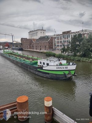
GRINZA 7
Cargo
Current Trip
YSSELMEER
| Time Travelled | 10 h, 48 mins |
|---|---|
| Remaining Time | --- |
| Distance Travelled | 3.59 nm |
| Remaining Distance | --- |
| AVG Speed | 4.6 Knopen |
| MAX Speed | 6 Knopen |
| AVG Wind | 13.9 knots |
| MAX Wind | 14 knots |
| MIN Temp | 11.8°C / 53.24°F |
| MAX Temp | 12.1°C / 53.78°F |
| Diepgang | 1.4 M |
| Positie ontvangen | 1 m geleden |
Current Position
| Lengtegraad | --- |
|---|---|
| Breedtegraat | --- |
| Status | Constrained by her draught |
| Snelheid | |
| Koers | --- |
| Gebied | North Sea |
| Station | T-AIS |
| Positie ontvangen | 1 m geleden |
Info
Information
The current position of GRINZA 7 is in North Sea with coordinates 52.52247° / 4.78071° as reported on 2025-12-09 04:49 by AIS to our vessel tracker app. The vessel's current speed is 0 Knopen
The vessel GRINZA 7 (MMSI: 244700356) is a Cargo It's sailing under the flag of [NL] Netherlands.
In this page you can find informations about the vessels current position, last detected port calls, and current voyage information. If the vessels is not in coverage by AIS you will find the latest position.
The current position of GRINZA 7 is detected by our AIS receivers and we are not responsible for the reliability of the data. The last position was recorded while the vessel was in Coverage by the Ais receivers of our vessel tracking app.
The current draught of GRINZA 7 as reported by AIS is 1.4 meters
Weather
| Temperature | 12°C / 53.6°F |
|---|---|
| Wind Speed | 9 knots |
| Direction | 198° SSW |
| Pressure | 1011 hPa |
| Humidity | 94 % |
| Cloud Coverage | 100 % |
Featured Company
Last Port Calls
| Port | Arrival | Departure | Time In Port |
|---|---|---|---|
| 2025-12-08 17:51 | 2025-12-08 19:03 | 1 h | |
| 2025-12-05 15:44 | 2025-12-08 09:08 | 2 d | |
| 2025-12-05 14:47 | 2025-12-05 15:39 | 52 m | |
| 2025-12-04 18:01 | 2025-12-05 12:40 | 18 h | |
| 2025-12-04 13:23 | 2025-12-04 14:31 | 1 h | |
| 2025-12-03 16:02 | 2025-12-03 17:38 | 1 h | |
| 2025-12-01 10:59 | 2025-12-01 13:58 | 2 h | |
| 2025-11-27 18:02 | 2025-11-27 18:57 | 54 m | |
| 2025-11-27 12:01 | 2025-11-27 15:30 | 3 h | |
| 2025-11-27 07:23 | 2025-11-27 08:04 | 40 m |
Last Trips
| Origin | Departure | Destination | Arrival | Distance | |
|---|---|---|---|---|---|
| 2025-12-08 09:08 | 2025-12-08 17:51 | 53.90 nm | |||
| 2025-12-05 15:39 | 2025-12-05 15:44 | 0.24 nm | |||
| 2025-12-05 12:40 | 2025-12-05 14:47 | 14.00 nm | |||
| 2025-12-04 14:31 | 2025-12-04 18:01 | 15.51 nm | |||
| 2025-12-03 17:38 | 2025-12-04 13:23 | 53.44 nm | |||
| 2025-12-01 13:58 | 2025-12-03 16:02 | 82.92 nm | |||
| 2025-11-27 18:57 | 2025-12-01 10:59 | 87.56 nm | |||
| 2025-11-27 15:30 | 2025-11-27 18:02 | 14.92 nm | |||
| 2025-11-27 08:04 | 2025-11-27 12:01 | 15.58 nm | |||
| 2025-11-26 13:35 | 2025-11-27 07:23 | 70.53 nm |
Events
| Tijd | Evenement | Details | Positie / Bestemming | Info |
|---|---|---|---|---|
| 2025-12-08 18:51 | Stop beweging | 0.45 nm, North of WESTKNOLLENDAM |
52.52243 / 4.78083
YSSELMEER
|
Snelheid: 0.3 kn Koers: 511° |
| 2025-12-08 18:03 | Vertrekhaven |
|
52.47591 / 4.81459
YSSELMEER
|
Snelheid: 5.3 kn Koers: 327.5° |
| 2025-12-08 17:47 | Start beweging |
52.45560 / 4.81262
[NL] ZAANDAM
|
Snelheid: 3.2 kn Koers: 327.6° |
|
| 2025-12-08 17:40 | Stop beweging |
52.45415 / 4.81464
[NL] ZAANDAM
|
Snelheid: 0.3 kn Koers: 511° |
|
| 2025-12-08 17:23 | Start beweging |
52.44105 / 4.82446
[NL] ZAANDAM
|
Snelheid: 4.3 kn Koers: 335.1° |
|
| 2025-12-08 17:14 | Stop beweging |
52.43948 / 4.82592
[NL] ZAANDAM
|
Snelheid: 0.3 kn Koers: 511° |
|
| 2025-12-08 16:51 | Aankomsthaven |
|
52.41694 / 4.85313
[NL] ZAANDAM
|
Snelheid: 8.8 kn Koers: 285.9° |
| 2025-12-08 16:15 | Start beweging | 0.27 nm, West of SCHELLINGWOUDE |
52.38079 / 4.95732
YSSELMEER
|
Snelheid: 5 kn Koers: 298.7° |
| 2025-12-08 15:51 | Stop beweging | 0.16 nm, South West of SCHELLINGWOUDE |
52.37983 / 4.96089
YSSELMEER
|
Snelheid: Koers: 511° |
| 2025-12-08 13:13 | Start beweging | 0.18 nm, West of LELYSTAD |
52.52520 / 5.43433
YSSELMEER
|
Snelheid: 5.3 kn Koers: 185.6° |