
GEORG STAGE
Sailing Vessel
Current Trip
| Time Travelled | 4 days |
|---|---|
| Remaining Time | --- |
| Distance Travelled | 385.82 nm |
| Remaining Distance | --- |
| AVG Speed | 6.8 Knopen |
| MAX Speed | 10.1 Knopen |
| AVG Wind | 17.2 knots |
| MAX Wind | 22 knots |
| MIN Temp | 2°C / 35.6°F |
| MAX Temp | 8.3°C / 46.94°F |
| Diepgang | 4.2 M |
| Positie ontvangen | 2 m geleden |
Current Position
| Lengtegraad | 1.77288° |
|---|---|
| Breedtegraat | 52.40731° |
| Status | At anchor |
| Snelheid | 0.8 Knopen |
| Koers | 213° |
| Gebied | North Sea |
| Station | T-AIS |
| Positie ontvangen | 2 m geleden |
Info
Information
The current position of GEORG STAGE is in North Sea with coordinates 52.40731° / 1.77288° as reported on 2024-04-25 15:11 by AIS to our vessel tracker app. The vessel's current speed is 0.8 Knopen
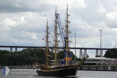
The vessel GEORG STAGE (IMO: 5128417, MMSI: 219417000) is a Sailing Vessel that was built in 1935 ( 89 Jaar oud ). It's sailing under the flag of [DK] Denmark.
In this page you can find informations about the vessels current position, last detected port calls, and current voyage information. If the vessels is not in coverage by AIS you will find the latest position.
The current position of GEORG STAGE is detected by our AIS receivers and we are not responsible for the reliability of the data. The last position was recorded while the vessel was in Coverage by the Ais receivers of our vessel tracking app.
The current draught of GEORG STAGE as reported by AIS is 4.2 meters
Weather
| Temperature | 6.1°C / 42.98°F |
|---|---|
| Wind Speed | 12 knots |
| Direction | 346° NNW |
| Pressure | 1001.1 hPa |
| Humidity | 89 % |
| Cloud Coverage | 100 % |
Featured Company
Last Port Calls
| Port | Arrival | Departure | Time In Port |
|---|---|---|---|
| 2024-04-17 08:40 | 2024-04-21 08:36 | 3 d | |
| 2024-04-08 15:10 | 2024-04-10 08:48 | 1 d | |
| 2024-04-06 10:44 | 2024-04-08 12:24 | 2 d | |
| 2024-04-01 12:46 |
Events
| Tijd | Evenement | Details | Positie / Bestemming | Info |
|---|---|---|---|---|
| 2024-04-25 13:59 | Binnenbereik |
52.40736 / 1.77341
North Sea
PORTSMOUTH, GB
|
Snelheid: 0.5 kn Koers: 1.3° |
|
| 2024-04-25 07:16 | Buitenbereik |
52.40667 / 1.77259
North Sea
PORTSMOUTH, GB
|
Snelheid: 0.1 kn Koers: 149.1° |
|
| 2024-04-25 00:35 | Destination Changed | PORTSMOUTH, GB HARTLEPOOL UK |
52.40668 / 1.77340
PORTSMOUTH, GB
|
Snelheid: 0.4 kn Koers: 217° |
| 2024-04-25 00:16 | Binnenbereik |
52.40653 / 1.77341
North Sea
HARTLEPOOL UK
|
Snelheid: 0.2 kn Koers: 262.4° |
|
| 2024-04-24 22:13 | Buitenbereik |
52.40579 / 1.77271
North Sea
HARTLEPOOL UK
|
Snelheid: 0.5 kn Koers: 37.1° |
|
| 2024-04-24 22:06 | Status Changed | At anchor Under way using engine |
52.40580 / 1.77261
HARTLEPOOL UK
|
Snelheid: 0.7 kn Koers: 19° |
| 2024-04-24 21:59 | Binnenbereik |
52.40586 / 1.77259
North Sea
HARTLEPOOL UK
|
Snelheid: 0.3 kn Koers: 68.6° |
|
| 2024-04-24 20:45 | Buitenbereik |
52.41493 / 1.91472
North Sea
HARTLEPOOL UK
|
Snelheid: 5 kn Koers: 225.4° |
|
| 2024-04-24 20:33 | Wijzig zee gebeid | United Kingdom part of the North Sea Danish part of the North Sea |
52.42952 / 1.93553
North Sea
HARTLEPOOL UK
|
Snelheid: 8.1 kn Koers: 202.8° |
| 2024-04-24 20:33 | Binnenbereik |
52.42952 / 1.93553
North Sea
HARTLEPOOL UK
|
Snelheid: 8.1 kn Koers: 202.8° |