
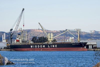
GENIUS STAR XI
Ro-Ro Cargo
Current Trip
| Time Travelled | 3 days |
|---|---|
| Remaining Time | --- |
| Distance Travelled | 786.81 nm |
| Remaining Distance | 17.61 nm |
| AVG Speed | 11.2 Knopen |
| MAX Speed | 16 Knopen |
| AVG Wind | 12.1 knots |
| MAX Wind | 25.1 knots |
| MIN Temp | 13.9°C / 57.02°F |
| MAX Temp | 21.4°C / 70.52°F |
| Diepgang | 6 M |
| Positie ontvangen | 1 h, 13 m geleden |
Current Position
| Lengtegraad | 140.93777° |
|---|---|
| Breedtegraat | 36.30170° |
| Status | Not under command |
| Snelheid | 2.1 Knopen |
| Koers | 37° |
| Gebied | North Pacific Ocean |
| Station | T-AIS |
| Positie ontvangen | 1 h, 13 m geleden |
Info
Information
The current position of GENIUS STAR XI is in North Pacific Ocean with coordinates 36.30170° / 140.93777° as reported on 2024-04-25 11:33 by AIS to our vessel tracker app. The vessel's current speed is 2.1 Knopen and is heading at the port of HITACHINAKA. The estimated time of arrival as calculated by MyShipTracking vessel tracking app is 2024-04-25 09:20 LT
The vessel GENIUS STAR XI (IMO: 9622710, MMSI: 373928000) is a Ro-Ro Cargo that was built in 2012 ( 12 Jaar oud ). It's sailing under the flag of [PA] Panama.
In this page you can find informations about the vessels current position, last detected port calls, and current voyage information. If the vessels is not in coverage by AIS you will find the latest position.
The current position of GENIUS STAR XI is detected by our AIS receivers and we are not responsible for the reliability of the data. The last position was recorded while the vessel was in Coverage by the Ais receivers of our vessel tracking app.
The current draught of GENIUS STAR XI as reported by AIS is 6 meters
Weather
| Temperature | 17.8°C / 64.04°F |
|---|---|
| Wind Speed | 11 knots |
| Direction | 112° ESE |
| Pressure | 1009.8 hPa |
| Humidity | 90.3 % |
| Cloud Coverage | 34 % |
Featured Company
Last Port Calls
| Port | Arrival | Departure | Time In Port |
|---|---|---|---|
| 2024-04-22 05:08 | 2024-04-22 10:16 | 5 h | |
| 2024-02-28 15:21 | 2024-03-03 22:29 | 4 d | |
| 2024-02-24 15:24 | 2024-02-28 06:53 | 3 d | |
| 2024-02-12 04:00 |
Most Visited Ports (Last year)
| Port | Arrivals | |
|---|---|---|
| 2 | ||
| 1 | ||
| 1 | ||
| 1 | ||
| 1 | ||
| 1 |
Last Trips
| Origin | Departure | Destination | Arrival | Distance | |
|---|---|---|---|---|---|
| 2024-03-03 14:29 | 2024-04-22 14:08 | 11286.61 nm | |||
| 2024-02-27 22:53 | 2024-02-28 07:21 | 89.47 nm | |||
| 2024-02-11 19:00 | 2024-02-24 07:24 | 2782.68 nm |
Events
| Tijd | Evenement | Details | Positie / Bestemming | Info |
|---|---|---|---|---|
| 2024-04-25 11:39 | Status Changed | Default Not under command |
36.30492 / 140.93726
JP HIC
|
Snelheid: 2.1 kn Koers: 37° |
| 2024-04-25 11:33 | Status Changed | Not under command Default |
36.30170 / 140.93777
JP HIC
|
Snelheid: 2.1 kn Koers: 35° |
| 2024-04-25 11:33 | Binnenbereik |
36.30170 / 140.93777
North Pacific Ocean
JP HIC
|
Snelheid: 2.1 kn Koers: 347.7° |
|
| 2024-04-25 11:33 | Buitenbereik |
36.30170 / 140.93777
North Pacific Ocean
JP HIC
|
Snelheid: 2.1 kn Koers: 347.7° |
|
| 2024-04-25 06:44 | Status Changed | Default Under way using engine |
35.78147 / 140.99844
JP HIC
|
Snelheid: 13.2 kn Koers: 355.2° |
| 2024-04-25 06:36 | Buitenbereik |
35.74976 / 140.99932
North Pacific Ocean
JP HIC
|
Snelheid: 13.2 kn Koers: 355.2° |
|
| 2024-04-25 01:03 | ETA Changed | 2024/04/25 09:20 2024/04/25 19:00 |
34.74819 / 140.15590
JP HIC
|
Snelheid: 14.7 kn Koers: 49.1° |
| 2024-04-25 00:44 | ETA Changed | 2024/04/25 19:00 2024/04/25 00:00 |
34.69505 / 140.08298
JP HIC
|
Snelheid: 14.7 kn Koers: 47° |
| 2024-04-25 00:23 | Wijzig zee gebeid | Japanese part of the North Pacific Ocean Japanese part of the Japan Sea |
34.64344 / 140.00912
North Pacific Ocean
JP HIC
|
Snelheid: 13.5 kn Koers: 51.3° |
| 2024-04-25 00:21 | Status Changed | Under way using engine Default |
34.63990 / 140.00383
JP HIC
|
Snelheid: 13.3 kn Koers: 52° |