
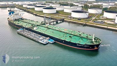
SEAWAYS LIBERTY
Tanker
Current Trip
| Time Travelled | 47 days |
|---|---|
| Remaining Time | --- |
| Distance Travelled | 11447.84 nm |
| Remaining Distance | --- |
| AVG Speed | 12 Knopen |
| MAX Speed | 16.8 Knopen |
| AVG Wind | 10.9 knots |
| MAX Wind | 26.2 knots |
| MIN Temp | 4.7°C / 40.46°F |
| MAX Temp | 30.8°C / 87.44°F |
| Diepgang | 11 M |
| Positie ontvangen | 4 h, 7 m geleden |
Current Position
| Lengtegraad | -40.97917° |
|---|---|
| Breedtegraat | -21.80606° |
| Status | Moored |
| Snelheid | 0.1 Knopen |
| Koers | 347° |
| Gebied | South Atlantic Ocean |
| Station | T-AIS |
| Positie ontvangen | 4 h, 7 m geleden |
Info
Information
The current position of SEAWAYS LIBERTY is in South Atlantic Ocean with coordinates -21.80606° / -40.97917° as reported on 2024-04-18 21:38 by AIS to our vessel tracker app. The vessel's current speed is 0.1 Knopen
The vessel SEAWAYS LIBERTY (IMO: 9727027, MMSI: 538006448) is a Tanker It's sailing under the flag of [MH] Marshall Is.
In this page you can find informations about the vessels current position, last detected port calls, and current voyage information. If the vessels is not in coverage by AIS you will find the latest position.
The current position of SEAWAYS LIBERTY is detected by our AIS receivers and we are not responsible for the reliability of the data. The last position was recorded while the vessel was in Coverage by the Ais receivers of our vessel tracking app.
The current draught of SEAWAYS LIBERTY as reported by AIS is 11 meters
Weather
| Temperature | 23.1°C / 73.58°F |
|---|---|
| Wind Speed | 20 knots |
| Direction | 211° SSW |
| Pressure | 1015.1 hPa |
| Humidity | 79.4 % |
| Cloud Coverage | 100 % |
Featured Company
Last Trips
| Origin | Departure | Destination | Arrival | Distance |
|---|
Events
| Tijd | Evenement | Details | Positie / Bestemming | Info |
|---|---|---|---|---|
| 2024-04-18 21:47 | Status Changed | Default Moored |
-21.80602 / -40.97931
ACU
|
Snelheid: 0.1 kn Koers: 347° |
| 2024-04-18 21:38 | Buitenbereik |
-21.80606 / -40.97917
South Atlantic Ocean
|
Snelheid: 0.1 kn Koers: 297.1° |
|
| 2024-04-18 19:44 | Status Changed | Moored Default |
-21.80588 / -40.97933
ACU
|
Snelheid: Koers: 347° |
| 2024-04-18 19:02 | Status Changed | Default Moored |
-21.80586 / -40.97946
ACU
|
Snelheid: Koers: 347° |
| 2024-04-18 18:08 | Status Changed | Moored Default |
-21.80594 / -40.97940
ACU
|
Snelheid: Koers: 347° |
| 2024-04-18 18:08 | Binnenbereik |
-21.80594 / -40.97940
South Atlantic Ocean
|
Snelheid: 0.1 kn Koers: 196.1° |
|
| 2024-04-18 12:26 | Status Changed | Default Moored |
-21.80585 / -40.97939
ACU
|
Snelheid: Koers: 347° |
| 2024-04-18 12:17 | Buitenbereik |
-21.80583 / -40.97937
South Atlantic Ocean
|
Snelheid: Koers: 73.2° |
|
| 2024-04-18 10:26 | Status Changed | Moored Default |
-21.80583 / -40.97936
ACU
|
Snelheid: Koers: 347° |
| 2024-04-18 10:20 | Binnenbereik |
-21.80583 / -40.97936
South Atlantic Ocean
|
Snelheid: Koers: 291.3° |