
GENCO RESOLUTE
Cargo
Current Trip
| Time Travelled | 12 days |
|---|---|
| Remaining Time | --- |
| Distance Travelled | 2628.14 nm |
| Remaining Distance | --- |
| AVG Speed | 8.4 Knopen |
| MAX Speed | 12 Knopen |
| AVG Wind | 15 knots |
| MAX Wind | 29.2 knots |
| MIN Temp | 2°C / 35.6°F |
| MAX Temp | 16.5°C / 61.7°F |
| Diepgang | 15.2 M |
| Positie ontvangen | 11 h, 43 m geleden |
Current Position
| Lengtegraad | -12.39340° |
|---|---|
| Breedtegraat | 37.32920° |
| Status | Under way using engine |
| Snelheid | 11.5 Knopen |
| Koers | 115.4° |
| Gebied | North Atlantic Ocean |
| Station | T-AIS |
| Positie ontvangen | 11 h, 43 m geleden |
Info
Information
The current position of GENCO RESOLUTE is in North Atlantic Ocean with coordinates 37.32920° / -12.39340° as reported on 2024-04-25 02:51 by AIS to our vessel tracker app. The vessel's current speed is 11.5 Knopen and is heading at the port of DJEN DJEN. The estimated time of arrival as calculated by MyShipTracking vessel tracking app is 2024-04-29 20:00 LT
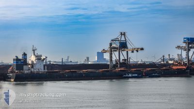
The vessel GENCO RESOLUTE (IMO: 9698977, MMSI: 538008119) is a Cargo It's sailing under the flag of [MH] Marshall Is.
In this page you can find informations about the vessels current position, last detected port calls, and current voyage information. If the vessels is not in coverage by AIS you will find the latest position.
The current position of GENCO RESOLUTE is detected by our AIS receivers and we are not responsible for the reliability of the data. The last position was recorded while the vessel was in Coverage by the Ais receivers of our vessel tracking app.
The current draught of GENCO RESOLUTE as reported by AIS is 15.2 meters
Weather
| Temperature | 16.4°C / 61.52°F |
|---|---|
| Wind Speed | 20 knots |
| Direction | 346° NNW |
| Pressure | 1015.4 hPa |
| Humidity | 72.7 % |
| Cloud Coverage | 3 % |
Featured Company
Last Port Calls
| Port | Arrival | Departure | Time In Port |
|---|---|---|---|
| 2024-04-12 01:30 | 2024-04-13 04:55 | 1 d | |
| 2024-03-12 22:52 | 2024-03-18 14:16 | 5 d | |
| 2024-02-08 05:01 | 2024-02-10 16:42 | 2 d |
Last Trips
| Origin | Departure | Destination | Arrival | Distance | |
|---|---|---|---|---|---|
| 2024-03-18 16:16 | 2024-04-11 21:30 | 4430.66 nm | |||
| 2024-02-10 13:42 | 2024-03-13 00:52 | 5339.36 nm | |||
| 2024-01-18 15:48 | 2024-02-08 02:01 | 6046.76 nm |
Events
| Tijd | Evenement | Details | Positie / Bestemming | Info |
|---|---|---|---|---|
| 2024-04-25 02:55 | Status Changed | Default Under way using engine |
37.32333 / -12.37833
CA SEI>DZ DJE
|
Snelheid: 11.5 kn Koers: 115.4° |
| 2024-04-25 02:51 | Buitenbereik |
37.32920 / -12.39340
North Atlantic Ocean
CA SEI>DZ DJE
|
Snelheid: 11.5 kn Koers: 115.4° |
|
| 2024-04-25 02:47 | Status Changed | Under way using engine Default |
37.33494 / -12.40864
CA SEI>DZ DJE
|
Snelheid: 11.5 kn Koers: 115° |
| 2024-04-25 02:18 | Status Changed | Default Under way using engine |
37.37532 / -12.51557
CA SEI>DZ DJE
|
Snelheid: 11.7 kn Koers: 115° |
| 2024-04-25 02:11 | Status Changed | Under way using engine Default |
37.38508 / -12.54285
CA SEI>DZ DJE
|
Snelheid: 11.6 kn Koers: 116° |
| 2024-04-25 02:11 | Binnenbereik |
37.38462 / -12.54162
North Atlantic Ocean
CA SEI>DZ DJE
|
Snelheid: 11.6 kn Koers: 113.8° |
|
| 2024-04-24 23:01 | Status Changed | Default Under way using engine |
37.64167 / -13.22333
CA SEI>DZ DJE
|
Snelheid: 11.2 kn Koers: 116.9° |
| 2024-04-24 22:57 | Buitenbereik |
37.64807 / -13.23880
North Atlantic Ocean
CA SEI>DZ DJE
|
Snelheid: 11.2 kn Koers: 116.9° |
|
| 2024-04-24 21:41 | Wijzig zee gebeid | Portuguese part of the North Atlantic Ocean High seas of the North Atlantic Ocean |
37.75078 / -13.51596
North Atlantic Ocean
CA SEI>DZ DJE
|
Snelheid: 11.6 kn Koers: 114.9° |
| 2024-04-24 21:41 | Status Changed | Under way using engine Default |
37.75102 / -13.51664
CA SEI>DZ DJE
|
Snelheid: 11.6 kn Koers: 112° |