
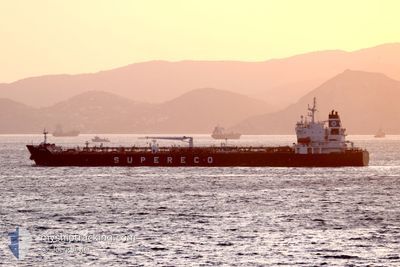
GEMMA
Tanker
Current Trip
| Time Travelled | 8 days |
|---|---|
| Remaining Time | 9 days |
| Distance Travelled | 2324.39 nm |
| Remaining Distance | 2658.03 nm |
| AVG Speed | 11.6 Knopen |
| MAX Speed | 13.6 Knopen |
| AVG Wind | 10.8 knots |
| MAX Wind | 23 knots |
| MIN Temp | 15.6°C / 60.08°F |
| MAX Temp | 26.1°C / 78.98°F |
| Diepgang | 10.2 M |
| Positie ontvangen | 7 d geleden |
Current Position
| Lengtegraad | 18.98099° |
|---|---|
| Breedtegraat | -34.89848° |
| Status | Under way using engine |
| Snelheid | 12 Knopen |
| Koers | 117° |
| Gebied | South Atlantic Ocean |
| Station | T-AIS |
| Positie ontvangen | 7 d geleden |
Info
Information
The current position of GEMMA is in South Atlantic Ocean with coordinates -34.89848° / 18.98099° as reported on 2024-04-16 17:56 by AIS to our vessel tracker app. The vessel's current speed is 12 Knopen and is heading at the port of KWINANA. The estimated time of arrival as calculated by MyShipTracking vessel tracking app is 2024-05-04 15:02 LT
The vessel GEMMA (IMO: 9808314, MMSI: 248768000) is a Tanker It's sailing under the flag of [MT] Malta.
In this page you can find informations about the vessels current position, last detected port calls, and current voyage information. If the vessels is not in coverage by AIS you will find the latest position.
The current position of GEMMA is detected by our AIS receivers and we are not responsible for the reliability of the data. The last position was recorded while the vessel was in Coverage by the Ais receivers of our vessel tracking app.
The current draught of GEMMA as reported by AIS is 10.2 meters
Weather
| Temperature | 18.7°C / 65.66°F |
|---|---|
| Wind Speed | 19 knots |
| Direction | 118° ESE |
| Pressure | 1021 hPa |
| Humidity | 81.5 % |
| Cloud Coverage | 100 % |
Featured Company
Last Port Calls
| Port | Arrival | Departure | Time In Port |
|---|---|---|---|
| 2024-04-15 11:49 | 2024-04-16 10:43 | 22 h | |
| 2024-03-15 00:05 | 2024-03-15 15:48 | 15 h | |
| 2024-03-02 14:29 | 2024-03-03 13:30 | 23 h | |
| 2024-02-02 16:42 | 2024-02-08 09:07 | 5 d |
Most Visited Ports (Last year)
| Port | Arrivals | |
|---|---|---|
| 5 | ||
| 1 | ||
| 1 | ||
| 1 | ||
| 1 | ||
| 1 |
Last Trips
| Origin | Departure | Destination | Arrival | Distance | |
|---|---|---|---|---|---|
| 2024-03-15 10:48 | 2024-04-15 13:49 | 7553.70 nm | |||
| 2024-03-03 09:30 | 2024-03-14 19:05 | 2626.05 nm | |||
| 2024-02-08 06:07 | 2024-03-02 10:29 | 5387.41 nm | |||
| 2023-12-22 16:09 | 2024-02-02 13:42 | 5895.86 nm |
Events
| Tijd | Evenement | Details | Positie / Bestemming | Info |
|---|---|---|---|---|
| 2024-04-16 18:01 | Status Changed | Default Under way using engine |
-34.90622 / 18.99831
KWINANA
|
Snelheid: 12 kn Koers: 117° |
| 2024-04-16 17:56 | Buitenbereik |
-34.89848 / 18.98099
South Atlantic Ocean
KWINANA
|
Snelheid: 12 kn Koers: 117° |
|
| 2024-04-16 17:53 | Status Changed | Under way using engine Default |
-34.89368 / 18.96936
KWINANA
|
Snelheid: 12.1 kn Koers: 118° |
| 2024-04-16 17:53 | Binnenbereik |
-34.89368 / 18.96936
South Atlantic Ocean
KWINANA
|
Snelheid: 12.1 kn Koers: 117.2° |
|
| 2024-04-16 16:05 | Status Changed | Default Under way using engine |
-34.66670 / 18.62161
KWINANA
|
Snelheid: 12.1 kn Koers: 129.9° |
| 2024-04-16 16:01 | Buitenbereik |
-34.65809 / 18.60969
South Atlantic Ocean
KWINANA
|
Snelheid: 12.1 kn Koers: 129.9° |
|
| 2024-04-16 13:48 | Status Changed | Under way using engine Default |
-34.31779 / 18.22465
KWINANA
|
Snelheid: 12.3 kn Koers: 168° |
| 2024-04-16 13:46 | Status Changed | Default Under way using engine |
-34.30854 / 18.22251
KWINANA
|
Snelheid: 12.4 kn Koers: 169.9° |
| 2024-04-16 13:39 | Status Changed | Under way using engine Default |
-34.28463 / 18.21656
KWINANA
|
Snelheid: 12.4 kn Koers: 171° |
| 2024-04-16 13:31 | Status Changed | Default Under way using engine |
-34.25706 / 18.21266
KWINANA
|
Snelheid: 12.6 kn Koers: 179° |