
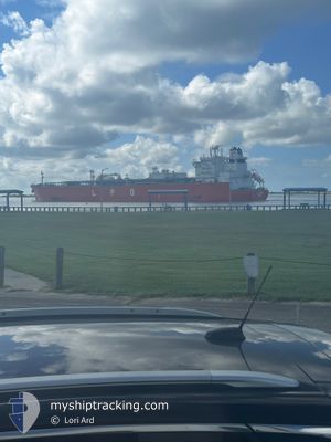
GAS JUSTESEN
Tanker
Current Trip
| Trip Time | 7 h, 36 mins |
|---|---|
| Trip Distance | 0.75 nm |
| AVG Speed | --- |
| MAX Speed | --- |
| Diepgang | 7.7 M |
| AVG Wind | 6.4 knots |
| MAX Wind | 8 knots |
| MIN Temp | 22.8°C / 73.04°F |
| MAX Temp | 29.7°C / 85.46°F |
| Positie ontvangen | 7 d geleden |
Current Position
| Lengtegraad | --- |
|---|---|
| Breedtegraat | --- |
| Status | Under way using engine |
| Snelheid | 16.7 Knopen |
| Koers | 217° |
| Gebied | Java Sea |
| Station | T-AIS |
| Positie ontvangen | 7 d geleden |
Info
Information
The current position of GAS JUSTESEN is in Java Sea with coordinates -6.23989° / 105.61671° as reported on 2025-11-29 11:49 by AIS to our vessel tracker app. The vessel's current speed is 16.7 Knopen and is currently inside the port of PORT LOUIS.
The vessel GAS JUSTESEN (IMO: 9940992, MMSI: 352002349) is a Tanker It's sailing under the flag of [PA] Panama.
In this page you can find informations about the vessels current position, last detected port calls, and current voyage information. If the vessels is not in coverage by AIS you will find the latest position.
The current position of GAS JUSTESEN is detected by our AIS receivers and we are not responsible for the reliability of the data. The last position was recorded while the vessel was in Coverage by the Ais receivers of our vessel tracking app.
The current draught of GAS JUSTESEN as reported by AIS is 7.7 meters
Weather
| Temperature | 29.4°C / 84.92°F |
|---|---|
| Wind Speed | 4 knots |
| Direction | 22° NNE |
| Pressure | 1015.2 hPa |
| Humidity | 48.6 % |
| Cloud Coverage | 12 % |
Featured Company
Last Port Calls
| Port | Arrival | Departure | Time In Port |
|---|---|---|---|
| 2025-12-07 12:49 | |||
| 2025-12-07 04:44 | 2025-12-07 05:13 | 29 m | |
| 2025-11-26 06:24 | 2025-11-29 16:16 | 3 d | |
| 2025-11-16 13:05 | 2025-11-17 01:30 | 12 h | |
| 2025-10-15 16:40 | 2025-10-18 09:42 | 2 d |
Most Visited Ports (Last year)
| Port | Arrivals | |
|---|---|---|
| 3 | ||
| 3 | ||
| 2 | ||
| 2 | ||
| 1 | ||
| 1 |
Last Trips
| Origin | Departure | Destination | Arrival | Distance | |
|---|---|---|---|---|---|
| 2025-12-07 05:13 | 2025-12-07 12:49 | 0.75 nm | |||
| 2025-11-29 16:16 | 2025-12-07 04:44 | 3006.61 nm | |||
| 2025-11-17 01:30 | 2025-11-26 06:24 | 3056.33 nm | |||
| 2025-10-18 09:42 | 2025-11-16 13:05 | 10022.12 nm | |||
| 2025-09-05 09:15 | 2025-10-15 16:40 | 13182.98 nm |
Events
| Tijd | Evenement | Details | Positie / Bestemming | Info |
|---|---|---|---|---|
| 2025-12-07 08:49 | Aankomsthaven |
|
-20.13152 / 57.47763
[MU] PORT LOUIS
|
Snelheid: Koers: 53° |
| 2025-12-07 01:13 | Vertrekhaven |
|
-20.12951 / 57.47670
MUPLU
|
Snelheid: 0.1 kn Koers: 67° |
| 2025-12-07 00:56 | Stop beweging |
-20.13164 / 57.47794
[MU] PORT LOUIS
|
Snelheid: 0.2 kn Koers: 5° |
|
| 2025-12-07 00:44 | Aankomsthaven |
|
-20.13088 / 57.47821
[MU] PORT LOUIS
|
Snelheid: 1.4 kn Koers: 61° |
| 2025-11-29 11:55 | Status Changed | Default Under way using engine |
-6.26251 / 105.59957
MUPLU
|
Snelheid: 16.7 kn Koers: 217° |
| 2025-11-29 11:49 | Buitenbereik |
-6.23989 / 105.61671
Java Sea
MUPLU
|
Snelheid: 16.7 kn Koers: 217° |
|
| 2025-11-29 11:39 | ETA Changed | 2025/12/07 04:00 2025/12/06 07:00 |
-6.20108 / 105.64577
MUPLU
|
Snelheid: 16.6 kn Koers: 216.9° |
| 2025-11-29 09:57 | ETA Changed | 2025/12/06 07:00 2025/12/08 07:00 |
-5.90325 / 105.96483
MUPLU
|
Snelheid: 4.5 kn Koers: 233° |
| 2025-11-29 09:45 | Draught Changed | 7.7 11.9 |
-5.89407 / 105.96996
MUPLU
|
Snelheid: 3.2 kn Koers: 225° |
| 2025-11-29 09:45 | Destination Changed | MUPLU IDTSE |
-5.89407 / 105.96996
MUPLU
|
Snelheid: 3.2 kn Koers: 225° |