
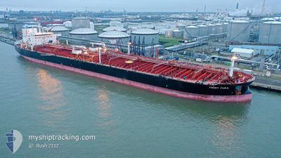
SFL PUMA
Tanker
Current Trip
| Time Travelled | 53 days |
|---|---|
| Remaining Time | --- |
| Distance Travelled | 12142.90 nm |
| Remaining Distance | --- |
| AVG Speed | 12.3 Knopen |
| MAX Speed | 16.5 Knopen |
| AVG Wind | 13.2 knots |
| MAX Wind | 36.7 knots |
| MIN Temp | 17.1°C / 62.78°F |
| MAX Temp | 29.9°C / 85.82°F |
| Diepgang | 14.4 M |
| Positie ontvangen | Nu |
Current Position
| Lengtegraad | -18.11630° |
|---|---|
| Breedtegraat | 18.23503° |
| Status | Under way using engine |
| Snelheid | 11.3 Knopen |
| Koers | 357.8° |
| Gebied | North Atlantic Ocean |
| Station | T-AIS |
| Positie ontvangen | Nu |
Info
Information
The current position of SFL PUMA is in North Atlantic Ocean with coordinates 18.23503° / -18.11630° as reported on 2024-04-20 16:11 by AIS to our vessel tracker app. The vessel's current speed is 11.3 Knopen and is heading at the port of LE HAVRE. The estimated time of arrival as calculated by MyShipTracking vessel tracking app is 2024-04-27 16:00 LT
The vessel SFL PUMA (IMO: 9664794, MMSI: 538006030) is a Tanker It's sailing under the flag of [MH] Marshall Is.
In this page you can find informations about the vessels current position, last detected port calls, and current voyage information. If the vessels is not in coverage by AIS you will find the latest position.
The current position of SFL PUMA is detected by our AIS receivers and we are not responsible for the reliability of the data. The last position was recorded while the vessel was in Coverage by the Ais receivers of our vessel tracking app.
The current draught of SFL PUMA as reported by AIS is 14.4 meters
Weather
| Temperature | 20.6°C / 69.08°F |
|---|---|
| Wind Speed | 18 knots |
| Direction | 349° N |
| Pressure | 1010.6 hPa |
| Humidity | 85.2 % |
| Cloud Coverage | 23 % |
Featured Company
Last Port Calls
| Port | Arrival | Departure | Time In Port |
|---|---|---|---|
| 2024-02-26 14:53 | 2024-02-27 15:40 | 1 d | |
| 2024-02-23 08:43 | 2024-02-26 14:11 | 3 d | |
| 2024-02-20 00:44 | 2024-02-21 14:40 | 1 d | |
| 2024-02-06 05:07 | 2024-02-08 02:36 | 1 d |
Most Visited Ports (Last year)
| Port | Arrivals | |
|---|---|---|
| 6 | ||
| 3 | ||
| 2 | ||
| 2 | ||
| 1 | ||
| 1 |
Last Trips
| Origin | Departure | Destination | Arrival | Distance | |
|---|---|---|---|---|---|
| 2024-02-26 22:11 | 2024-02-26 22:53 | 1.73 nm | |||
| 2024-02-21 22:40 | 2024-02-23 16:43 | 19.02 nm | |||
| 2024-02-08 11:36 | 2024-02-20 08:44 | 2592.47 nm | |||
| 2024-01-30 18:38 | 2024-02-06 14:07 | 714.09 nm |
Events
| Tijd | Evenement | Details | Positie / Bestemming | Info |
|---|---|---|---|---|
| 2024-04-20 14:35 | Status Changed | Under way using engine Default |
17.93380 / -18.11594
FRLEH
|
Snelheid: 11.3 kn Koers: 0° |
| 2024-04-20 14:33 | Status Changed | Default Under way using engine |
17.92705 / -18.11595
FRLEH
|
Snelheid: 11.3 kn Koers: 0.5° |
| 2024-04-20 14:09 | Status Changed | Under way using engine Default |
17.85171 / -18.11624
FRLEH
|
Snelheid: 11.5 kn Koers: 357° |
| 2024-04-20 13:41 | Status Changed | Default Under way using engine |
17.76098 / -18.11187
FRLEH
|
Snelheid: 11.6 kn Koers: 357.4° |
| 2024-04-20 13:10 | Status Changed | Under way using engine Default |
17.66202 / -18.10766
FRLEH
|
Snelheid: 11.6 kn Koers: 357° |
| 2024-04-20 12:59 | Status Changed | Default Under way using engine |
17.62810 / -18.10616
FRLEH
|
Snelheid: 11.5 kn Koers: 357.8° |
| 2024-04-20 12:41 | Status Changed | Under way using engine Default |
17.57009 / -18.10351
FRLEH
|
Snelheid: 11.3 kn Koers: 358° |
| 2024-04-20 12:38 | Status Changed | Default Under way using engine |
17.55843 / -18.10319
FRLEH
|
Snelheid: 11.4 kn Koers: 357.7° |
| 2024-04-20 12:31 | Status Changed | Under way using engine Default |
17.53904 / -18.10254
FRLEH
|
Snelheid: 11.3 kn Koers: 359° |
| 2024-04-20 12:26 | Status Changed | Default Under way using engine |
17.52108 / -18.10180
FRLEH
|
Snelheid: 11.2 kn Koers: 358.1° |