
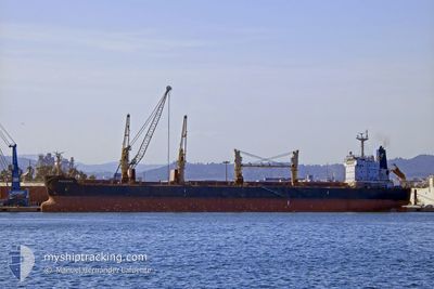
FRIEDERIKE
Cargo
Current Trip
| Time Travelled | 11 days |
|---|---|
| Remaining Time | --- |
| Distance Travelled | 2587.03 nm |
| Remaining Distance | --- |
| AVG Speed | 10.5 Knopen |
| MAX Speed | 13.2 Knopen |
| AVG Wind | 15.8 knots |
| MAX Wind | 51 knots |
| MIN Temp | 8.2°C / 46.76°F |
| MAX Temp | 23.2°C / 73.76°F |
| Diepgang | 10.6 M |
| Positie ontvangen | 1 d geleden |
Current Position
| Lengtegraad | 14.58517° |
|---|---|
| Breedtegraat | 36.16588° |
| Status | Under way using engine |
| Snelheid | 11.6 Knopen |
| Koers | 88° |
| Gebied | Mediterranean Sea - Eastern Basin |
| Station | T-AIS |
| Positie ontvangen | 1 d geleden |
Info
Information
The current position of FRIEDERIKE is in Mediterranean Sea - Eastern Basin with coordinates 36.16588° / 14.58517° as reported on 2024-04-17 01:21 by AIS to our vessel tracker app. The vessel's current speed is 11.6 Knopen and is heading at the port of MARTAS. The estimated time of arrival as calculated by MyShipTracking vessel tracking app is 2024-04-18 08:00 LT
The vessel FRIEDERIKE (IMO: 9436769, MMSI: 538004370) is a Cargo It's sailing under the flag of [MH] Marshall Is.
In this page you can find informations about the vessels current position, last detected port calls, and current voyage information. If the vessels is not in coverage by AIS you will find the latest position.
The current position of FRIEDERIKE is detected by our AIS receivers and we are not responsible for the reliability of the data. The last position was recorded while the vessel was in Coverage by the Ais receivers of our vessel tracking app.
The current draught of FRIEDERIKE as reported by AIS is 10.6 meters
Weather
| Temperature | 17.1°C / 62.78°F |
|---|---|
| Wind Speed | 18 knots |
| Direction | 312° NW |
| Pressure | 1008.4 hPa |
| Humidity | 70.9 % |
| Cloud Coverage | 2 % |
Featured Company
Last Port Calls
| Port | Arrival | Departure | Time In Port |
|---|---|---|---|
| 2024-04-01 08:45 | 2024-04-06 15:05 | 5 d | |
| 2024-03-13 04:23 | 2024-03-20 17:47 | 7 d | |
| 2024-02-01 00:00 |
Most Visited Ports (Last year)
| Port | Arrivals | |
|---|---|---|
| 3 | ||
| 2 | ||
| 2 | ||
| 1 | ||
| 1 | ||
| 1 |
Last Trips
| Origin | Departure | Destination | Arrival | Distance | |
|---|---|---|---|---|---|
| 2024-03-20 18:47 | 2024-04-01 10:45 | 233.19 nm | |||
| 2024-01-31 18:00 | 2024-03-13 05:23 | 6014.54 nm |
Events
| Tijd | Evenement | Details | Positie / Bestemming | Info |
|---|---|---|---|---|
| 2024-04-17 01:27 | Status Changed | Default Under way using engine |
36.16620 / 14.60925
MARTAS,TURKEY
|
Snelheid: 11.6 kn Koers: 88° |
| 2024-04-17 01:21 | Buitenbereik |
36.16588 / 14.58517
Mediterranean Sea - Eastern Basin
MARTAS,TURKEY
|
Snelheid: 11.6 kn Koers: 88° |
|
| 2024-04-16 21:44 | Status Changed | Under way using engine Default |
36.41957 / 13.79298
MARTAS,TURKEY
|
Snelheid: 11.5 kn Koers: 113° |
| 2024-04-16 21:04 | Status Changed | Default Under way using engine |
36.47200 / 13.64443
MARTAS,TURKEY
|
Snelheid: 11.5 kn Koers: 113° |
| 2024-04-16 20:54 | Gevonden in zee | Maltese part of the Mediterranean Sea - Eastern Basin |
36.48467 / 13.60872
Mediterranean Sea - Eastern Basin
MARTAS,TURKEY
|
Snelheid: 11.5 kn Koers: 114° |
| 2024-04-16 20:54 | Status Changed | Under way using engine Default |
36.48467 / 13.60872
MARTAS,TURKEY
|
Snelheid: 11.5 kn Koers: 113° |
| 2024-04-16 20:35 | Binnenbereik |
36.48467 / 13.60872
Mediterranean Sea - Eastern Basin
MARTAS,TURKEY
|
Snelheid: 11.5 kn Koers: 114° |
|
| 2024-04-14 14:06 | Status Changed | Default Under way using engine |
36.99337 / 1.43522
MARTAS,TURKEY
|
Snelheid: 11.8 kn Koers: 73° |
| 2024-04-14 14:01 | Status Changed | Under way using engine Default |
36.98911 / 1.41685
MARTAS,TURKEY
|
Snelheid: 11.8 kn Koers: 73° |
| 2024-04-14 14:01 | Buitenbereik |
36.98911 / 1.41685
Mediterranean Sea - Western Basin
MARTAS,TURKEY
|
Snelheid: 11.8 kn Koers: 73° |