
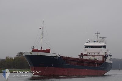
FRI BREVIK
General Cargo
Current Trip
| Time Travelled | 2 days |
|---|---|
| Remaining Time | 1 day |
| Distance Travelled | 453.12 nm |
| Remaining Distance | 312.10 nm |
| AVG Speed | 7.9 Knopen |
| MAX Speed | 11.8 Knopen |
| AVG Wind | 12.8 knots |
| MAX Wind | 31 knots |
| MIN Temp | 0.6°C / 33.08°F |
| MAX Temp | 9.2°C / 48.56°F |
| Diepgang | 6.1 M |
| Positie ontvangen | 1 m geleden |
Current Position
| Lengtegraad | 5.97260° |
|---|---|
| Breedtegraat | 53.74639° |
| Status | Under way using engine |
| Snelheid | 9.8 Knopen |
| Koers | 248.4° |
| Gebied | North Sea |
| Station | T-AIS |
| Positie ontvangen | 1 m geleden |
Info
Information
The current position of FRI BREVIK is in North Sea with coordinates 53.74639° / 5.97260° as reported on 2024-04-20 00:08 by AIS to our vessel tracker app. The vessel's current speed is 9.8 Knopen and is heading at the port of SHOREHAM. The estimated time of arrival as calculated by MyShipTracking vessel tracking app is 2024-04-21 07:55 LT
The vessel FRI BREVIK (IMO: 9190183, MMSI: 209488000) is a General Cargo that was built in 2001 ( 23 Jaar oud ). It's sailing under the flag of [CY] Cyprus.
In this page you can find informations about the vessels current position, last detected port calls, and current voyage information. If the vessels is not in coverage by AIS you will find the latest position.
The current position of FRI BREVIK is detected by our AIS receivers and we are not responsible for the reliability of the data. The last position was recorded while the vessel was in Coverage by the Ais receivers of our vessel tracking app.
The current draught of FRI BREVIK as reported by AIS is 6.1 meters
Weather
| Temperature | 7.2°C / 44.96°F |
|---|---|
| Wind Speed | 27 knots |
| Direction | 344° NNW |
| Pressure | 1014.6 hPa |
| Humidity | 77.7 % |
| Cloud Coverage | 74 % |
Featured Company
Last Port Calls
| Port | Arrival | Departure | Time In Port |
|---|---|---|---|
| 2024-04-17 08:08 | 2024-04-17 21:01 | 12 h | |
| 2024-04-16 17:15 | 2024-04-16 17:51 | 35 m | |
| 2024-04-14 09:57 | 2024-04-16 10:35 | 2 d | |
| 2024-04-14 02:58 | 2024-04-14 03:18 | 20 m | |
| 2024-04-07 04:53 | 2024-04-08 19:51 | 1 d | |
| 2024-04-03 07:41 | 2024-04-03 20:18 | 12 h | |
| 2024-03-28 19:44 | 2024-03-29 16:45 | 21 h | |
| 2024-03-27 01:03 | 2024-03-28 13:30 | 1 d | |
| 2024-03-20 06:05 | 2024-03-21 17:24 | 1 d | |
| 2024-03-19 21:10 | 2024-03-19 21:12 | 1 m |
Most Visited Ports (Last year)
| Port | Arrivals | |
|---|---|---|
| 6 | ||
| 5 | ||
| 3 | ||
| 3 | ||
| 2 | ||
| 2 |
Last Trips
| Origin | Departure | Destination | Arrival | Distance | |
|---|---|---|---|---|---|
| 2024-04-16 19:51 | 2024-04-17 10:08 | 161.94 nm | |||
| 2024-04-16 12:35 | 2024-04-16 19:15 | 65.06 nm | |||
| 2024-04-14 05:18 | 2024-04-14 11:57 | 65.67 nm | |||
| 2024-04-08 20:51 | 2024-04-14 04:58 | 1270.54 nm | |||
| 2024-04-03 20:18 | 2024-04-07 05:53 | 853.44 nm | |||
| 2024-03-29 16:45 | 2024-04-03 07:41 | 911.71 nm | |||
| 2024-03-28 13:30 | 2024-03-28 19:44 | 67.76 nm | |||
| 2024-03-21 18:24 | 2024-03-27 01:03 | 1062.64 nm | |||
| 2024-03-19 22:12 | 2024-03-20 07:05 | 81.54 nm | |||
| 2024-03-12 05:43 | 2024-03-19 22:10 | 1200.25 nm |
Events
| Tijd | Evenement | Details | Positie / Bestemming | Info |
|---|---|---|---|---|
| 2024-04-19 23:02 | Wijzig zee gebeid | Dutch part of the North Sea German part of the North Sea |
53.80633 / 6.26137
North Sea
GBSHO
|
Snelheid: 9.9 kn Koers: 252° |
| 2024-04-19 16:59 | Status Changed | Under way using engine Default |
54.01520 / 7.65802
GBSHO
|
Snelheid: 7.4 kn Koers: 257° |
| 2024-04-19 16:53 | Status Changed | Default Under way using engine |
54.01781 / 7.67898
GBSHO
|
Snelheid: 7 kn Koers: 263.4° |
| 2024-04-19 16:48 | Status Changed | Under way using engine Default |
54.01986 / 7.69542
GBSHO
|
Snelheid: 7.5 kn Koers: 272° |
| 2024-04-19 16:48 | Binnenbereik |
54.01986 / 7.69542
North Sea
GBSHO
|
Snelheid: 7 kn Koers: 263.4° |
|
| 2024-04-19 13:09 | Buitenbereik |
53.96694 / 8.57593
North Sea
GBSHO
|
Snelheid: 11.5 kn Koers: 282.1° |
|
| 2024-04-19 10:52 | Start beweging | 1.52 nm, South West of BRUNSBUETTEL |
53.88503 / 9.12982
GBSHO
|
Snelheid: 9.2 kn Koers: 223.4° |
| 2024-04-19 10:44 | Wijzig zee gebeid | German part of the North Sea German part of the Baltic Sea |
53.89346 / 9.14475
North Sea
GBSHO
|
Snelheid: 2.3 kn Koers: 225.7° |
| 2024-04-19 10:36 | Stop beweging | 0.73 nm, South West of BRUNSBUETTEL |
53.89412 / 9.14593
GBSHO
|
Snelheid: Koers: 228° |
| 2024-04-19 05:50 | Start beweging | 6.66 nm, North East of FISCHERHUTTE |
54.19680 / 9.54758
GBSHO
|
Snelheid: 4.3 kn Koers: 252° |