
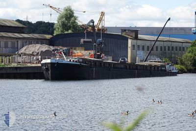
FERDINAND
Cargo
Current Trip
JA MOIN
| Time Travelled | 6 days |
|---|---|
| Remaining Time | --- |
| Distance Travelled | 241.47 nm |
| Remaining Distance | --- |
| AVG Speed | 5.8 Knopen |
| MAX Speed | 5.8 Knopen |
| AVG Wind | 8.3 knots |
| MAX Wind | 19.5 knots |
| MIN Temp | 3.5°C / 38.3°F |
| MAX Temp | 20.3°C / 68.54°F |
| Diepgang | 2.5 M |
| Positie ontvangen | 1 d geleden |
Current Position
| Lengtegraad | 9.74075° |
|---|---|
| Breedtegraat | 52.40736° |
| Status | Under way using engine |
| Snelheid | 7 Knopen |
| Koers | 117.6° |
| Gebied | North Sea |
| Station | T-AIS |
| Positie ontvangen | 1 d geleden |
Info
Information
The current position of FERDINAND is in North Sea with coordinates 52.40736° / 9.74075° as reported on 2024-04-18 12:59 by AIS to our vessel tracker app. The vessel's current speed is 7 Knopen
The vessel FERDINAND (MMSI: 211504140) is a Cargo It's sailing under the flag of [DE] Germany.
In this page you can find informations about the vessels current position, last detected port calls, and current voyage information. If the vessels is not in coverage by AIS you will find the latest position.
The current position of FERDINAND is detected by our AIS receivers and we are not responsible for the reliability of the data. The last position was recorded while the vessel was in Coverage by the Ais receivers of our vessel tracking app.
The current draught of FERDINAND as reported by AIS is 2.5 meters
Weather
| Temperature | 8.6°C / 47.48°F |
|---|---|
| Wind Speed | 14 knots |
| Direction | 285° WNW |
| Pressure | 1000.9 hPa |
| Humidity | 79.3 % |
| Cloud Coverage | 100 % |
Featured Company
Last Port Calls
| Port | Arrival | Departure | Time In Port |
|---|---|---|---|
| 2024-04-13 09:42 | 2024-04-13 10:12 | 29 m | |
| 2024-03-31 07:06 | 2024-04-12 04:32 | 11 d | |
| 2024-03-29 19:12 | 2024-03-30 06:38 | 11 h | |
| 2024-03-26 10:04 | 2024-03-29 14:57 | 3 d | |
| 2024-03-24 09:56 | 2024-03-26 07:32 | 1 d | |
| 2024-03-22 12:36 | |||
| 2024-03-19 20:09 | 2024-03-20 05:50 | 9 h | |
| 2024-03-19 14:30 | |||
| 2024-03-12 09:00 | 2024-03-12 17:54 | 8 h | |
| 2024-02-29 18:18 | 2024-03-01 05:52 | 11 h |
Last Trips
| Origin | Departure | Destination | Arrival | Distance | |
|---|---|---|---|---|---|
| 2024-04-12 06:32 | 2024-04-13 11:42 | 32.53 nm | |||
| 2024-03-30 07:38 | 2024-03-31 09:06 | 34.81 nm | |||
| 2024-03-29 15:57 | 2024-03-29 20:12 | 21.78 nm | |||
| 2024-03-26 08:32 | 2024-03-26 11:04 | 19.05 nm | |||
| 2024-03-22 13:36 | 2024-03-24 10:56 | 99.01 nm | |||
| 2024-03-19 15:30 | 2024-03-19 21:09 | 9.41 nm | |||
| 2024-03-01 06:52 | 2024-03-12 10:00 | 253.80 nm | |||
| 2024-02-29 14:10 | 2024-02-29 19:18 | 26.97 nm | |||
| 2024-02-27 14:28 | 2024-02-29 13:19 | 57.64 nm | |||
| 2024-02-21 07:53 | 2024-02-24 15:54 | 73.42 nm |
Events
| Tijd | Evenement | Details | Positie / Bestemming | Info |
|---|---|---|---|---|
| 2024-04-18 12:59 | Buitenbereik |
52.40736 / 9.74075
North Sea
|
Snelheid: 7 kn Koers: 117.6° |
|
| 2024-04-18 12:40 | Status Changed | Under way using engine Default |
52.42331 / 9.68754
JA MOIN
|
Snelheid: 4 kn Koers: -1° |
| 2024-04-18 12:06 | Status Changed | Default Under way using engine |
52.40667 / 9.58833
JA MOIN
|
Snelheid: 7.1 kn Koers: 90.2° |
| 2024-04-18 06:05 | Binnenbereik |
52.33776 / 8.59336
North Sea
|
Snelheid: 7.1 kn Koers: 102.6° |
|
| 2024-04-17 19:04 | Buitenbereik |
52.33514 / 8.30957
North Sea
|
Snelheid: 7.1 kn Koers: 101.1° |
|
| 2024-04-17 18:45 | Status Changed | Under way using engine Default |
52.34991 / 8.25485
JA MOIN
|
Snelheid: 7 kn Koers: 119° |
| 2024-04-17 18:40 | Status Changed | Default Under way using engine |
52.35500 / 8.23833
JA MOIN
|
Snelheid: 7.4 kn Koers: 145.3° |
| 2024-04-17 16:53 | Start beweging | 1.47 nm, West of BRAMSCHE |
52.39216 / 7.95786
JA MOIN
|
Snelheid: 5.2 kn Koers: 75.4° |
| 2024-04-17 16:50 | Stop beweging | 1.59 nm, West of BRAMSCHE |
52.39106 / 7.95517
JA MOIN
|
Snelheid: 0.3 kn Koers: 355° |
| 2024-04-17 16:41 | Start beweging | 1.99 nm, West of BRAMSCHE |
52.38924 / 7.94449
JA MOIN
|
Snelheid: 3.1 kn Koers: 234° |