
FLIBERALL
Military ops
Current Trip
OPEN SEA
| Time Travelled | --- |
|---|---|
| Remaining Time | --- |
| Distance Travelled | --- |
| Remaining Distance | --- |
| AVG Speed | --- |
| MAX Speed | --- |
| AVG Wind | --- |
| MAX Wind | --- |
| MIN Temp | --- |
| MAX Temp | --- |
| Diepgang | 7 M |
| Positie ontvangen | 4 d geleden |
Current Position
| Lengtegraad | -43.13882° |
|---|---|
| Breedtegraat | -22.86604° |
| Status | Under way using engine |
| Snelheid | 0.1 Knopen |
| Koers | --- |
| Gebied | South Atlantic Ocean |
| Station | T-AIS |
| Positie ontvangen | 4 d geleden |
Info
Information
The current position of FLIBERALL is in South Atlantic Ocean with coordinates -22.86604° / -43.13882° as reported on 2024-04-19 14:05 by AIS to our vessel tracker app. The vessel's current speed is 0.1 Knopen
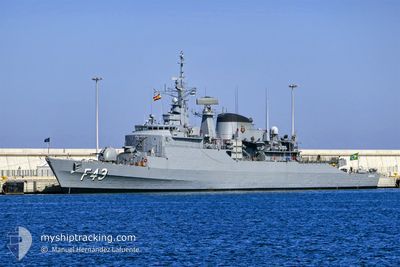
The vessel FLIBERALL (MMSI: 710466000) is a Military ops It's sailing under the flag of [BR] Brazil.
In this page you can find informations about the vessels current position, last detected port calls, and current voyage information. If the vessels is not in coverage by AIS you will find the latest position.
The current position of FLIBERALL is detected by our AIS receivers and we are not responsible for the reliability of the data. The last position was recorded while the vessel was in Coverage by the Ais receivers of our vessel tracking app.
The current draught of FLIBERALL as reported by AIS is 7 meters
Weather
| Temperature | 24.3°C / 75.74°F |
|---|---|
| Wind Speed | 2 knots |
| Direction | 190° S |
| Pressure | 1019 hPa |
| Humidity | 66.1 % |
| Cloud Coverage | 97 % |
Featured Company
Last Port Calls
Last Trips
| Origin | Departure | Destination | Arrival | Distance |
|---|
Events
| Tijd | Evenement | Details | Positie / Bestemming | Info |
|---|---|---|---|---|
| 2024-04-19 14:05 | Buitenbereik |
-22.86604 / -43.13882
South Atlantic Ocean
|
Snelheid: 0.1 kn Koers: 329.9° |
|
| 2024-04-19 12:51 | Binnenbereik |
-22.86606 / -43.13879
South Atlantic Ocean
|
Snelheid: Koers: 261.7° |
|
| 2024-04-16 12:00 | Buitenbereik |
-22.86602 / -43.13880
South Atlantic Ocean
|
Snelheid: Koers: 257.4° |
|
| 2024-04-16 10:35 | Stop beweging | 1.86 nm, North West of NITEROI |
-22.86281 / -43.14554
OPEN SEA
|
Snelheid: 0.3 kn Koers: 65° |
| 2024-04-16 09:21 | Binnenbereik |
-23.01674 / -43.11662
South Atlantic Ocean
|
Snelheid: 11 kn Koers: 310.9° |
|
| 2024-04-15 14:58 | Buitenbereik |
-23.12224 / -44.15747
South Atlantic Ocean
|
Snelheid: 0.1 kn Koers: 289.6° |
|
| 2024-04-15 14:16 | Binnenbereik |
-23.12217 / -44.15747
South Atlantic Ocean
|
Snelheid: Koers: 186.1° |
|
| 2024-04-15 11:46 | Buitenbereik |
-23.12225 / -44.15735
South Atlantic Ocean
|
Snelheid: 0.1 kn Koers: 186.1° |
|
| 2024-04-15 07:52 | Binnenbereik |
-23.12222 / -44.15735
South Atlantic Ocean
|
Snelheid: Koers: 205.5° |
|
| 2024-04-15 02:25 | Buitenbereik |
-23.12162 / -44.15725
South Atlantic Ocean
|
Snelheid: Koers: 205.5° |