
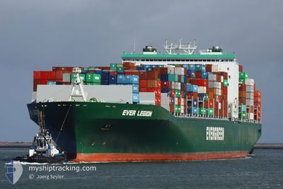
EVER LEGION
Container Ship
Current Trip
| Time Travelled | 12 days |
|---|---|
| Remaining Time | --- |
| Distance Travelled | 4830.07 nm |
| Remaining Distance | --- |
| AVG Speed | 16 Knopen |
| MAX Speed | 16 Knopen |
| AVG Wind | 10.5 knots |
| MAX Wind | 29.8 knots |
| MIN Temp | 14.7°C / 58.46°F |
| MAX Temp | 29.4°C / 84.92°F |
| Diepgang | 12 M |
| Positie ontvangen | 4 d geleden |
Current Position
| Lengtegraad | -18.24245° |
|---|---|
| Breedtegraat | 22.14786° |
| Status | Under way using engine |
| Snelheid | 16.1 Knopen |
| Koers | 182.8° |
| Gebied | North Atlantic Ocean |
| Station | T-AIS |
| Positie ontvangen | 4 d geleden |
Info
Information
The current position of EVER LEGION is in North Atlantic Ocean with coordinates 22.14786° / -18.24245° as reported on 2024-04-20 23:07 by AIS to our vessel tracker app. The vessel's current speed is 16.1 Knopen and is heading at the port of PORT KLANG. The estimated time of arrival as calculated by MyShipTracking vessel tracking app is 2024-05-15 22:00 LT
The vessel EVER LEGION (IMO: 9604110, MMSI: 566970000) is a Container Ship that was built in 2013 ( 11 Jaar oud ). It's sailing under the flag of [SG] Singapore.
In this page you can find informations about the vessels current position, last detected port calls, and current voyage information. If the vessels is not in coverage by AIS you will find the latest position.
The current position of EVER LEGION is detected by our AIS receivers and we are not responsible for the reliability of the data. The last position was recorded while the vessel was in Coverage by the Ais receivers of our vessel tracking app.
The current draught of EVER LEGION as reported by AIS is 12 meters
Weather
| Temperature | 28.5°C / 83.3°F |
|---|---|
| Wind Speed | 17 knots |
| Direction | 145° SE |
| Pressure | 1008.9 hPa |
| Humidity | 77.6 % |
| Cloud Coverage | 64 % |
Featured Company
Last Port Calls
| Port | Arrival | Departure | Time In Port |
|---|---|---|---|
| 2024-04-12 05:34 | 2024-04-13 06:22 | 1 d | |
| 2024-04-04 12:15 | 2024-04-06 20:29 | 2 d | |
| 2024-04-01 15:30 | 2024-04-03 23:41 | 2 d | |
| 2024-03-27 22:11 | 2024-03-29 06:06 | 1 d | |
| 2024-02-22 08:18 | 2024-02-23 05:55 | 21 h | |
| 2024-02-16 16:34 | 2024-02-17 07:14 | 14 h | |
| 2024-02-12 11:42 | 2024-02-13 10:51 | 23 h | |
| 2024-02-06 09:09 | 2024-02-07 09:18 | 1 d |
Most Visited Ports (Last year)
| Port | Arrivals | |
|---|---|---|
| 7 | ||
| 5 | ||
| 5 | ||
| 4 | ||
| 4 | ||
| 4 |
Last Trips
| Origin | Departure | Destination | Arrival | Distance | |
|---|---|---|---|---|---|
| 2024-04-06 22:29 | 2024-04-12 07:34 | 1443.19 nm | |||
| 2024-04-04 01:41 | 2024-04-04 14:15 | 12.82 nm | |||
| 2024-03-29 08:06 | 2024-04-01 17:30 | 1219.80 nm | |||
| 2024-02-23 13:55 | 2024-03-28 00:11 | 12569.76 nm | |||
| 2024-02-17 15:14 | 2024-02-22 16:18 | 1474.83 nm | |||
| 2024-02-13 19:51 | 2024-02-17 00:34 | 1185.27 nm | |||
| 2024-02-07 17:18 | 2024-02-12 20:42 | 779.53 nm | |||
| 2024-01-30 08:06 | 2024-02-06 17:09 | 896.69 nm |
Events
| Tijd | Evenement | Details | Positie / Bestemming | Info |
|---|---|---|---|---|
| 2024-04-20 23:11 | Status Changed | Default Under way using engine |
22.13210 / -18.24301
EGPSD>MYPKL
|
Snelheid: 16.1 kn Koers: 182.8° |
| 2024-04-20 23:07 | Status Changed | Under way using engine Default |
22.14786 / -18.24245
EGPSD>MYPKL
|
Snelheid: 16 kn Koers: 182° |
| 2024-04-20 23:07 | Binnenbereik |
22.14786 / -18.24245
North Atlantic Ocean
EGPSD>MYPKL
|
Snelheid: 16.1 kn Koers: 182.8° |
|
| 2024-04-20 23:07 | Buitenbereik |
22.14786 / -18.24245
North Atlantic Ocean
EGPSD>MYPKL
|
Snelheid: 16.1 kn Koers: 182.8° |
|
| 2024-04-20 20:59 | Status Changed | Default Under way using engine |
22.63613 / -17.96267
EGPSD>MYPKL
|
Snelheid: 15.9 kn Koers: 215.1° |
| 2024-04-20 20:54 | Buitenbereik |
22.65448 / -17.94920
North Atlantic Ocean
EGPSD>MYPKL
|
Snelheid: 15.9 kn Koers: 215.1° |
|
| 2024-04-20 20:38 | Gevonden in zee | Western Saharan part of the North Atlantic Ocean |
22.71289 / -17.90549
North Atlantic Ocean
EGPSD>MYPKL
|
Snelheid: 16 kn Koers: 215.5° |
| 2024-04-20 20:38 | Status Changed | Under way using engine Default |
22.71289 / -17.90549
EGPSD>MYPKL
|
Snelheid: 16 kn Koers: 215° |
| 2024-04-20 20:21 | Binnenbereik |
22.71289 / -17.90549
North Atlantic Ocean
EGPSD>MYPKL
|
Snelheid: 16 kn Koers: 215.5° |
|
| 2024-04-19 21:20 | Buitenbereik |
27.74321 / -13.86967
North Atlantic Ocean
EGPSD>MYPKL
|
Snelheid: 15.7 kn Koers: 215.7° |