
EVER GREET
Cargo
Current Trip
| Time Travelled | 2 days |
|---|---|
| Remaining Time | 1 day |
| Distance Travelled | 854.32 nm |
| Remaining Distance | 808.34 nm |
| AVG Speed | 15.5 Knopen |
| MAX Speed | 20.6 Knopen |
| AVG Wind | 9.6 knots |
| MAX Wind | 17 knots |
| MIN Temp | 6.2°C / 43.16°F |
| MAX Temp | 13.1°C / 55.58°F |
| Diepgang | 11.9 M |
| Positie ontvangen | 9 h, 47 m geleden |
Current Position
| Lengtegraad | -8.42870° |
|---|---|
| Breedtegraat | 45.56595° |
| Status | Under way using engine |
| Snelheid | 20 Knopen |
| Koers | 208.5° |
| Gebied | North Atlantic Ocean |
| Station | T-AIS |
| Positie ontvangen | 9 h, 47 m geleden |
Info
Information
The current position of EVER GREET is in North Atlantic Ocean with coordinates 45.56595° / -8.42870° as reported on 2024-04-24 19:42 by AIS to our vessel tracker app. The vessel's current speed is 20 Knopen and is heading at the port of ROTTERDAM. The estimated time of arrival as calculated by MyShipTracking vessel tracking app is 2024-04-26 20:05 LT
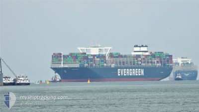
The vessel EVER GREET (IMO: 9832729, MMSI: 371829000) is a Cargo It's sailing under the flag of [PA] Panama.
In this page you can find informations about the vessels current position, last detected port calls, and current voyage information. If the vessels is not in coverage by AIS you will find the latest position.
The current position of EVER GREET is detected by our AIS receivers and we are not responsible for the reliability of the data. The last position was recorded while the vessel was in Coverage by the Ais receivers of our vessel tracking app.
The current draught of EVER GREET as reported by AIS is 11.9 meters
Weather
| Temperature | 13.1°C / 55.58°F |
|---|---|
| Wind Speed | 13 knots |
| Direction | 313° NW |
| Pressure | 1015.6 hPa |
| Humidity | 81.7 % |
| Cloud Coverage | 92 % |
Featured Company
Last Port Calls
| Port | Arrival | Departure | Time In Port |
|---|---|---|---|
| 2024-04-20 11:14 | 2024-04-23 05:01 | 2 d | |
| 2024-04-16 20:40 | 2024-04-19 05:02 | 2 d | |
| 2024-04-12 03:36 | 2024-04-14 08:43 | 2 d | |
| 2024-03-09 18:49 | 2024-03-10 21:20 | 1 d | |
| 2024-03-03 14:36 | 2024-03-04 10:49 | 20 h | |
| 2024-02-27 19:10 | 2024-02-28 22:39 | 1 d | |
| 2024-02-22 00:19 | 2024-02-23 13:55 | 1 d | |
| 2024-02-13 03:22 | 2024-02-13 23:27 | 20 h |
Last Trips
| Origin | Departure | Destination | Arrival | Distance | |
|---|---|---|---|---|---|
| 2024-04-19 07:02 | 2024-04-20 13:14 | 332.33 nm | |||
| 2024-04-14 10:43 | 2024-04-16 22:40 | 505.92 nm | |||
| 2024-03-11 05:20 | 2024-04-12 05:36 | 12065.60 nm | |||
| 2024-03-04 18:49 | 2024-03-10 02:49 | 1463.55 nm | |||
| 2024-02-29 06:39 | 2024-03-03 22:36 | 878.42 nm | |||
| 2024-02-23 21:55 | 2024-02-28 03:10 | 935.59 nm | |||
| 2024-02-14 07:27 | 2024-02-22 08:19 | 3004.17 nm | |||
| 2024-01-16 21:33 | 2024-02-13 11:22 | 11919.51 nm |
Events
| Tijd | Evenement | Details | Positie / Bestemming | Info |
|---|---|---|---|---|
| 2024-04-24 19:47 | Status Changed | Default Under way using engine |
45.54236 / -8.44674
ROTTERDAM>MYTPP
|
Snelheid: 20 kn Koers: 208.5° |
| 2024-04-24 19:42 | Buitenbereik |
45.56595 / -8.42870
North Atlantic Ocean
ROTTERDAM>MYTPP
|
Snelheid: 20 kn Koers: 208.5° |
|
| 2024-04-24 19:05 | Wijzig zee gebeid | Spanish part of the North Atlantic Ocean French part of the North Atlantic Ocean |
45.74770 / -8.28659
North Atlantic Ocean
ROTTERDAM>MYTPP
|
Snelheid: 20.2 kn Koers: 208.8° |
| 2024-04-24 18:05 | Gevonden in zee | French part of the North Atlantic Ocean |
46.04138 / -8.05858
North Atlantic Ocean
ROTTERDAM>MYTPP
|
Snelheid: 19.8 kn Koers: 208.4° |
| 2024-04-24 18:03 | Status Changed | Under way using engine Default |
46.04807 / -8.05335
ROTTERDAM>MYTPP
|
Snelheid: 19.9 kn Koers: 208° |
| 2024-04-24 18:03 | Binnenbereik |
46.04138 / -8.05858
North Atlantic Ocean
ROTTERDAM>MYTPP
|
Snelheid: 19.8 kn Koers: 208.4° |
|
| 2024-04-24 12:20 | Status Changed | Default Under way using engine |
47.68454 / -6.77547
ROTTERDAM>MYTPP
|
Snelheid: 18.9 kn Koers: 208.1° |
| 2024-04-24 12:17 | Buitenbereik |
47.70033 / -6.76300
Celtic Sea
ROTTERDAM>MYTPP
|
Snelheid: 18.9 kn Koers: 208.1° |
|
| 2024-04-24 12:15 | Status Changed | Under way using engine Default |
47.70724 / -6.75756
ROTTERDAM>MYTPP
|
Snelheid: 19.1 kn Koers: 208° |
| 2024-04-24 12:05 | Status Changed | Default Under way using engine |
47.75354 / -6.72030
ROTTERDAM>MYTPP
|
Snelheid: 19.1 kn Koers: 208.3° |